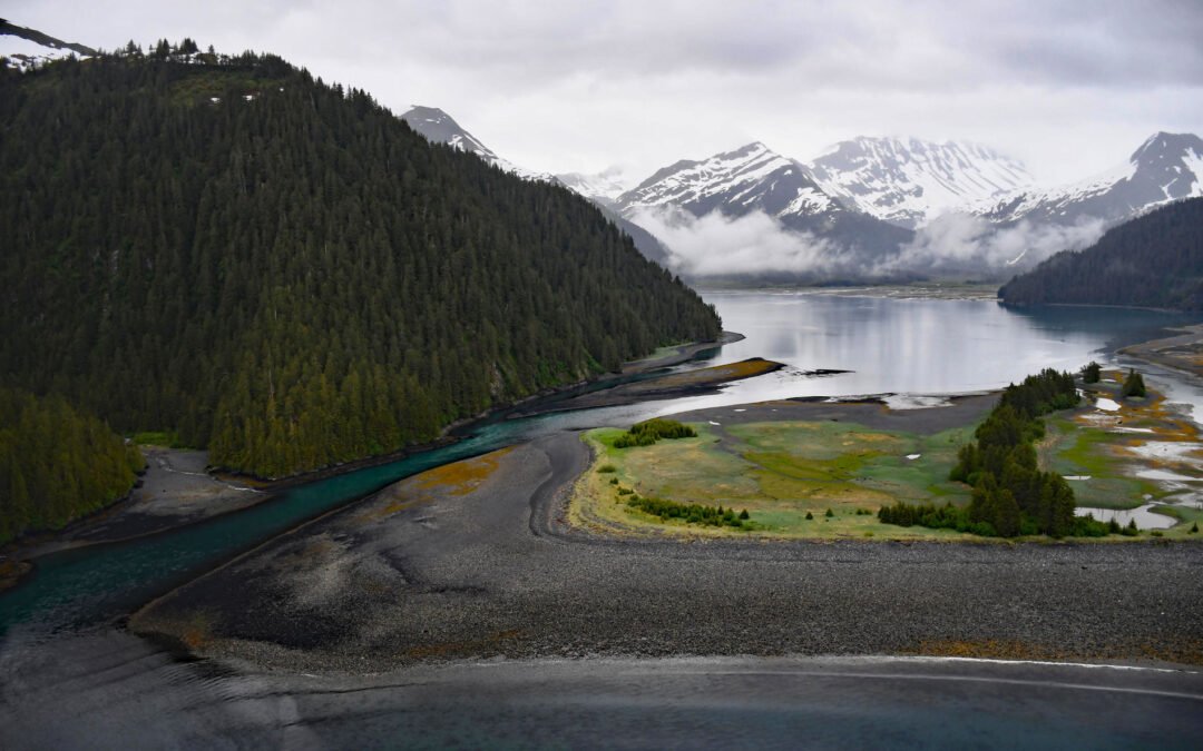
by CoastView | Feb 6, 2025 | 2025, Alaska, Biodiversity, Climate Change, Coastal Features, Glaciers, Land Use, Parks
Listen to the article here https://coastview.org/wp-content/uploads/2025/03/McCarty.mp3 James Lagoon is a drowned cirque basin about 0.5 miles (0.8 km) wide, partially enclosed by the remains of a terminal moraine, on the western shore of McCarty Fjord in Kenai Fjords...
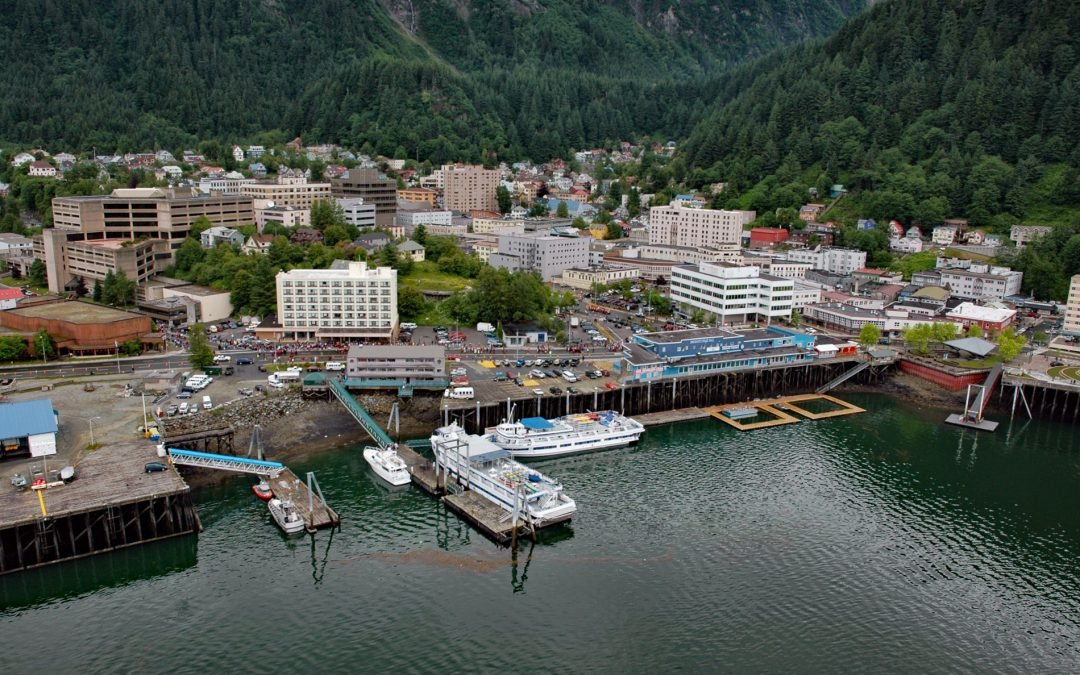
by CoastView | Feb 5, 2025 | 2025, Alaska, Climate Change, Coastal Features, Communities, Developments, Embayments, Historical, Land Use, Mines, Rivers
Listen to the article here https://coastview.org/wp-content/uploads/2025/03/Juneau.mp3 Juneau is the state capital, situated at the mouth of Gold Creek on Gastineau Channel, about 93 miles (150 km) northeast of Sitka and 87 miles (140 km) south-southeast of Skagway,...
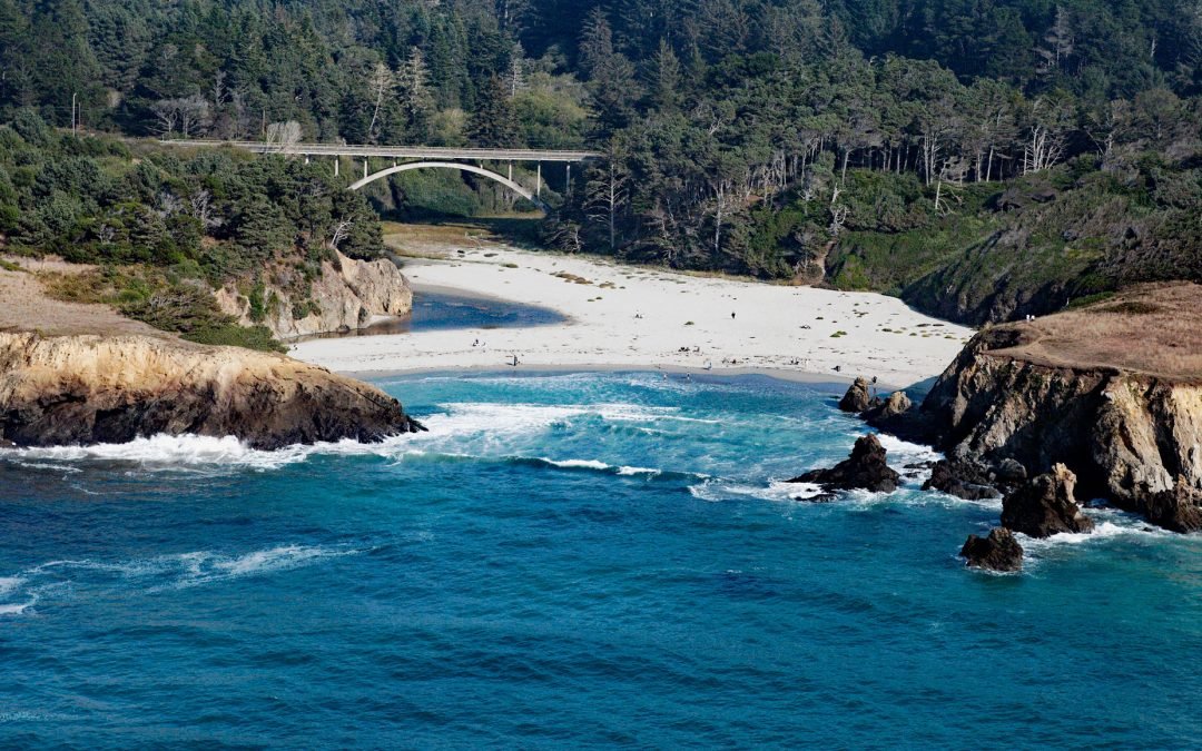
by CoastView | Feb 4, 2025 | 2025, Beaches, Biodiversity, California, Climate Change, Coastal Features, Embayments, Historical, Land Use, Parks, Rivers
Listen to the article here https://coastview.org/wp-content/uploads/2025/03/Jug-Handle-Cove.mp3 Jug Handle Cove is a California State Natural Preserve made up of a series of ancient marine terraces, known as the Ecological Staircase, which exhibit different stages of...

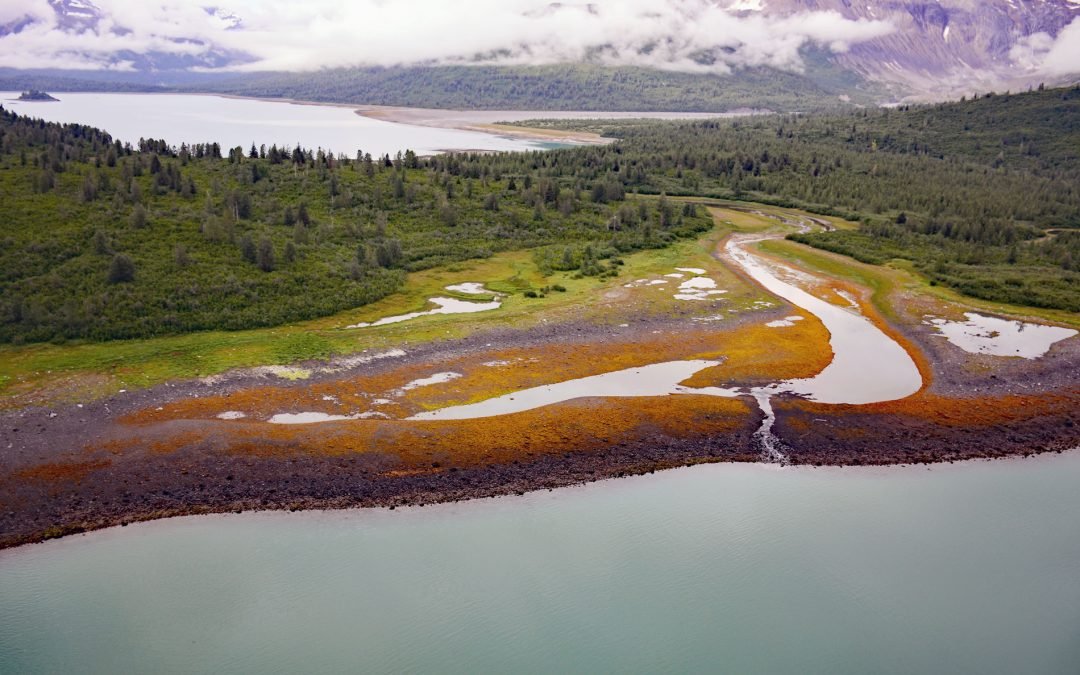
by CoastView | Feb 3, 2025 | 2025, Alaska, Climate Change, Coastal Features, Embayments, Freshwater, Glaciers, Historical
Listen to the article here https://coastview.org/wp-content/uploads/2025/03/Yale.mp3 Yale Glacier is a massive tidewater glacier in College Fjord, Prince William Sound, that originates at an elevation of 9,270 feet (2,826 m) between Mount Cardozo and Mount Einstein in...
by CoastView | Jan 30, 2025 | 2025, Alaska, Biodiversity, Climate Change, Coastal Features, Embayments, Glaciers, Historical, Land Use, Mines, Parks
Listen to the article here https://coastview.org/wp-content/uploads/2025/03/Scidmore.mp3 Scidmore Bay, enclosed by the Gilbert Peninsula to the east and the Fairweather Mountains to the west, lies in Glacier Bay National Park and Preserve, about 119 miles (192 km)...
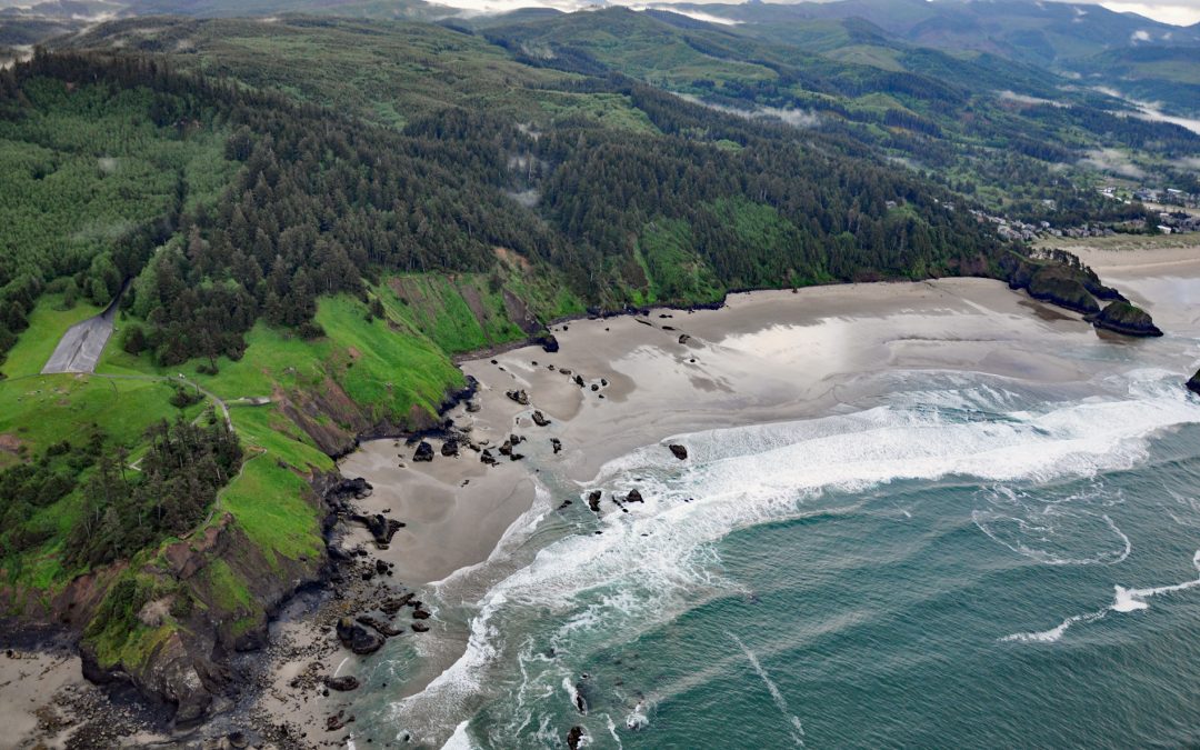
by CoastView | Jan 27, 2025 | 2025, Beaches, Biodiversity, Climate Change, Coastal Features, Headlands, Historical, Land Use, Oregon, Parks
Listen to the article here https://coastview.org/wp-content/uploads/2025/03/Ecola.mp3 Crescent Beach lies between Ecola Point and Chapman Point in Ecola State Park, about 20 miles (32 km) south-southwest of Astoria and 2 miles (3.2 km) north-northwest of Cannon Beach,...