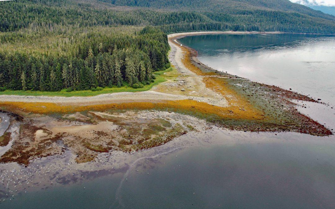
by CoastView | Jun 16, 2026 | 2026, Alaska, Beaches, Coastal Features, Embayments, Historical, June 2026, Land Use, Natural History, Parks
Listen to the article here https://coastview.org/wp-content/uploads/2026/02/SumdumVillage.mp3 Sumdum is a historical Tlingit village of the S’awdaan Kwáan located north of Powers Creek at the northern end of Endicott Arm where it meets Holkham Bay in Tracy Arm-Fords...
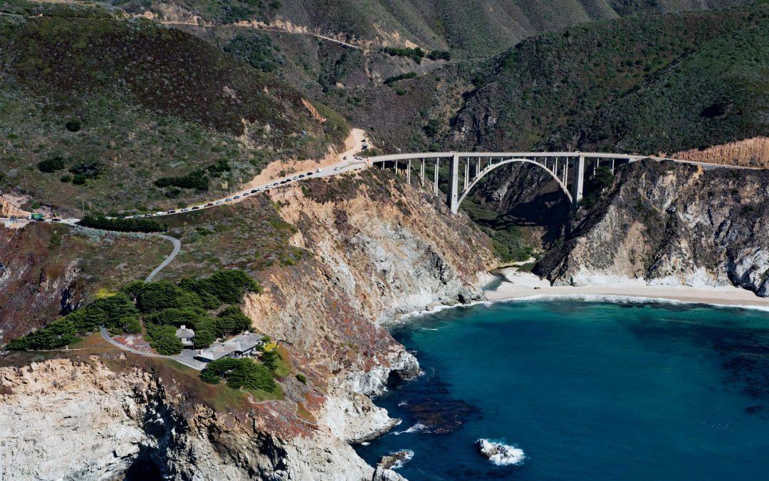
by CoastView | Jun 14, 2026 | 2026, California, Coastal Features, Developments, Historical, June 2026, Land Use, Natural History, Rivers
Listen to the article here https://coastview.org/wp-content/uploads/2026/02/BixbyBridge.mp3 Bixby Creek starts at the confluence of Mill Creek and Turner Creek, which flow from an elevation of 2,500 feet (762 m) on the west flank of Skinner Ridge, for a total run of...
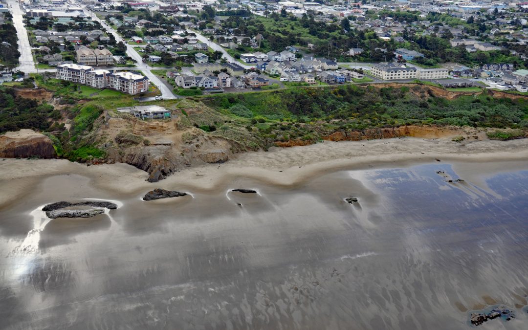
by CoastView | Jun 12, 2026 | 2026, Beaches, Coastal Features, Communities, Historical, June 2026, Land Use, Natural History, Oregon
Listen to the article here https://coastview.org/wp-content/uploads/2026/02/NyeBeach.mp3 Nye Beach is situated in Newport between Agate Beach to the north and Yaquina Beach to the south, about 22 miles (35 km) south of Lincoln City and 1.9 miles (3 km) north of...

by CoastView | Jun 11, 2026 | 2026, Alaska, Biodiversity, Coastal Features, Embayments, Headlands, June 2026, Kachemak, Land Use, Natural History, Parks
Listen to the article here https://coastview.org/wp-content/uploads/2026/02/PointPogibshi.mp3 Point Pogibshi is a prominent flat-topped grassy headland with rocky sides about 50 feet (15 m) high on the southern shore of Kachemak Bay, roughly 20 miles (23 km) southwest...
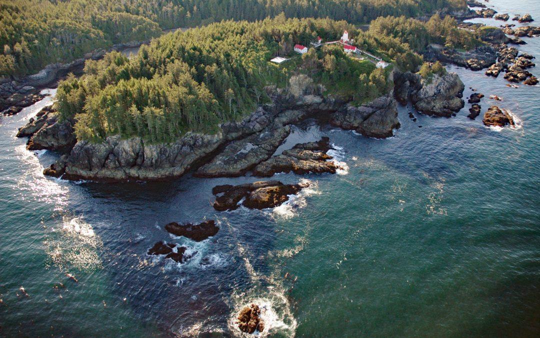
by CoastView | Jun 10, 2026 | 2026, British Columbia, Coastal Features, Historical, June 2026, Land Use, Lighthouses, Natural History, Parks, Shipwrecks
Listen to the article here https://coastview.org/wp-content/uploads/2026/02/CapeBeale.mp3 Cape Beale is the site of a historic lighthouse marking the southern entrance to Barkley Sound on the west coast of Vancouver Island in Pacific Rim National Park Reserve, about...
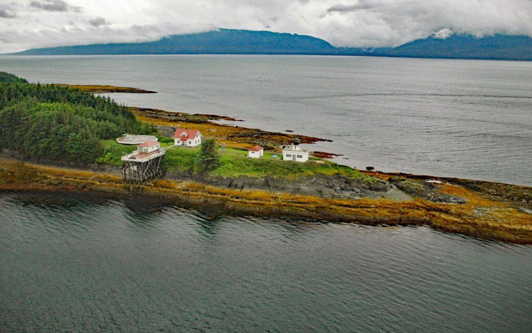
by CoastView | Jun 9, 2026 | 2026, Alaska, Coastal Features, Embayments, Historical, Islands, June 2026, Land Use, Lighthouses, Natural History
Listen to the article here https://coastview.org/wp-content/uploads/2026/02/PointRetreat.mp3 Point Retreat is a headland with a historic lighthouse on the Mansfield Peninsula at the northern tip of Admiralty Island, between Lynn Canal to the west and Saginaw Channel...