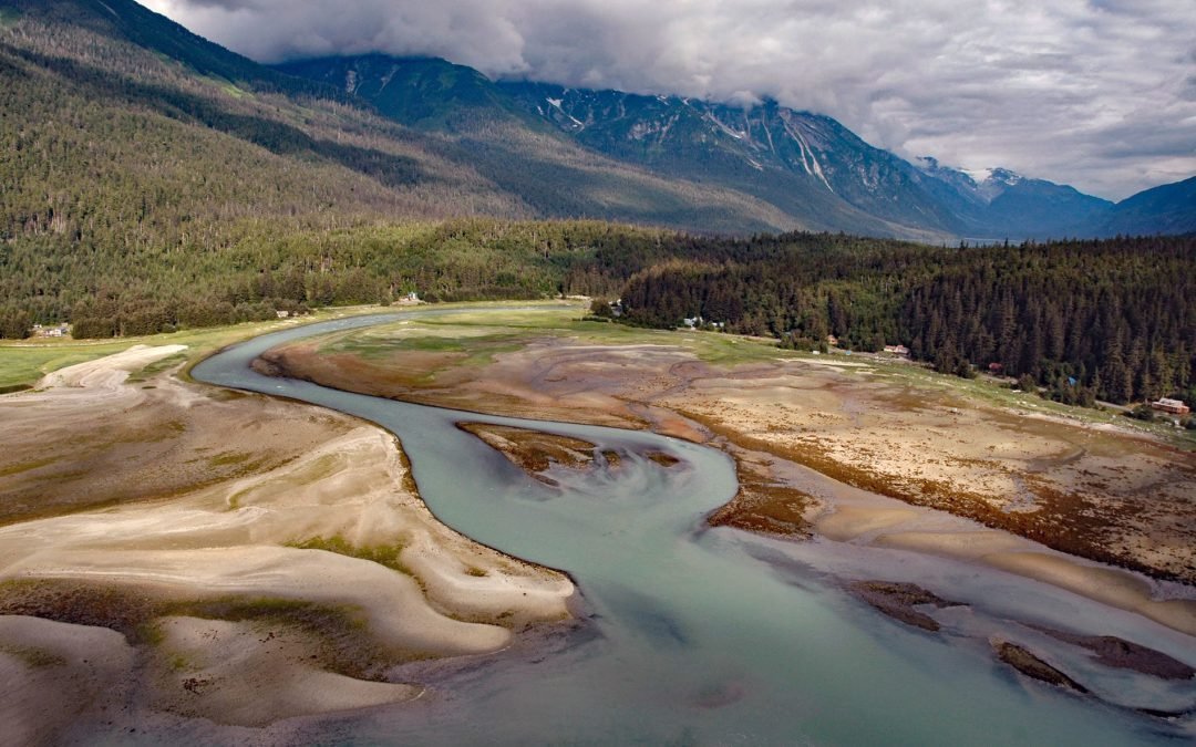
by CoastView | Jul 14, 2025 | 2025, Alaska, Biodiversity, Coastal Features, Communities, Embayments, Historical, Land Use, Natural History, Parks, Rivers
Listen to the article here https://coastview.org/wp-content/uploads/2025/05/Chilkoot.mp3 Chilkoot is a historical Tlingit village located on the Chilkoot River between Lutak Inlet to the south and Chilkoot Lake to the north, about 83 miles (134 km) north-northwest of...
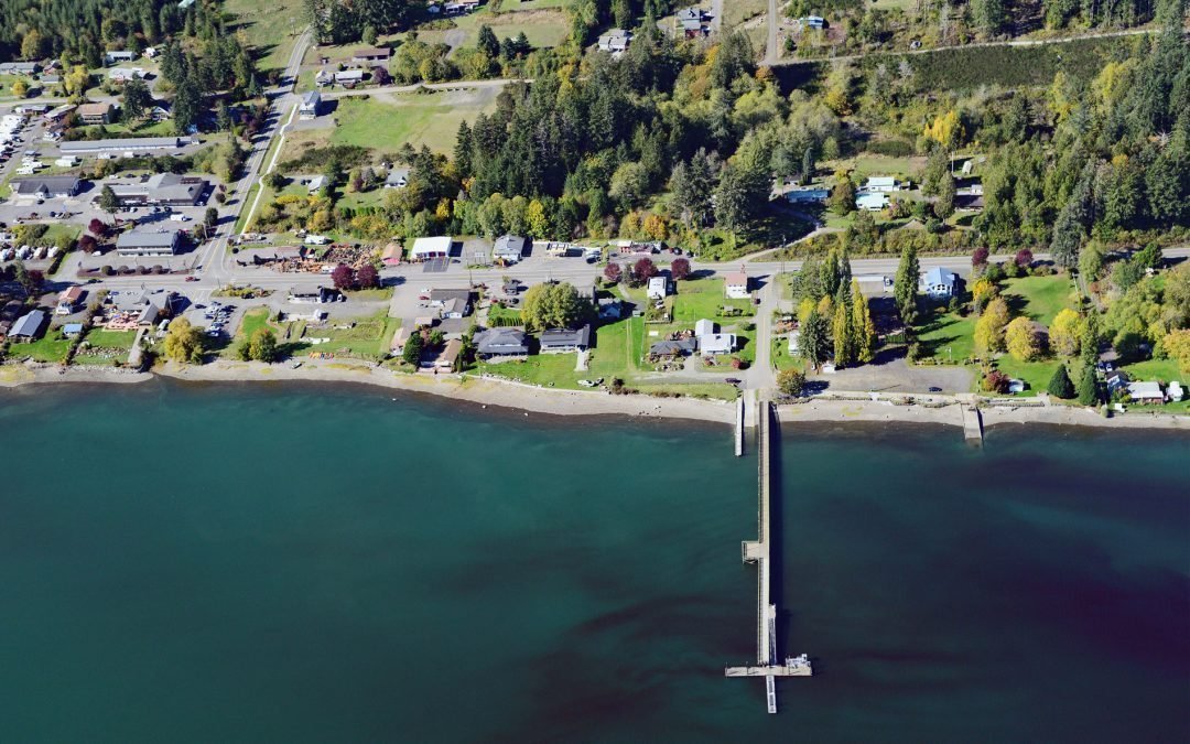
by CoastView | Jul 13, 2025 | 2025, Beaches, Biodiversity, Communities, Developments, Embayments, Historical, Land Use, Natural History, Rivers, Washington
Listen to the article here https://coastview.org/wp-content/uploads/2025/05/Allyn.mp3 Allyn is a community at the mouth of Sherwood Creek on the western shore of Case Inlet in the North Bay region of South Puget Sound, about 21 miles (34 km) northwest of Tacoma and 17...
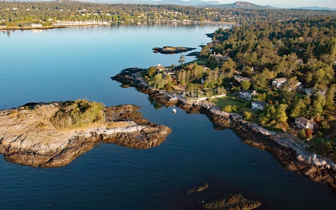
by CoastView | Jul 11, 2025 | 2025, Biodiversity, British Columbia, Coastal Features, Communities, Embayments, Headlands, Historical, Land Use, Natural History
Listen to the article here https://coastview.org/wp-content/uploads/2025/05/Ten-Mile-Point.mp3 Flower Island is a small, uninhabited islet located about 250 feet (80 m) offshore from the southern end of Ten Mile Point, roughly 15 miles (24 km) south-southeast of...
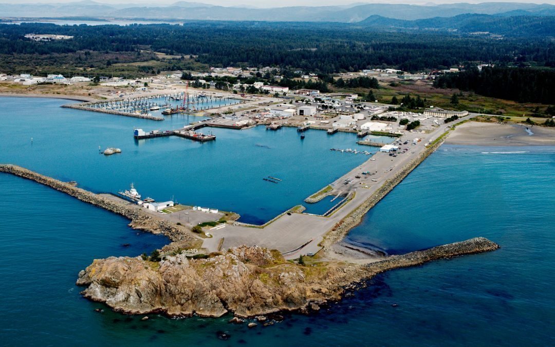
by CoastView | Jul 8, 2025 | 2025, Best of 2025, Biodiversity, California, Coastal Features, Communities, Developments, Historical, Islands, Land Use, Natural History
Listen to the article here https://coastview.org/wp-content/uploads/2025/05/Whaler-Island.mp3 Whaler Island, about 700 feet (215m) across, lies 0.4 miles (0.65km) offshore and is now connected to the mainland by a paved road on an artificial breakwater, about 16 miles...

by CoastView | Jul 6, 2025 | 2025, Beaches, Biodiversity, Coastal Features, Communities, Developments, Historical, Land Use, Natural History, Parks, Rivers, Washington
Listen to the article here https://coastview.org/wp-content/uploads/2025/05/Copalis-Beach.mp3 The Copalis River flows southwest for 22 miles (35 km) to the community of Copalis Beach, then another 2 miles (3.2 km) to the Pacific Ocean at Griffith-Priday State Park,...
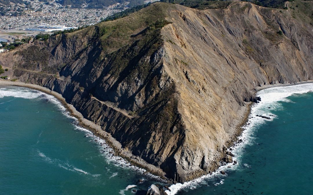
by CoastView | Jun 25, 2025 | 2025, Biodiversity, California, Coastal Features, Communities, Headlands, Historical, Land Use, Natural History, Parks
Listen to the article here https://coastview.org/wp-content/uploads/2025/05/Point-San-Pedro.mp3 Point San Pedro forms the northwestern extent of Pedro Point Headland on San Pedro Mountain, about 3.6 miles (5.8 km) north of Montara and the southern boundary of...