
by CoastView | Jan 5, 2025 | 2025, Beaches, Biodiversity, British Columbia, Coastal Features, Communities, Historical, Land Use, Parks, Rivers, Shipwrecks
Listen to the article here https://coastview.org/wp-content/uploads/2025/03/Clo-oose.mp3 Clo-oose is the site of an abandoned village of the Ditidaht First Nation on the southwest coast of Vancouver Island, above a beach 0.25 miles (0.4 km) west of the Cheewhat River...

by CoastView | Jan 4, 2025 | 2025, Alaska, Biodiversity, Climate Change, Coastal Features, Communities, Embayments, Historical, Land Use, Rivers
Listen to the article here https://coastview.org/wp-content/uploads/2025/03/Noatak.mp3 Noatak River starts from several small cirque glaciers on the northeast flank of Mount Igikpak in the Schwatka Mountains and flows generally west for 425 miles (684 km) to Hotham...
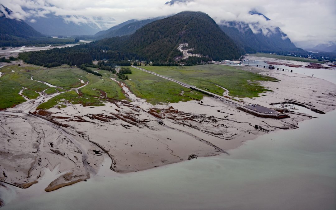
by CoastView | Jan 3, 2025 | 2025, Alaska, British Columbia, Communities, Developments, Embayments, Glaciers, Historical, Land Use, Mines, Rivers
Listen to the article here https://coastview.org/wp-content/uploads/2025/03/Hyder.mp3 Hyder is a small community at the mouth of the Salmon River, on the western shore and near the head of Portland Canal, about 75 miles (121 km) northeast of Ketchikan and 2.5 miles (4...
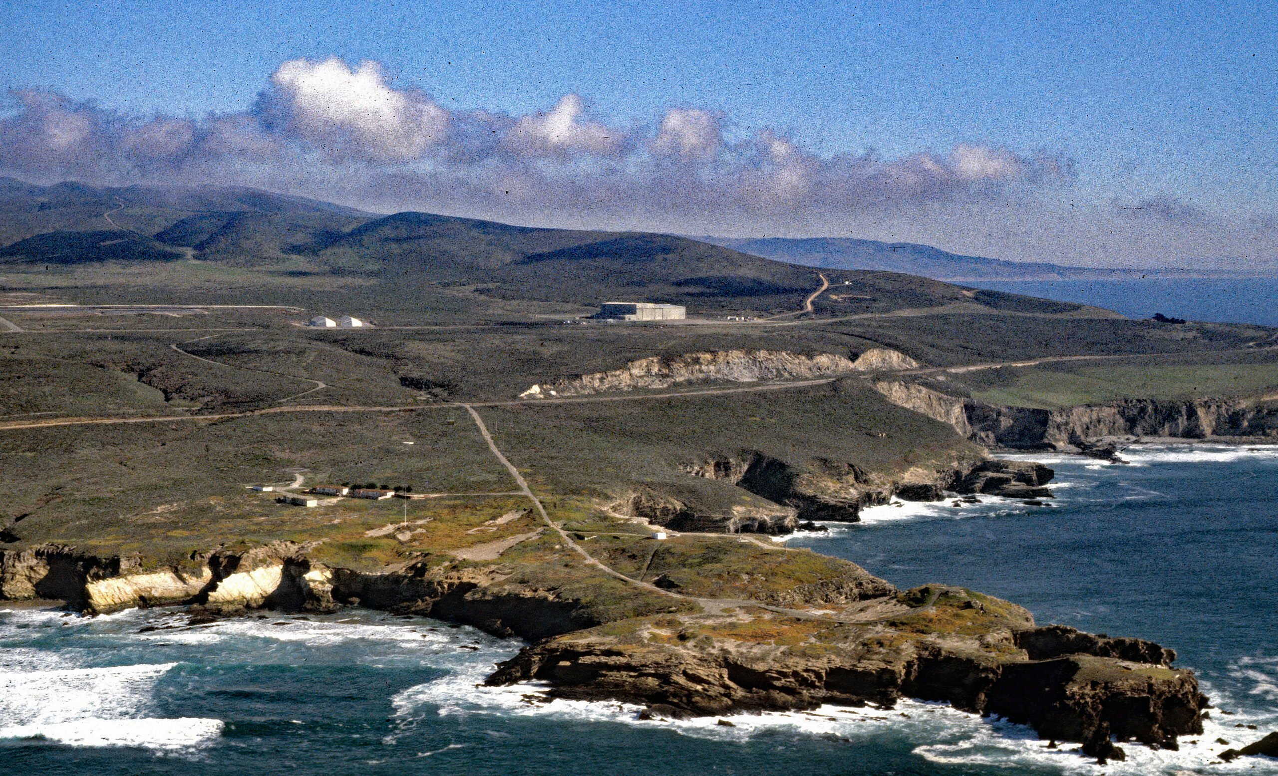
by CoastView | Jan 2, 2025 | 2025, California, Coastal Features, Communities, Developments, Headlands, Historical, Land Use, Lighthouses
Listen to the article here https://coastview.org/wp-content/uploads/2025/06/Point-Arguello.mp3 Point Arguello is a prominent headland and the site of the Vandenberg Space Launch Complex, as well as a historical cattle ranch, lighthouse station, and Loran station,...
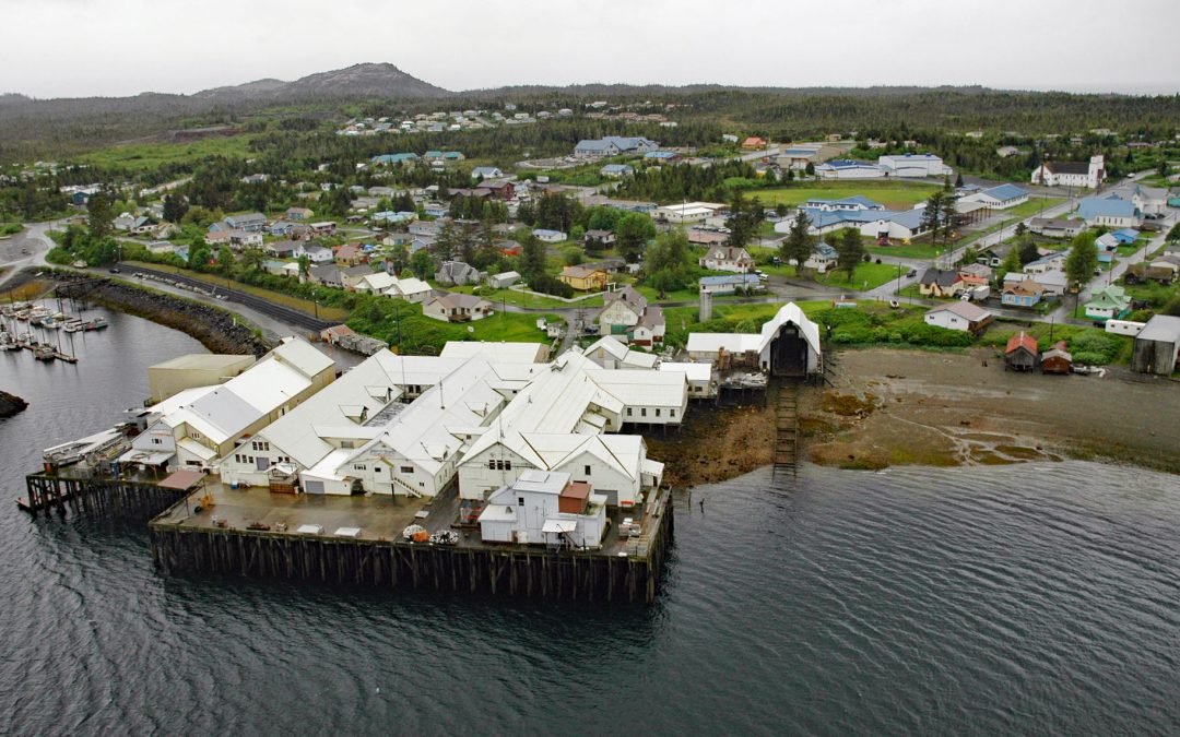
by CoastView | Dec 30, 2024 | 2024, Alaska, Beaches, Canneries, Coastal Features, Communities, Developments, Embayments, Historical, Islands, Land Use
Metlakatla is a Tsimshian community situated on Port Chester, an embayment on the west coast of Annette Island, about 75 miles (121 km) northwest of Prince Rupert and 16 miles (26 km) south-southeast of Ketchikan, Alaska. Port Chester was named for Commander Colby M....
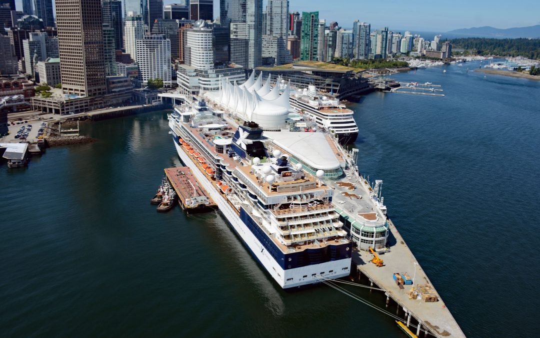
by CoastView | Dec 29, 2024 | 2024, Biodiversity, British Columbia, Climate Change, Coastal Features, Communities, Developments, Embayments, Glaciers, Historical, Land Use, Rivers
Vancouver is a coastal seaport located on the Burrard Peninsula in the Fraser River Delta, between Burrard Inlet to the north and the Fraser River to the south, about 60 miles (97 km) north-northeast of Victoria and 38 miles (61 km) east-northeast of Nanaimo, British...