
by CoastView | Dec 27, 2024 | 2024, Alaska, Biodiversity, Canneries, Coastal Features, Communities, Developments, Embayments, Hatcheries, Historical, Islands, Land Use, Rivers
Loring is a small community at the site of a historical salmon cannery on the west coast of Revillagigedo Island, at the head of Naha Bay and near the mouth of the Naha River, about 66 miles (106 km) south-southeast of Wrangell and 17 miles (27 km) north of Ketchikan,...
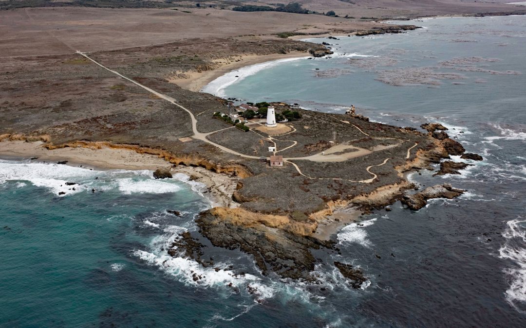
by CoastView | Dec 26, 2024 | 2024, Beaches, Biodiversity, California, Coastal Features, Communities, Developments, Headlands, Historical, Land Use, Lighthouses, Parks
Point Piedras Blancas is a prominent headland and the site of a historic light station within the California Coastal National Monument, and surrounded by the Hearst San Simeon State Park, about 73 miles (117 km) south-southeast of Monterey and 6 miles (10 km)...
by CoastView | Dec 22, 2024 | 2024, Biodiversity, British Columbia, Coastal Features, Communities, Embayments, Historical, Land Use, Rivers
Anacla is a community of the Huu-ay-aht First Nation on the Pachena River near the head of Pachena Bay, about 37 miles (60 km) northwest of Port Renfrew and 2.4 miles (4 km) south-southwest of Bamfield, British Columbia. The Huu-ay-aht are part of the larger culture...

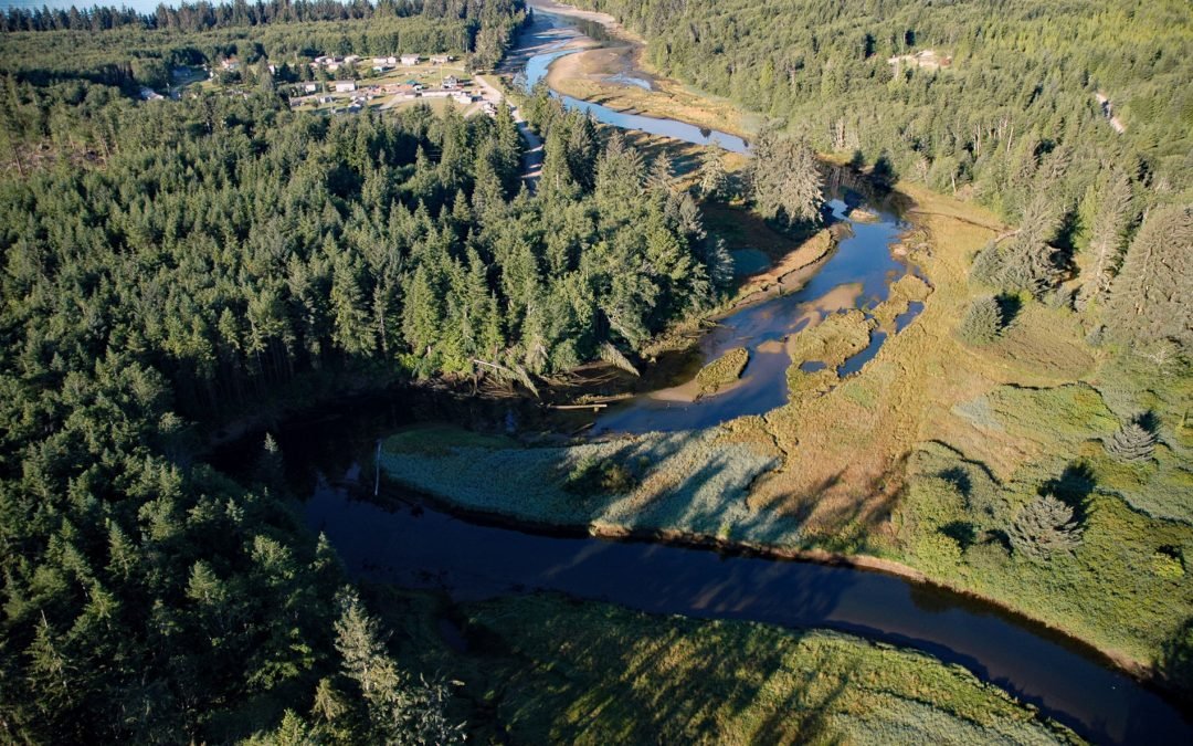
by CoastView | Dec 21, 2024 | 2024, Alaska, Biodiversity, Climate Change, Coastal Features, Communities, Developments, Embayments, Freshwater, Historical, Islands, Land Use, Natural History
Thorne Bay is a small community, and an estuary of the Thorne River on the eastern coast of Prince of Wales Island, the largest of approximately 1,100 islands interspersed by marine channels in the Alexander Archipelago of Southeast Alaska, about 55 miles (89 km)...

by CoastView | Dec 19, 2024 | 2024, Beaches, Biodiversity, California, Canneries, Climate Change, Coastal Features, Communities, Developments, Embayments, Historical, Land Use
Cannery Row is the Monterey waterfront between San Carlos Beach and Cabrillo Beach, or between the Monterey Harbor Marina and the Monterey Bay Aquarium, where several historical Pacific sardine canneries once operated, about 25 miles (40 km) south-southeast of Santa...

by CoastView | Dec 16, 2024 | 2024, Biodiversity, British Columbia, Coastal Features, Communities, Developments, Embayments, Freshwater, Historical, Islands, Land Use
Sooke is a community on the western shore of Sooke Harbour, a narrow natural embayment separated from the Strait of Juan de Fuca by Whiffin Spit, about 35 miles (56 km) southwest of Port Renfrew and 17 miles (27 km) west-southwest of Victoria, British Columbia. Sooke...