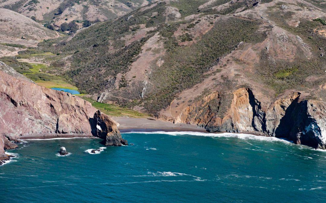
by CoastView | Feb 23, 2026 | 2026, Beaches, Best of 2023, California, Embayments, February 2026, Historical, Land Use, Parks, Shipwrecks
Listen to the article here https://coastview.org/wp-content/uploads/2026/01/TennesseeCove-1.mp3 Tennessee Cove is an embayment with a sandy beach roughly 600 feet (180 m) long on the Pacific Ocean, between Pirates Cove to the north and Rodeo Cove to the south, in the...
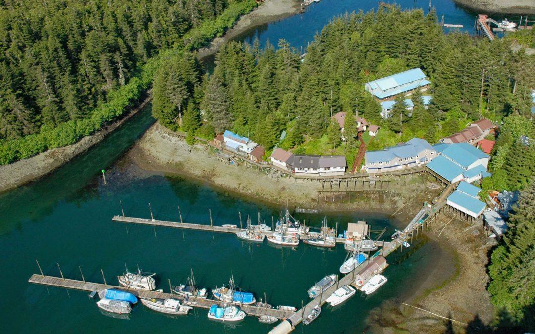
by CoastView | Feb 22, 2026 | 2026, Alaska, Best of 2023, Communities, Embayments, Islands, Land Use
Listen to the article here https://coastview.org/wp-content/uploads/2026/01/ElfinCove.mp3 Elfin Cove is an embayment extending south from Cross Sound for 1 mile (1.6 km), narrowing to just over 100 feet (30 m) on the western shore of the Inian Peninsula at Chichagof...

by CoastView | Feb 18, 2026 | 2026, Alaska, Coastal Features, Developments, Embayments, February 2026, Historical, Islands, Land Use
Listen to the article here https://coastview.org/wp-content/uploads/2026/01/MuttonCove.mp3 Mutton Cove is an embayment on Unalaska Island, about 0.3 miles (0.5 km) across, on the northern shore of Chernofski Harbor, about 64 miles (103 km) north-east of Nikolski and...
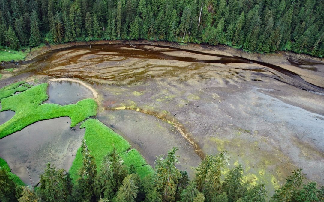
by CoastView | Feb 15, 2026 | 2026, Alaska, Biodiversity, Coastal Features, Embayments, February 2026, Historical, Land Use, Natural History
Listen to the article here https://coastview.org/wp-content/uploads/2026/01/MinkBay.mp3 Mink Bay is an estuary extending south for 5.4 miles (8.7 km) from Boca de Quadra, an embayment on the east side of Revillagigedo Channel, about 54 miles (87 km) north-northwest of...
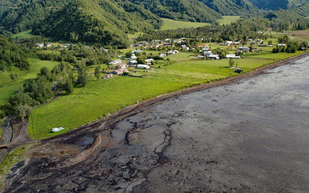
by CoastView | Feb 6, 2026 | 2026, Alaska, Coastal Features, Communities, Embayments, February 2026, Kachemak, Land Use
Listen to the article here https://coastview.org/wp-content/uploads/2026/01/KachemakSelo.mp3 Kachemak Selo is a small community at the head of Kachemak Bay adjacent to the Fox River Flats on the Kenai Peninsula, about 27 miles (44 km) southeast of Ninilchik and 20...
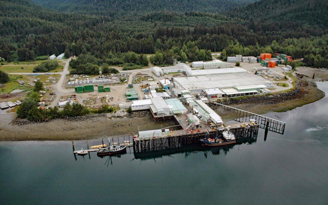
by CoastView | Feb 5, 2026 | 2026, Alaska, Canneries, Communities, Developments, Embayments, February 2026, Historical, Land Use, Natural History
Listen to the article here https://coastview.org/wp-content/uploads/2026/01/ExcursionInlet.mp3 Excursion Inlet is an embayment extending 11 miles (18 km) north-northwest from the northern coast of Icy Strait to the mouth of Excursion River, about 38 miles (61 km)...