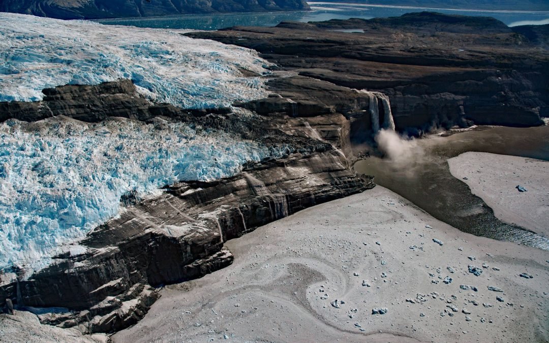
by CoastView | Jun 26, 2026 | 2026, Alaska, Climate Change, Coastal Features, Embayments, Glaciers, June 2026, Natural History, Parks, Waterfalls
Listen to the article here https://coastview.org/wp-content/uploads/2026/03/KashteenPeninsula.mp3 The Kashteen Peninsula is located in Wrangell-Saint Elias National Park and Preserve on the eastern shore of Icy Bay, between Tsaa Fjord to the south and Guyot Fjord to...

by CoastView | Jun 25, 2026 | 2026, Coastal Features, Developments, Embayments, Historical, June 2026, Oregon, Rivers, Shipwrecks
Listen to the article here https://coastview.org/wp-content/uploads/2026/02/MaryDHume.mp3 Mary D. Hume sank on November 13, 1985, on the south bank of the Rogue River during a restoration effort to convert her to a museum ship for the Curry County Historical Society;...

by CoastView | Jun 24, 2026 | 2026, Biodiversity, British Columbia, Coastal Features, Embayments, Islands, June 2026, Natural History, Waterfalls
Listen to the article here https://coastview.org/wp-content/uploads/2026/02/SaltLagoon.mp3 Salt Lagoon sits at the southwestern base of the Spiller Range on Porcher Island, connected by a tidal channel 1.8 miles (2.9 km) long to Porcher Inlet, which extends 11 miles...
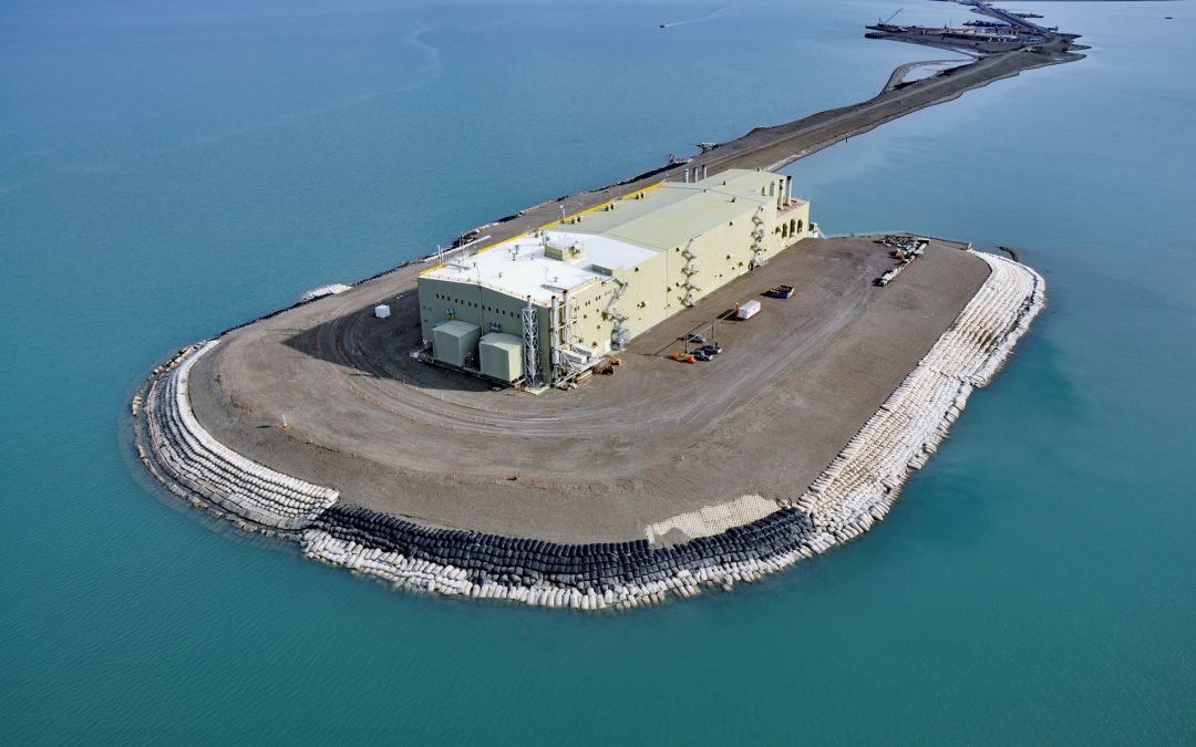
by CoastView | Jun 23, 2026 | 2026, Alaska, Developments, Embayments, June 2026, Land Use, Natural History
Listen to the article here https://coastview.org/wp-content/uploads/2026/02/WestDock.mp3 West Dock Causeway was constructed in the Beaufort Sea, between Gwydyr Bay to the west and Prudhoe Bay to the east, to support oil exploration and to access a seawater treatment...
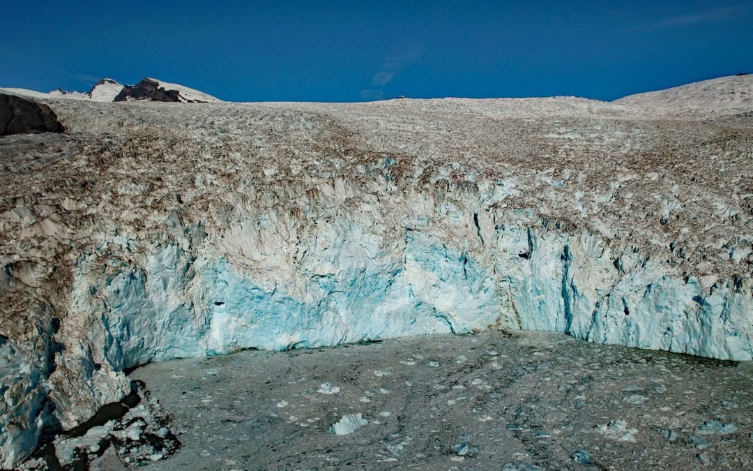
by CoastView | Jun 22, 2026 | 2026, Alaska, Climate Change, Embayments, Glaciers, June 2026, Land Use, Natural History, Parks
Listen to the article here https://coastview.org/wp-content/uploads/2026/02/GuyotGlacier.mp3 Guyot Glacier originates at about 6,700 feet (2,042 m) on the eastern flank of Yaga Peak in the Robinson Mountains and flows east-southeast for 34 miles (55 km) to its...
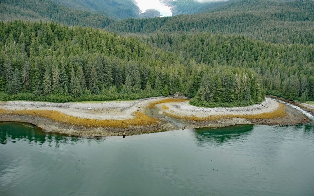
by CoastView | Jun 20, 2026 | 2026, Alaska, Climate Change, Embayments, Glaciers, June 2026, Land Use, Mines, Natural History, Parks
Listen to the article here https://coastview.org/wp-content/uploads/2026/02/SumdumGlacier.mp3 Sumdum Glacier begins on the south flank of Mount Sumdum, whose summit reaches 6,666 feet (2,032 m), and flows southwest to a hanging terminus at 2,100 feet (640 m), where...