by CoastView | Nov 1, 2024 | 2024, Alaska, Beaches, Biodiversity, Climate Change, Communities, Freshwater, Historical, Rivers
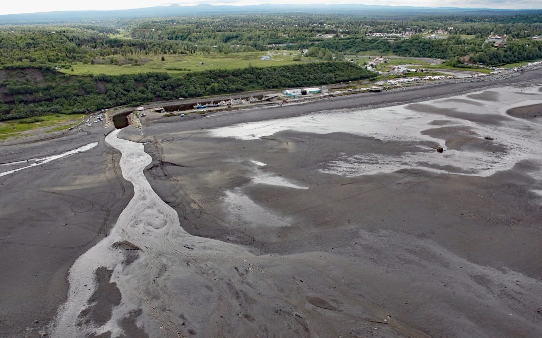
Ninilchik is a community at Cape Ninilchik at the mouth of the Ninilchik River on the Kenai Peninsula and on the eastern shore of Cook Inlet, about 99 miles (160 km) southwest of Anchorage and 30 miles (48 km) north-northwest of Homer, Alaska. Road access to the...
by CoastView | Oct 29, 2024 | 2024, Alaska, Biodiversity, Canneries, Coastal Features, Communities, Developments, Embayments, Freshwater, Historical, Land Use
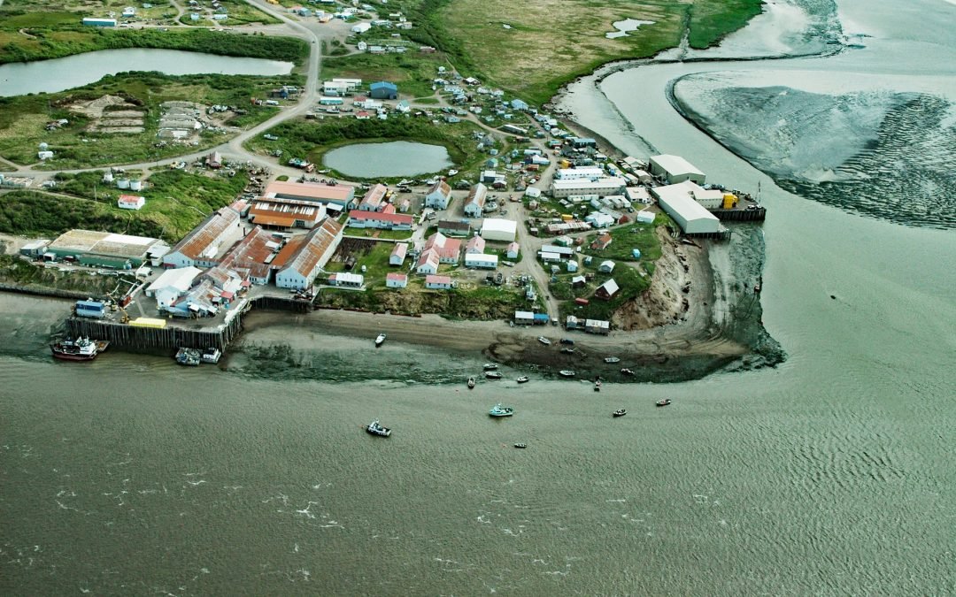
Egegik is a small Yup’ik village on the south bank of Egegik Bay on the eastern shore of Bristol Bay, about 69 miles (111 km) southeast of Dillingham and 37 miles (60 km) south-southwest of Naknek, Alaska. The name was first published in 1835 as Ougagouck by...
by CoastView | Oct 9, 2024 | 2024, Alaska, Climate Change, Coastal Features, Developments, Embayments, Freshwater, Glaciers, Historical, Land Use
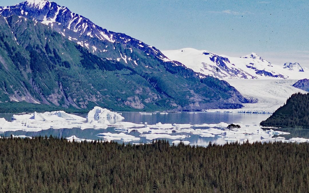
Excelsior Glacier flows south for about 8 miles (13 km) from the Sargent Icefield on the Kenai Peninsula to its terminus at Big Johnstone Lake, formerly called Excelsior Lake, about 28 miles (45 km) west-southwest of Chenega Bay and 26 miles (42 km) southeast of...
by CoastView | Oct 5, 2024 | 2024, Alaska, Coastal Features, Freshwater, Islands, Waterfalls
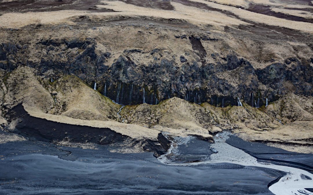
The Weeping Wall is a cliff with water seeps on the northwest side of Okmok Volcano on the northeastern part of Umnak Island, one of the Fox Islands in the Eastern Aleutians, about 73 miles (117 km) west-southwest of Dutch Harbor and 49 miles (79 km) north-northeast...
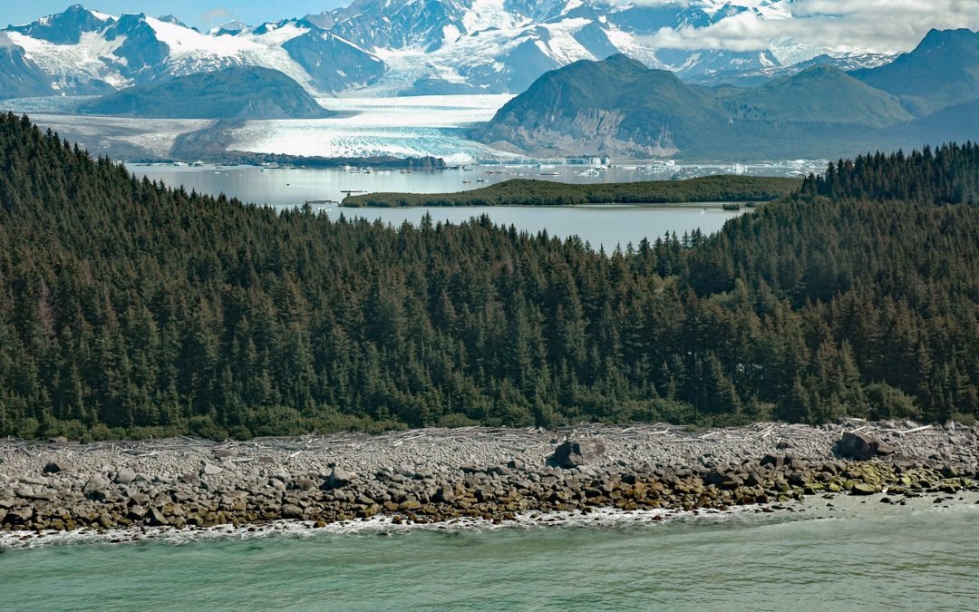
by CoastView | Sep 25, 2024 | 2024, Alaska, Biodiversity, Climate Change, Coastal Features, Freshwater, Glaciers, Historical, Land Use, Parks, Rivers
Grand Plateau Glacier starts on the north flank of Mount Fairweather in the Fairweather Range of the Saint Elias Mountains and flows generally northwest for 19 miles (31 km) where it splits into two terminal lobes, with the southern lobe flowing 6 miles (10 km) to...
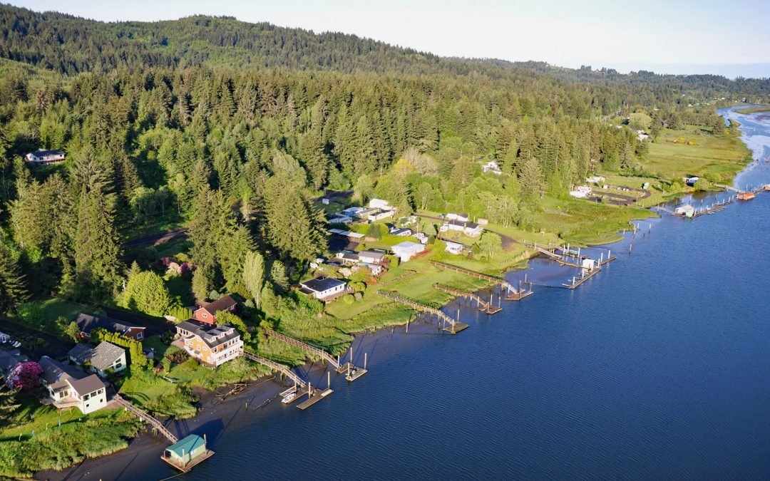
by CoastView | Sep 22, 2024 | 2024, Biodiversity, Communities, Developments, Freshwater, Historical, Land Use, Oregon, Rivers
Drift Creek Landing is a community on the south bank of the Alsea River, opposite the confluence of Drift Creek, a major Coast Range tributary joining the Alsea about 3.4 miles (5.5 km) east of Waldport, about 16 miles (26 km) south-southeast of Newport and 9 miles...