
by CoastView | Feb 27, 2026 | 2026, Alaska, Beaches, Biodiversity, Coastal Features, Embayments, February 2026, Kachemak, Land Use, Parks, Rivers
Listen to the article here https://coastview.org/wp-content/uploads/2026/01/GrewingkCreek.mp3 Grewingk Creek drains a glaciated watershed of 29,138 acres (11,792 ha) and flows northwest for 3.5 miles (5.6 km) from the terminus lake of the retreating Grewingk Glacier...
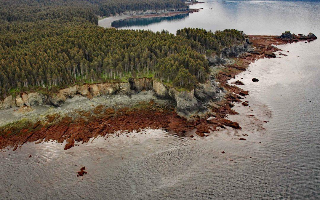
by CoastView | Feb 20, 2026 | 2026, Alaska, Coastal Features, February 2026, Headlands, Historical, Kachemak, Shipwrecks
Listen to the article here https://coastview.org/wp-content/uploads/2026/01/DangerousCape.mp3 Dangerous Cape is a headland rising 66 feet (20 m) on the southern Kenai Peninsula, at the northern entrance to Port Graham near the mouth of Kachemak Bay, about 22 miles (35...
by CoastView | Feb 12, 2026 | 2026, Alaska, Biodiversity, Coastal Features, Developments, February 2026, Hatcheries, Kachemak, Natural History
Listen to the article here https://coastview.org/wp-content/uploads/2026/02/TutkaBayLagoon.mp3 Tutka Bay Lagoon hosts a fish hatchery on the southern shore of Tutka Bay in Kachemak Bay State Park, roughly 10 miles (16 km) east of Seldovia and 15 miles (24 km)...
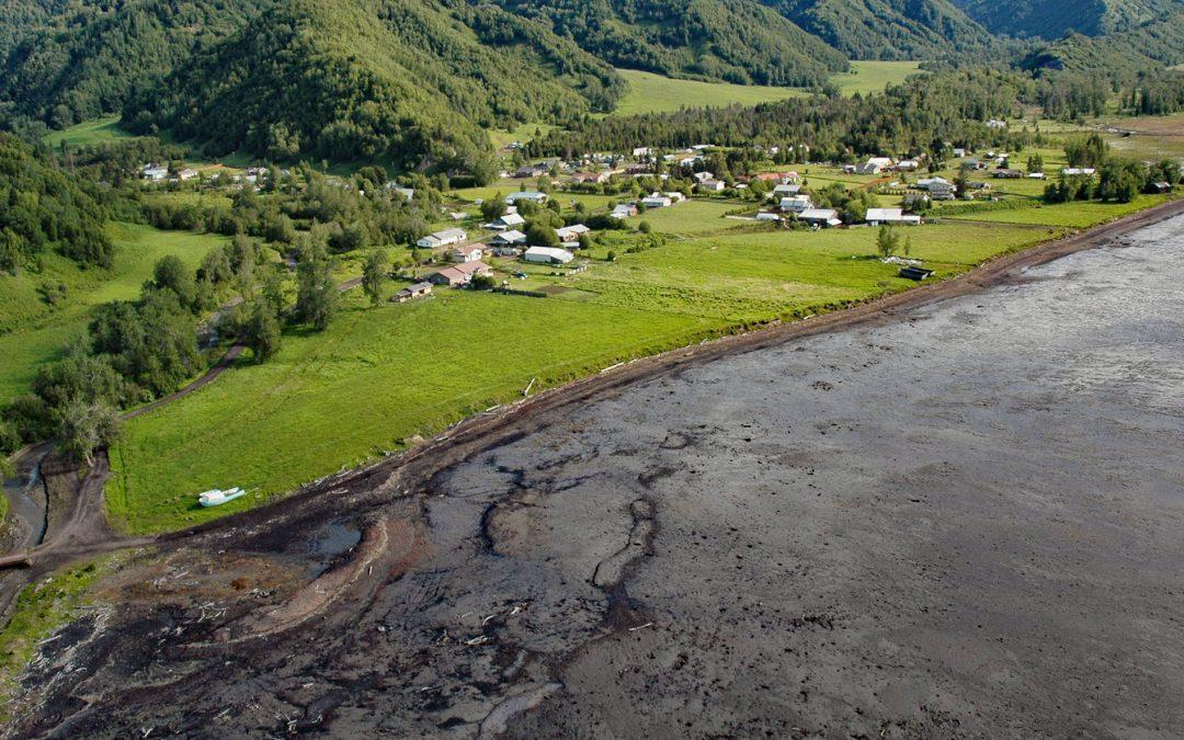
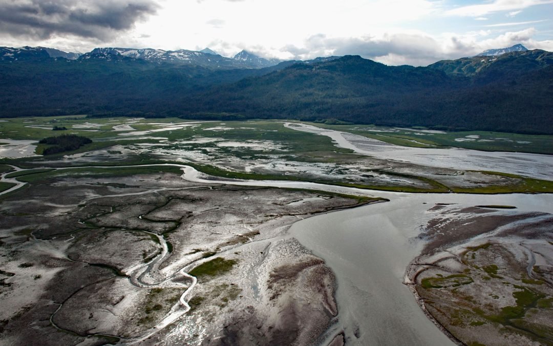
by CoastView | Feb 6, 2026 | 2026, Alaska, Coastal Features, Communities, Embayments, February 2026, Kachemak, Land Use
Listen to the article here https://coastview.org/wp-content/uploads/2026/01/KachemakSelo.mp3 Kachemak Selo is a small community at the head of Kachemak Bay adjacent to the Fox River Flats on the Kenai Peninsula, about 27 miles (44 km) southeast of Ninilchik and 20...
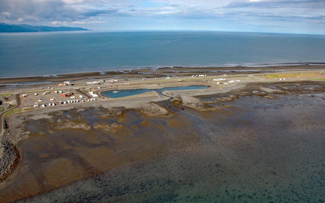
by CoastView | Jan 30, 2026 | 2026, Alaska, Developments, Embayments, January 2026, Kachemak, Land Use, Natural History
Listen to the article here https://coastview.org/wp-content/uploads/2026/01/DudiakLagoon.mp3 The Nick Dudiak Fishing Lagoon, also known as the Fishing Hole, is located on the Homer Spit, a peninsula projecting 4 miles (6.4 km) south-east from the northern shore of...
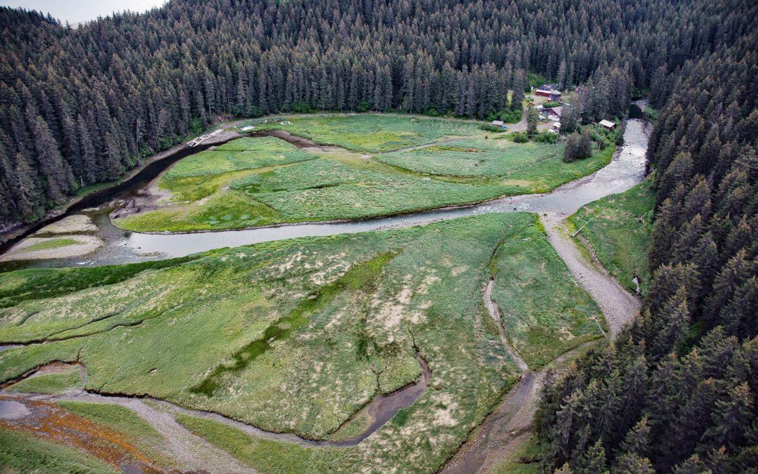
by CoastView | Jan 23, 2026 | 2026, Alaska, Biodiversity, Coastal Features, Embayments, Glaciers, January 2026, Kachemak, Land Use, Natural History, Parks, Rivers
Listen to the article here https://coastview.org/wp-content/uploads/2026/01/BradleyRiver.mp3 Bradley River is located on the Kenai Peninsula and flows north-west for 7 miles (11 km) from Bradley Lake at an elevation of 1,090 feet (332 m) to Kachemak Bay, about 31...