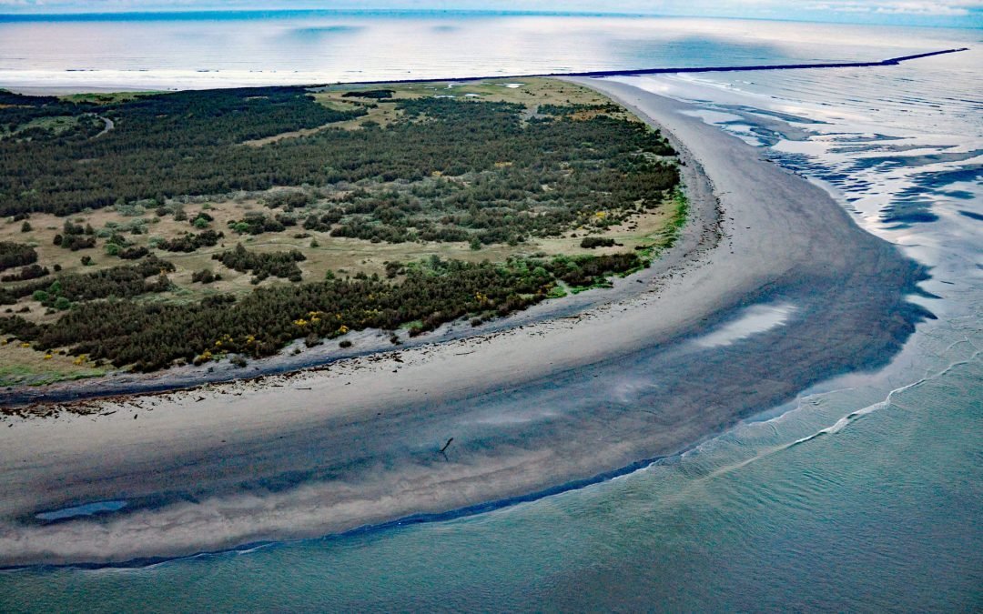
by CoastView | Feb 7, 2026 | 2026, Beaches, Coastal Features, February 2026, Land Use, Natural History, Oregon, Parks, Rivers
Listen to the article here https://coastview.org/wp-content/uploads/2026/01/ClatsopSpit.mp3 Clatsop Spit is part of Fort Stevens State Park that projects north from the south bank of the Columbia River and the submerged portion forms the Columbia River Bar, about 80...
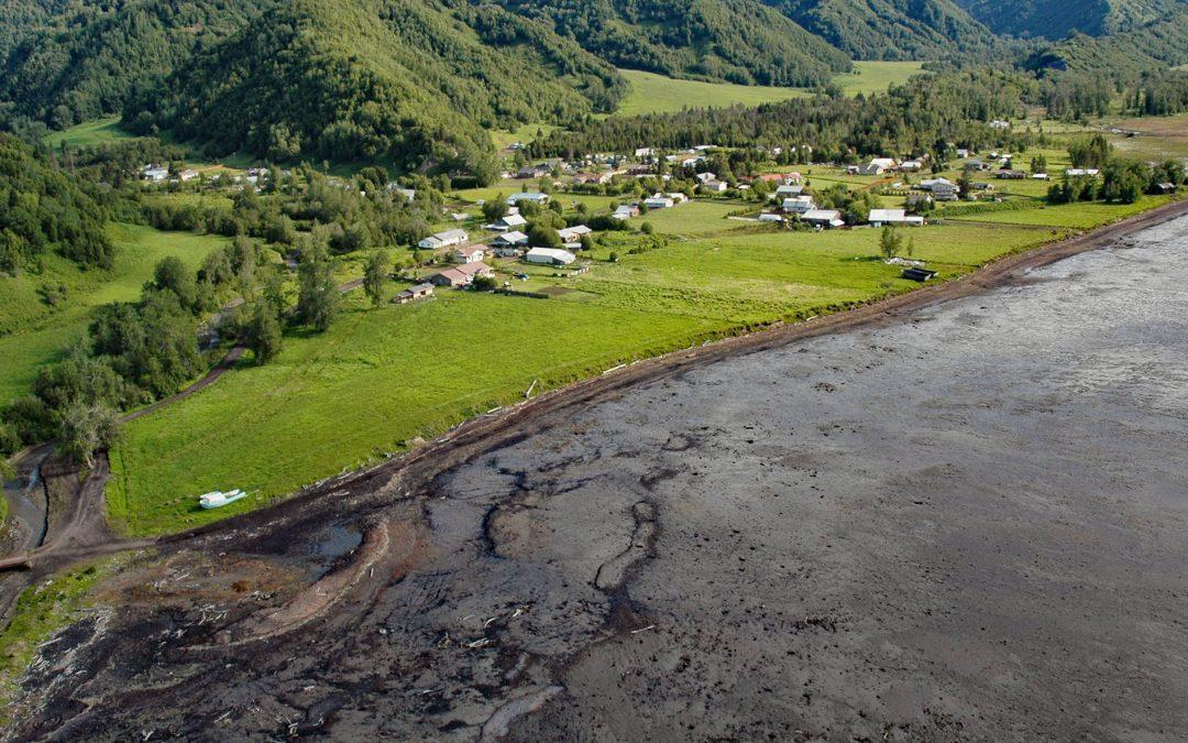
by CoastView | Feb 6, 2026 | 2026, Alaska, Coastal Features, Communities, Embayments, February 2026, Kachemak, Land Use
Listen to the article here https://coastview.org/wp-content/uploads/2026/01/KachemakSelo.mp3 Kachemak Selo is a small community at the head of Kachemak Bay adjacent to the Fox River Flats on the Kenai Peninsula, about 27 miles (44 km) southeast of Ninilchik and 20...
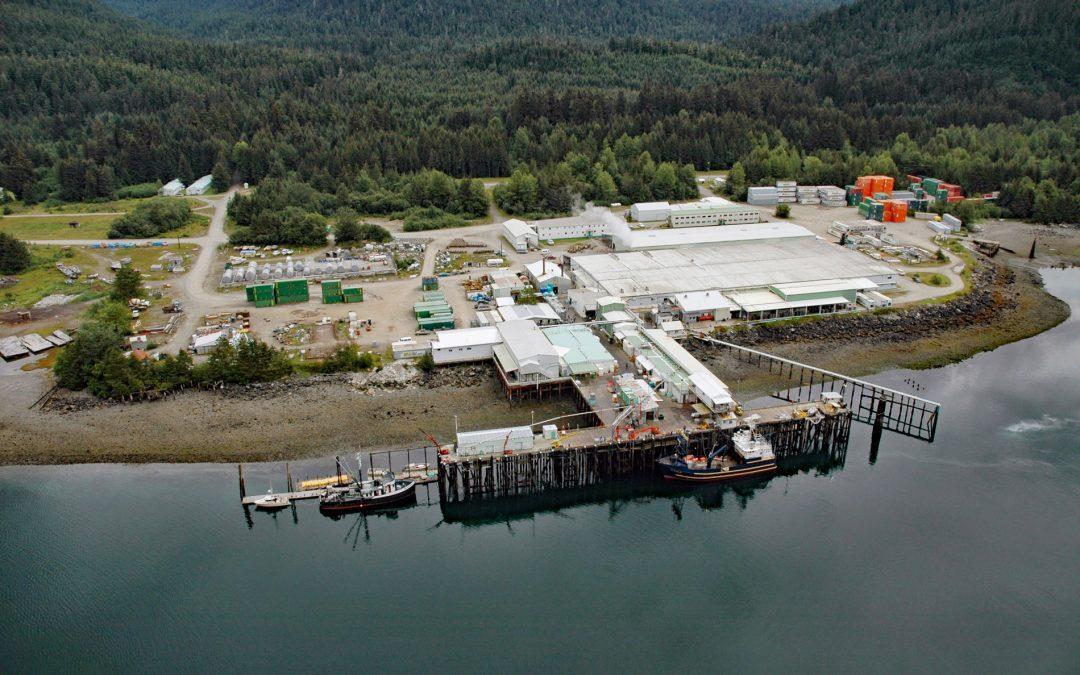
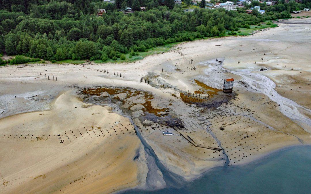
by CoastView | Feb 5, 2026 | 2026, Alaska, Canneries, Communities, Developments, Embayments, February 2026, Historical, Land Use, Natural History
Listen to the article here https://coastview.org/wp-content/uploads/2026/01/ExcursionInlet.mp3 Excursion Inlet is an embayment extending 11 miles (18 km) north-northwest from the northern coast of Icy Strait to the mouth of Excursion River, about 38 miles (61 km)...
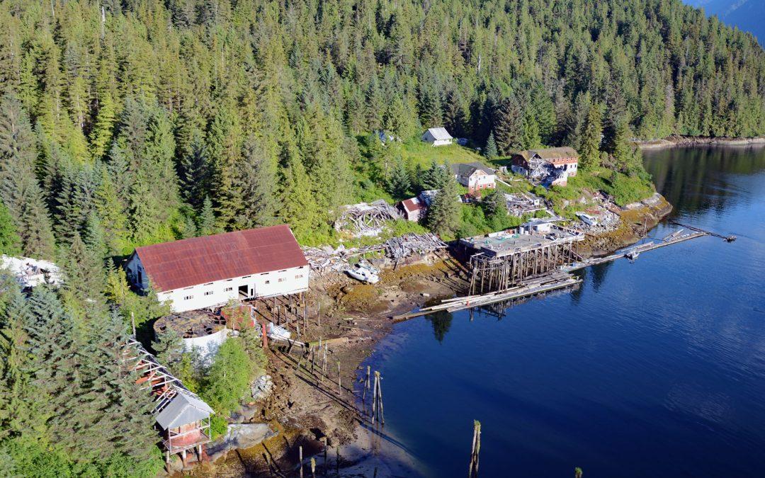
by CoastView | Feb 4, 2026 | 2026, British Columbia, Canneries, Coastal Features, Communities, Embayments, February 2026, Historical, Land Use
Listen to the article here https://coastview.org/wp-content/uploads/2026/01/Butedale.mp3 Butedale is a historical salmon cannery and community located on a small embayment adjacent to Butedale Falls along the Inside Passage on the north-east side of Princess Royal...
by CoastView | Feb 3, 2026 | 2026, Alaska, Developments, Embayments, February 2026, Historical, Islands, Land Use, Mines
Listen to the article here https://coastview.org/wp-content/uploads/2026/01/TreadwellMine.mp3 Treadwell is a historical gold mine on the eastern coast of Douglas Island on Gastineau Channel, about 1.2 miles (1.9 km) south-east of the community of Douglas and 3 miles...
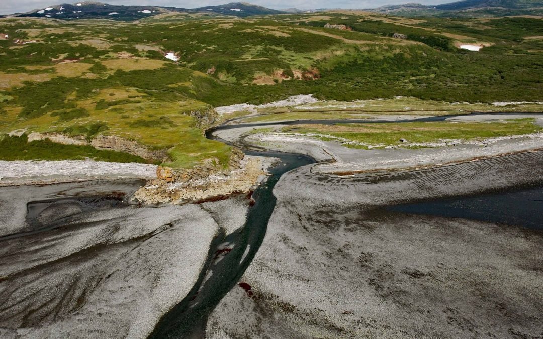
by CoastView | Feb 1, 2026 | 2026, Alaska, Coastal Features, Developments, Embayments, February 2026, Land Use, Natural History, Rivers
Listen to the article here https://coastview.org/wp-content/uploads/2026/02/AmakdedoriCreek.mp3 Amakdedori Creek drains a watershed of 17,781 acres (7,196 ha) on the eastern flank of the Aleutian Range and flows south-east for 10 miles (16 km) to Kamishak Bay, about...