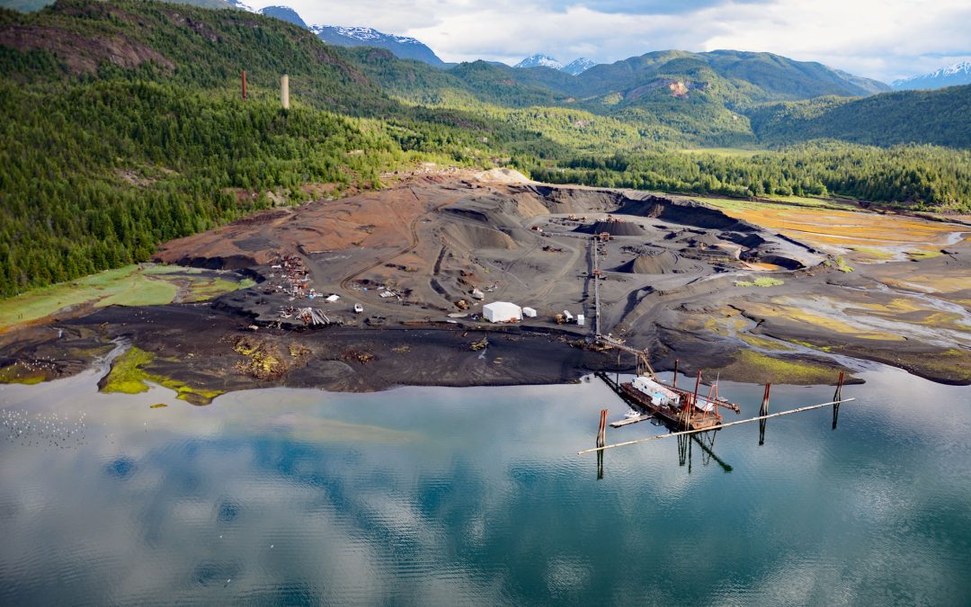
by CoastView | Feb 20, 2025 | 2025, British Columbia, Chemical Pollution, Coastal Features, Communities, Developments, Embayments, Historical, Land Use, Mines
Listen to the article here https://coastview.org/wp-content/uploads/2025/03/Anyox.mp3 Anyox, an abandoned mining community in the Coast Mountains, lies at the mouth of Anyox Creek on Granby Bay in Observatory Inlet, about 79 miles (127 km) north-northeast of Prince...
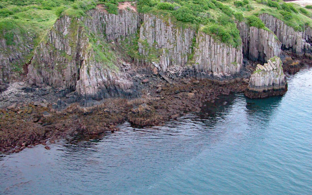
by CoastView | Feb 9, 2025 | 2025, Alaska, Embayments, Historical, Islands, Land Use, Mines, Parks
Listen to the article here https://coastview.org/wp-content/uploads/2025/03/Takli.mp3 Takli Island is in Amalik Bay, between Cape Ilktugitak to the southwest and Cape Atushagvik to the northeast, along the Shelikof Strait coast of the Alaska Peninsula in Katmai...
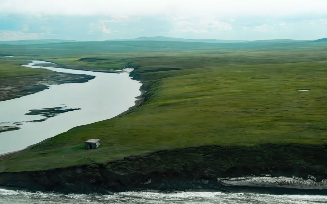
by CoastView | Feb 8, 2025 | 2025, Alaska, Beaches, Coastal Features, Historical, Mines, Rivers, Shelter Cabins
Listen to the article here https://coastview.org/wp-content/uploads/2025/03/Pitmegea.mp3 The Pitmegea River originates at an elevation of about 1,300 feet (396 m) in the De Long Mountains of the western Brooks Range, and flows northwest for 37 miles (60 km) to the...
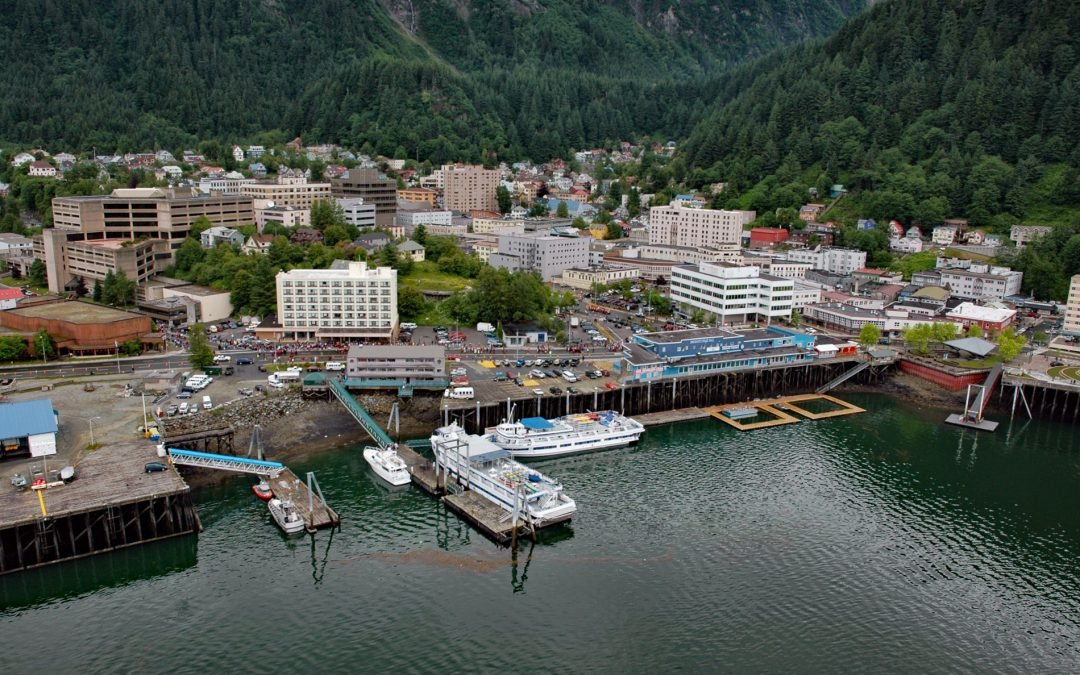
by CoastView | Feb 5, 2025 | 2025, Alaska, Climate Change, Coastal Features, Communities, Developments, Embayments, Historical, Land Use, Mines, Rivers
Listen to the article here https://coastview.org/wp-content/uploads/2025/03/Juneau.mp3 Juneau is the state capital, situated at the mouth of Gold Creek on Gastineau Channel, about 93 miles (150 km) northeast of Sitka and 87 miles (140 km) south-southeast of Skagway,...
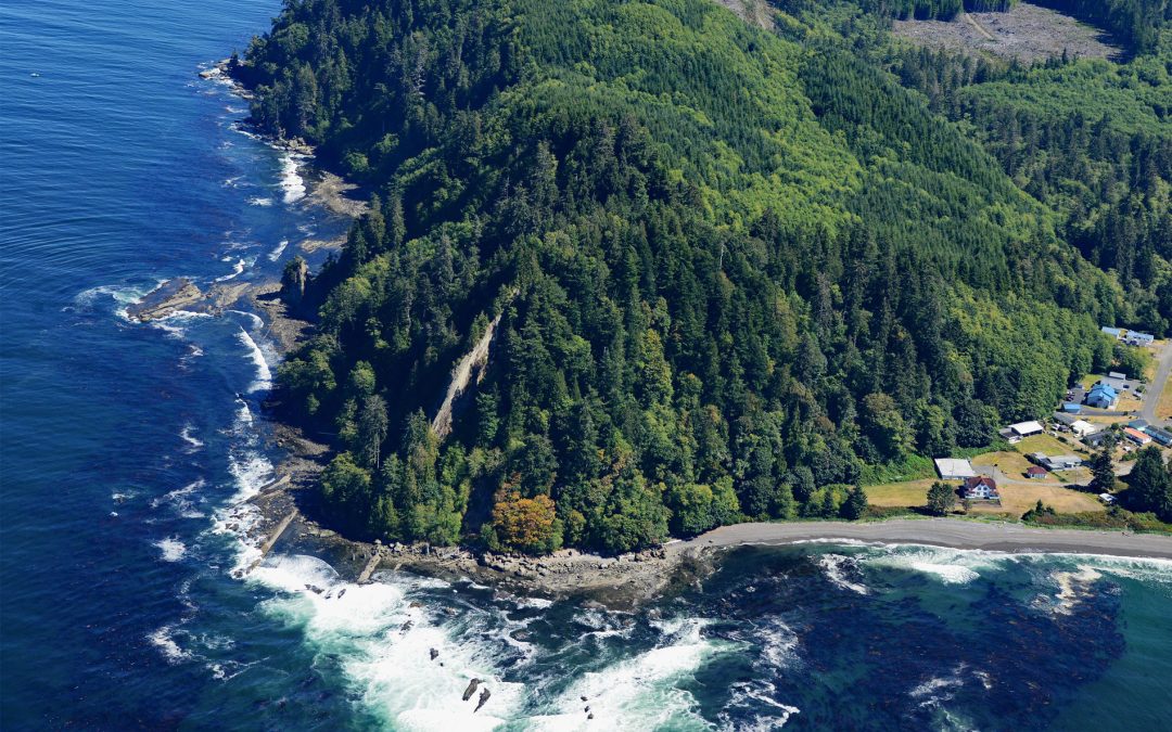
by CoastView | Feb 2, 2025 | 2025, Beaches, Biodiversity, Coastal Features, Communities, Embayments, Headlands, Historical, Land Use, Lighthouses, Mines, Rivers, Washington
Listen to the article here https://coastview.org/wp-content/uploads/2025/03/Slip-Point.mp3 Slip Point sits on the southern shore of the Strait of Juan de Fuca at the eastern end of Clallam Bay on the Olympic Peninsula, about 39 miles (63 km) west-northwest of Port...
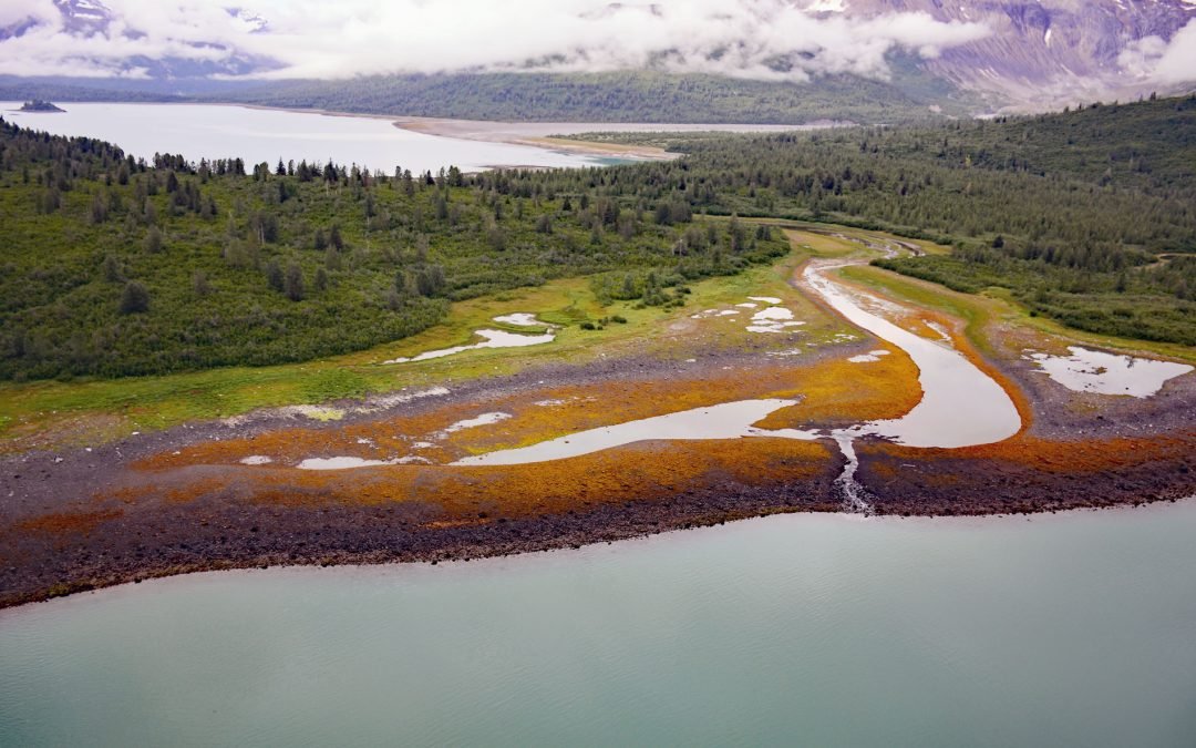
by CoastView | Jan 30, 2025 | 2025, Alaska, Biodiversity, Climate Change, Coastal Features, Embayments, Glaciers, Historical, Land Use, Mines, Parks
Listen to the article here https://coastview.org/wp-content/uploads/2025/03/Scidmore.mp3 Scidmore Bay, enclosed by the Gilbert Peninsula to the east and the Fairweather Mountains to the west, lies in Glacier Bay National Park and Preserve, about 119 miles (192 km)...