
by CoastView | Nov 13, 2024 | 2024, Alaska, Coastal Features, Developments, Embayments, Historical, Islands, Land Use, Mines, Parks
New Year Islands are at the mouth of Drier Bay in Knight Island Passage on the west coast of Knight Island in Prince William Sound, about 55 miles (89 km) east-northeast of Seward and 41 miles (66 km) southeast of Whittier, Alaska. The island cluster includes eight...

by CoastView | Nov 2, 2024 | 2024, Beaches, Biodiversity, Coastal Features, Headlands, Historical, Land Use, Mines, Parks, Washington
Point of Arches and the adjacent Shi Shi Beach represent a unique wilderness shoreline located at the western edge of the Olympic National Park, about 24 miles (39 km) north of La Push and 9 miles (15 km) south-southwest of Neah Bay, Washington. The archaeological...
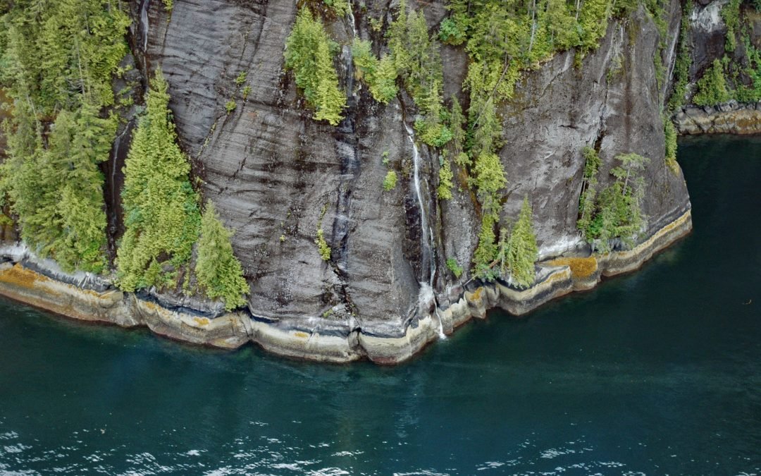
by CoastView | Oct 21, 2024 | 2024, Alaska, Coastal Features, Embayments, Historical, Land Use, Mines, Parks, Waterfalls
Rudyerd Bay is a deglaciated fjord in the Coast Range of Southeast Alaska in Misty Fjords National Monument, about 89 miles (143 km) north-northwest of Prince Rupert and 39 miles (63 km) northeast of Ketchikan, Alaska. The fjord extends northeast for 11.5 miles (19...
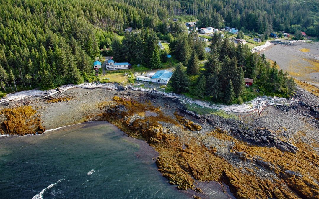
by CoastView | Oct 19, 2024 | 2024, Alaska, Canneries, Communities, Developments, Embayments, Historical, Islands, Land Use, Mines
Kasaan is a small community on the north shore of Kasaan Bay and the southern shore of the Kasaan Peninsula, on the east coast of Prince of Wales Island, about 65 miles (105 km) south of Wrangell and 33 miles (53 km) west-northwest of Ketchikan, Alaska. Kasaan is the...
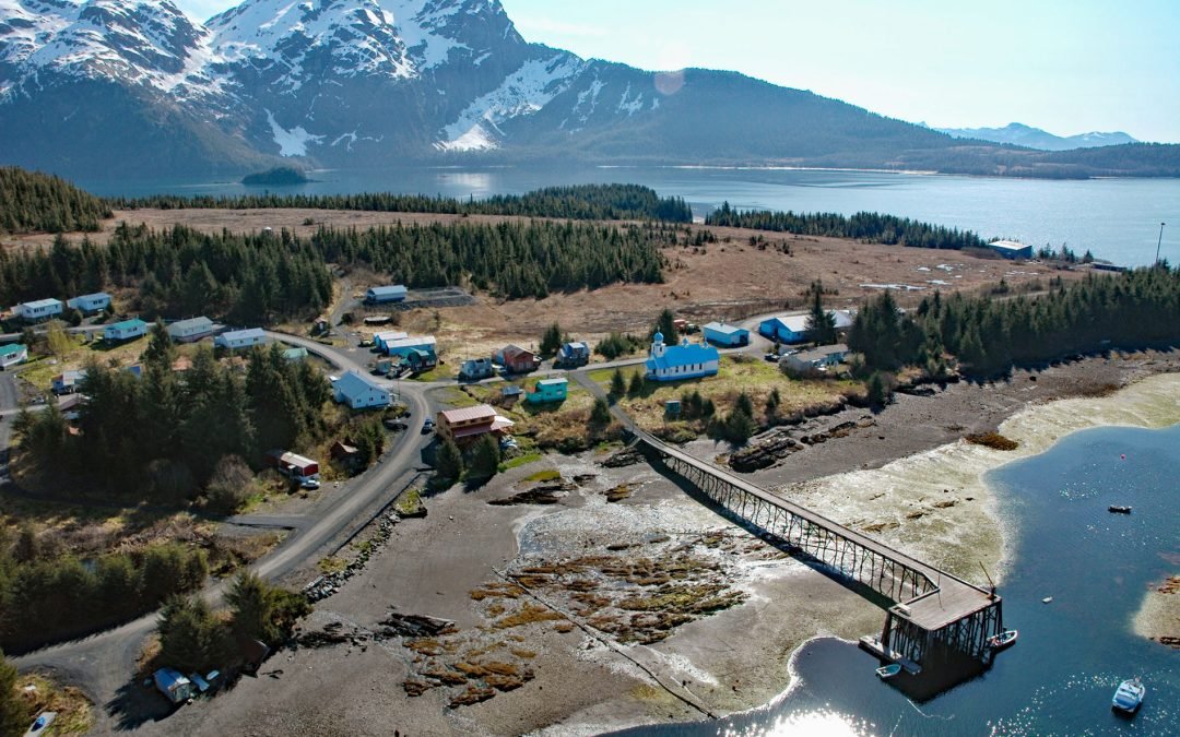
by CoastView | Sep 30, 2024 | 2024, Alaska, Biodiversity, Chemical Pollution, Communities, Developments, Embayments, Historical, Land Use, Mines
Tatitlek is a small Chugach Alutiiq community located on the northeastern shore of Tatitlek Narrows across from Bligh Island and at the mouth of Boulder Bay on the eastern shore of Prince William Sound, about 24 miles (38 km) southwest of Valdez and 39 miles (63 km)...
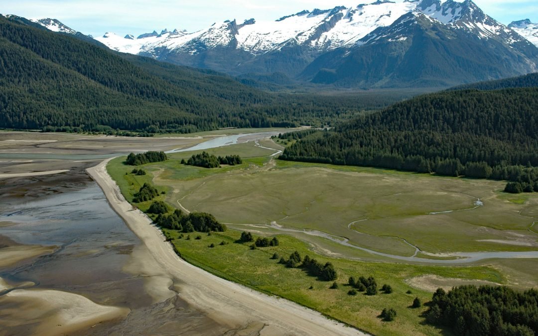
by CoastView | Sep 19, 2024 | 2024, Alaska, Beaches, Coastal Features, Developments, Embayments, Historical, Land Use, Mines, Rivers
Eagle Beach is at the mouth of Eagle River on the eastern shore of Favorite Channel, about 68 miles (109 km) south-southeast of Skagway and 22 miles (35 km) northwest of Juneau, Alaska. Favorite Channel is a waterway extending northwest for 16 miles (25 km) from...