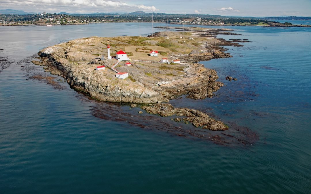
by CoastView | Feb 11, 2026 | 2026, Biodiversity, British Columbia, Coastal Features, Developments, February 2026, Islands, Land Use, Lighthouses, Natural History
Listen to the article here https://coastview.org/wp-content/uploads/2026/01/StainesPoint.mp3 Staines Point is the southern tip of the Trial Islands, which comprise two islets separated by a narrow channel in the Strait of Juan de Fuca about 0.5 miles (0.8 km) offshore...
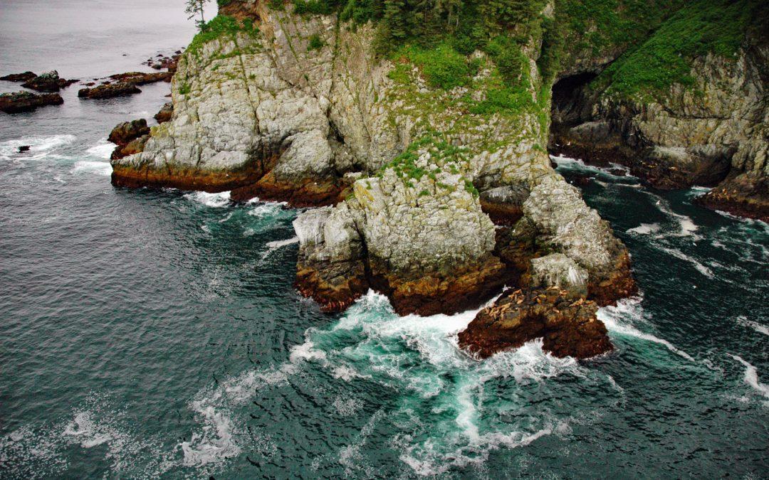
by CoastView | Feb 9, 2026 | 2026, Alaska, Coastal Features, February 2026, Historical, Islands, Land Use, Natural History, Shipwrecks
Listen to the article here https://coastview.org/wp-content/uploads/2026/01/SSYukon.mp3 The steamship Yukon, bound from Goodnews Bay on the Kuskokwim River to Seattle in 1913, ran aground in fog and became a total loss on the north-west end of Sanak Island on what is...
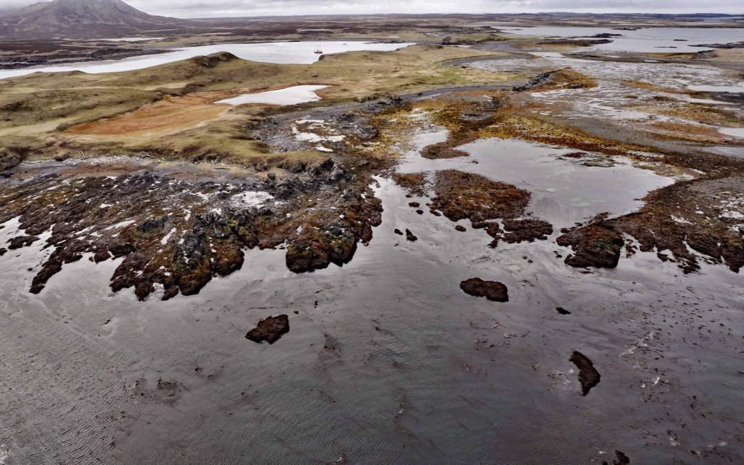
by CoastView | Feb 8, 2026 | 2026, Alaska, Biodiversity, Coastal Features, February 2026, Headlands, Islands, Natural History
Listen to the article here https://coastview.org/wp-content/uploads/2026/01/Elringtonisland.mp3 Point Elrington is a tied-island connected by a gravel isthmus to the south-western tip of Elrington Island in the Gulf of Alaska, about 96 miles (155 km) south-west of...
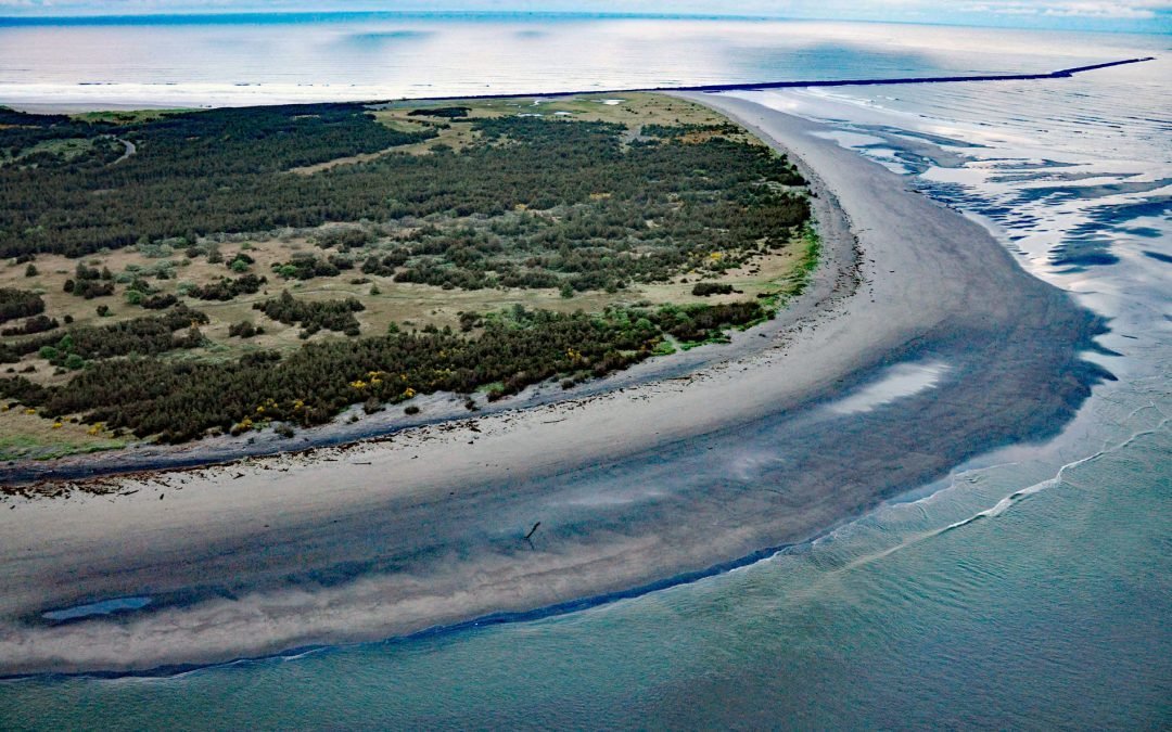
by CoastView | Feb 7, 2026 | 2026, Beaches, Coastal Features, February 2026, Land Use, Natural History, Oregon, Parks, Rivers
Listen to the article here https://coastview.org/wp-content/uploads/2026/01/ClatsopSpit.mp3 Clatsop Spit is part of Fort Stevens State Park that projects north from the south bank of the Columbia River and the submerged portion forms the Columbia River Bar, about 80...
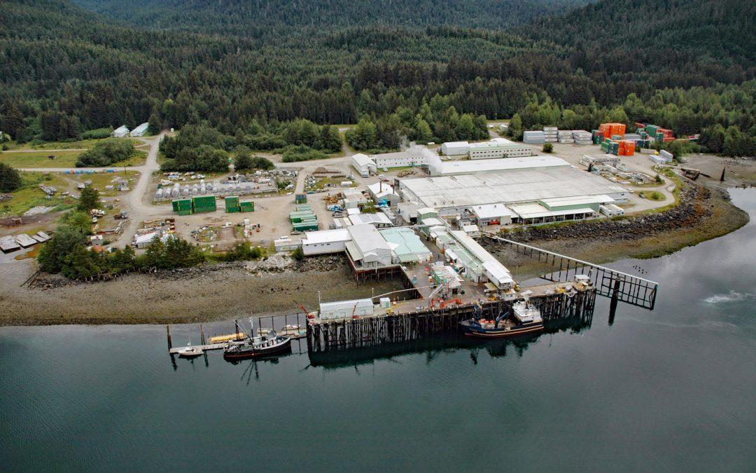
by CoastView | Feb 5, 2026 | 2026, Alaska, Canneries, Communities, Developments, Embayments, February 2026, Historical, Land Use, Natural History
Listen to the article here https://coastview.org/wp-content/uploads/2026/01/ExcursionInlet.mp3 Excursion Inlet is an embayment extending 11 miles (18 km) north-northwest from the northern coast of Icy Strait to the mouth of Excursion River, about 38 miles (61 km)...
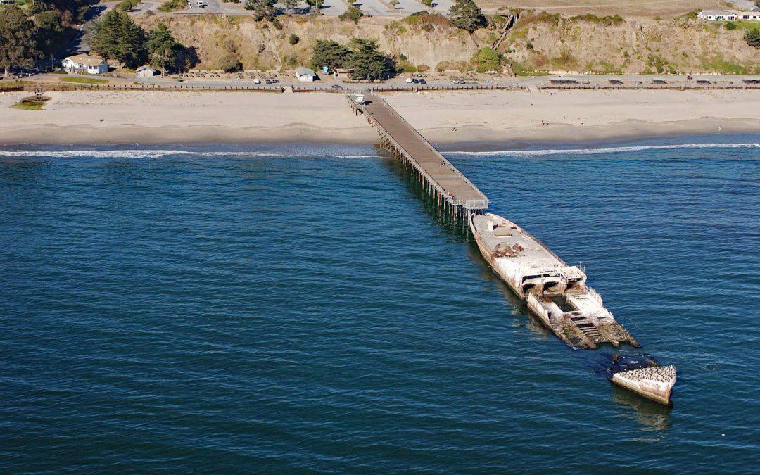
by CoastView | Feb 2, 2026 | 2026, Beaches, California, Communities, Developments, February 2026, Historical, Natural History, Shipwrecks
Listen to the article here https://coastview.org/wp-content/uploads/2026/01/SSPaloAlto.mp3 SS Palo Alto is a shipwreck now serving as an artificial reef located at Seacliff State Beach on the northern coast of Monterey Bay, approximately 6.4 miles (10.3 km) east of...