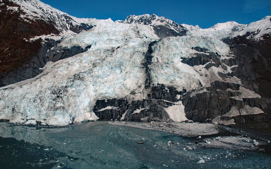
by CoastView | Oct 13, 2024 | 2024, Alaska, Climate Change, Coastal Features, Embayments, Glaciers, Historical, Natural History
Bryn Mawr Glacier flows southeast for about 4.5 miles (7 km) to Harvard Arm of College Fjord in northwestern Prince William Sound, about 52 miles (84 km) west of Valdez and 44 miles (71 km) northeast of Whittier, Alaska. The terminus of Bryn Mawr Glacier is 1.8 miles...
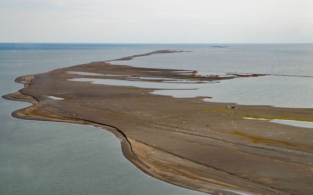
by CoastView | Oct 2, 2024 | 2024, Alaska, Beaches, Biodiversity, Climate Change, Coastal Features, Embayments, Historical, Islands, Natural History
Cooper Island is an Arctic barrier island and one of the Plover Islands on Elson Lagoon on the Beaufort Sea coast, about 129 miles (208 km) northwest of Nuiqsut and 24 miles (39 km) east of Utqiaġvik, Alaska. The Iñupiat name for the island is Lglurak, generally...
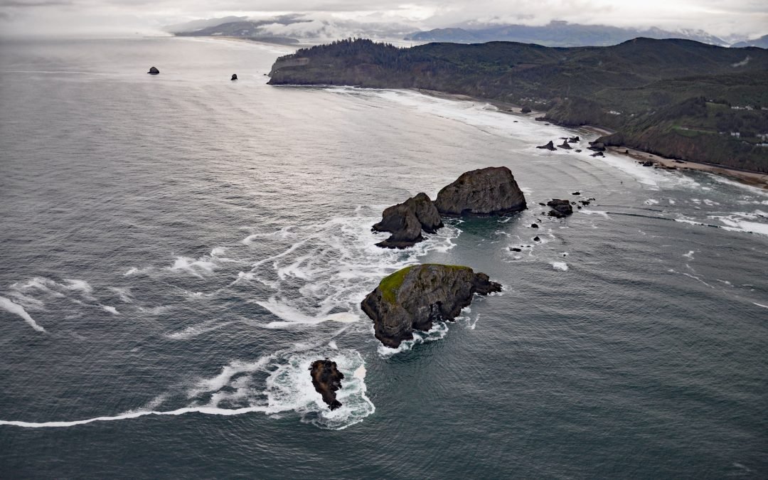
by CoastView | Sep 29, 2024 | 2024, Coastal Features, Headlands, Historical, Islands, Land Use, Natural History, Oregon, Parks
Listen to the article here https://coastview.org/wp-content/uploads/2026/01/ThreeArchRocks.mp3 Three Arch Rocks are massive arched basalt sea stacks located south of Cape Meares and 0.5 miles (0.9 km) offshore from Maxwell Point at the community of Oceanside, about 8...

by CoastView | Sep 9, 2024 | 2024, Beaches, Biodiversity, Climate Change, Coastal Features, Land Use, Natural History, Oregon, Parks
Strawberry Hill is part of Neptune State Park, situated between Nancy Creek and Bob Creek, about 19 miles (31 km) north of Florence and 5 miles (8 km) south of Yachats, Oregon. The Strawberry Hill Rocky Shore Area is a series of basalt outcrops along the base of Cape...

by CoastView | Aug 18, 2024 | 2024, Alaska, Coastal Features, Historical, Land Use, Natural History, Parks, Rivers, Shelter Cabins
Mount Susitna is a prominent mountain and landmark in northern Cook Inlet, with an elevation of 4,396 feet (1,340 m) rising from the Susitna Flats on the west bank of the Susitna River, about 65 miles (105 km) north-northeast of Kenai and 33 miles (53 km) northwest of...
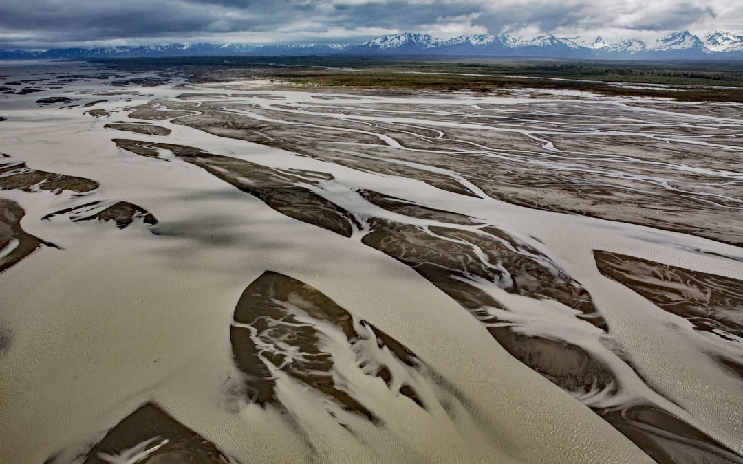
by CoastView | Jul 31, 2024 | 2024, Alaska, Coastal Features, Glaciers, Islands, Land Use, Mines, Natural History, Rivers
The Copper River watershed drains about 24,000 square miles (62,000 sq km) in the Wrangell, Chugach, and Saint Elias mountains and the mainstem flows for about 290 miles (470 km) to the Gulf of Alaska where it creates a wide delta, about 195 miles west-northwest of...