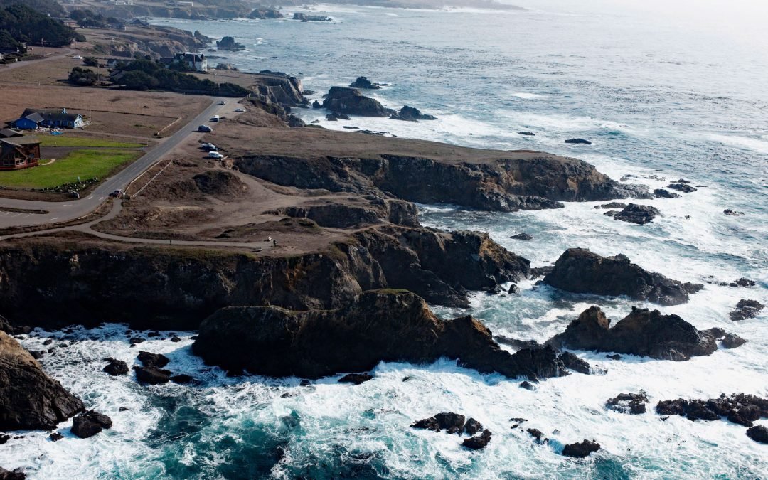
by CoastView | Nov 10, 2025 | 2025, California, Headlands, November 2025, Parks
Listen to the article here https://coastview.org/wp-content/uploads/2025/07/Pomo-Bluffs.mp3 Pomo Bluffs is a park located on the ocean bluffs at Todd’s Point, overlooking Noyo Bay, approximately 1 mile (1.6 km) south of Fort Bragg, in the community of Noyo,...
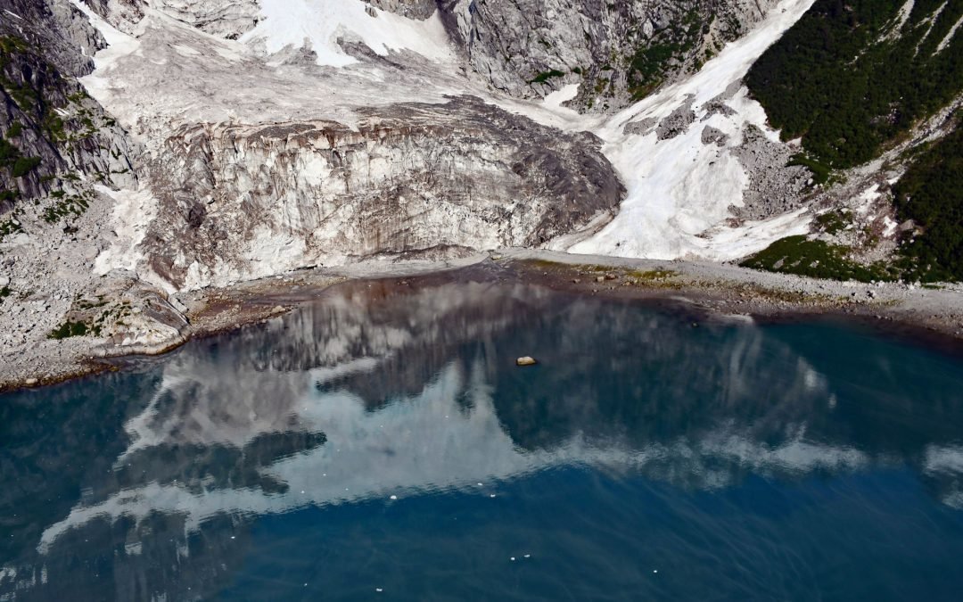
by CoastView | Nov 3, 2025 | 2025, Alaska, Climate Change, Coastal Features, Embayments, Glaciers, Historical, Land Use, Natural History, November 2025, Parks
Listen to the article here https://coastview.org/wp-content/uploads/2025/07/Anchor-Glacier.mp3 Anchor Glacier flows east for 3 miles (5 km) to Northwestern Fjord, which is located approximately 52 miles (84 km) east-northeast of Homer and 32 miles (52 km) southwest of...
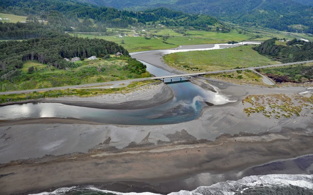
by CoastView | Nov 2, 2025 | 2025, Beaches, Biodiversity, Coastal Features, Historical, Land Use, Natural History, November 2025, Oregon, Parks, Rivers
Listen to the article here https://coastview.org/wp-content/uploads/2025/07/Pistol-River.mp3 Pistol River flows generally southwest for 21 miles (34 km) to the Pistol River State Scenic Viewpoint overlooking the Pacific Ocean near the community of Pistol River, about...

by CoastView | Oct 31, 2025 | 2025, British Columbia, Coastal Features, Historical, Islands, Land Use, Natural History, October 2025, Parks
Listen to the article here https://coastview.org/wp-content/uploads/2025/07/DArcy-Island.mp3 D’Arcy Island, part of the Southern Gulf Islands in Haro Strait, covers approximately 205 acres (83 ha), about 30 miles (48 km) west of Anacortes and 10 miles (16 km)...

by CoastView | Oct 30, 2025 | 2025, Alaska, Biodiversity, Coastal Features, Embayments, Islands, Natural History, October 2025, Parks
Listen to the article here https://coastview.org/wp-content/uploads/2025/07/Shakun-Island.mp3 Shakun Islets is a group of grass-covered islands and submerged reefs extending 1.8 miles (2.9 km) north to south at the entrance of Swikshak Bay in Shelikof Strait, about...

by CoastView | Oct 27, 2025 | 2025, Alaska, Coastal Features, Communities, Developments, Historical, Land Use, Mines, October 2025, Parks, Rivers
Listen to the article here https://coastview.org/wp-content/uploads/2025/07/Rainbow-Valley.mp3 Rainbow Valley is a watershed located on Turnagain Arm between Rainbow Peak to the west and Indianhouse Mountain to the east, approximately 17 miles (27 km) south-southeast...