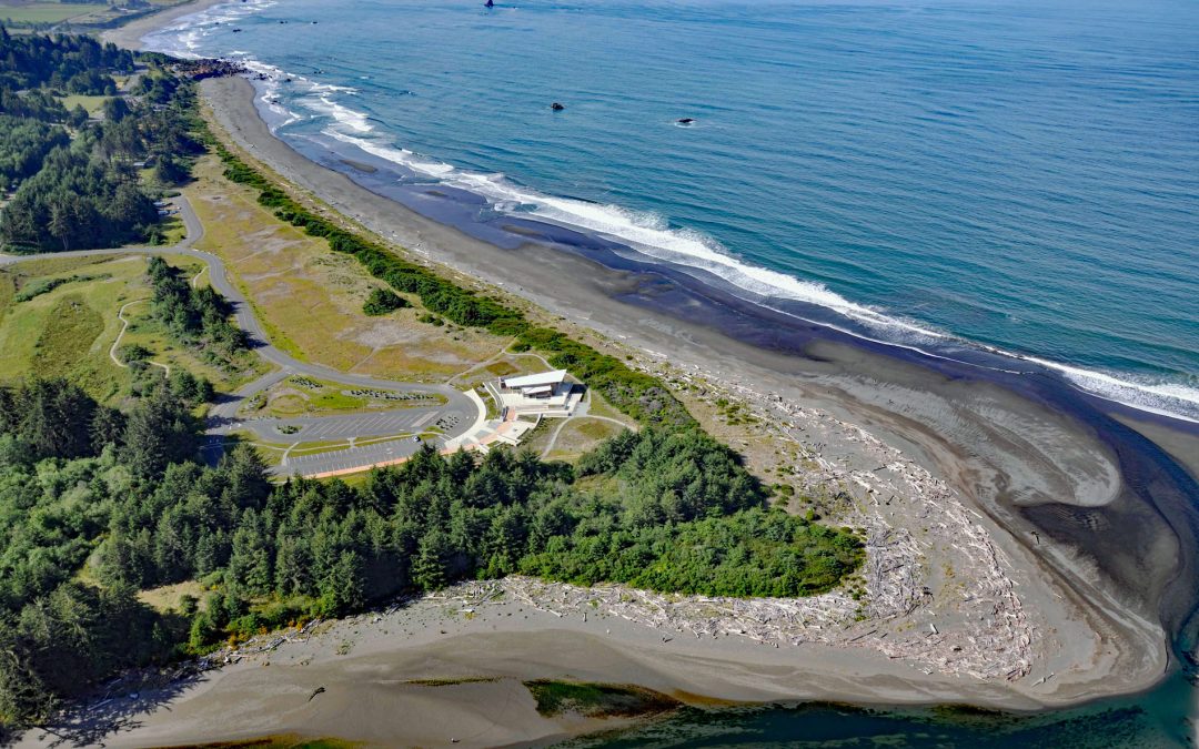
by CoastView | Feb 21, 2026 | 2026, Beaches, Coastal Features, Developments, February 2026, Land Use, Natural History, Oregon, Parks, Rivers
Listen to the article here https://coastview.org/wp-content/uploads/2026/01/Crissey-Field.mp3 The Winchuck River starts at an elevation of about 2,000 feet (610 m) and flows generally south-west for 19 miles (31 km) through the Rogue River–Siskiyou National Forest to...
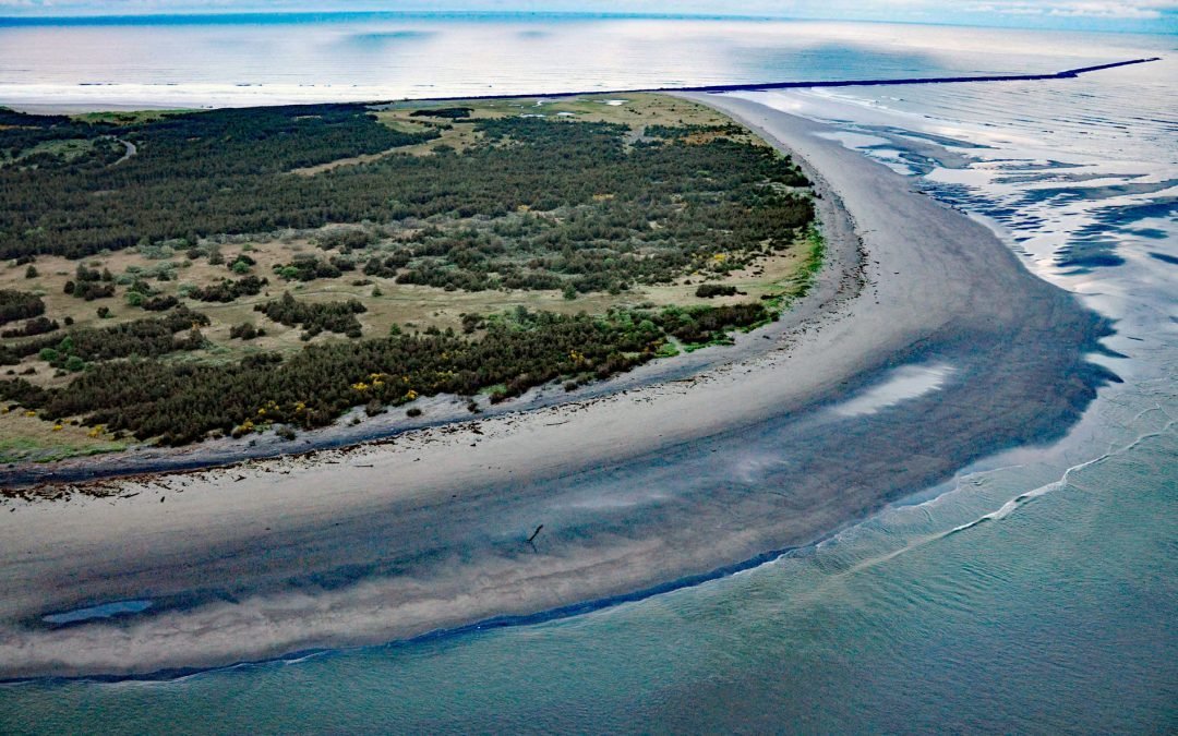
by CoastView | Feb 17, 2026 | 2026, Alaska, Beaches, Biodiversity, Coastal Features, February 2026, Natural History, Parks, Rivers
Listen to the article here https://coastview.org/wp-content/uploads/2026/01/PollyCreek.mp3 Polly Creek and Little Polly Creek drain a combined watershed of 16,113 acres (6,521 ha) and flow generally south for nine miles (14 km) and eight miles (13 km) respectively to...
by CoastView | Feb 7, 2026 | 2026, Beaches, Coastal Features, February 2026, Land Use, Natural History, Oregon, Parks, Rivers
Listen to the article here https://coastview.org/wp-content/uploads/2026/01/ClatsopSpit.mp3 Clatsop Spit is part of Fort Stevens State Park that projects north from the south bank of the Columbia River and the submerged portion forms the Columbia River Bar, about 80...

by CoastView | Jan 29, 2026 | 2026, British Columbia, Coastal Features, Communities, Developments, Historical, January 2026, Land Use, Parks
Listen to the article here https://coastview.org/wp-content/uploads/2026/01/SiwashRock.mp3 Siwash Rock is a sea stack on the western shoreline of Stanley Park on Burrard Inlet, between English Bay to the south and the entrance to Vancouver Harbour to the north, about...

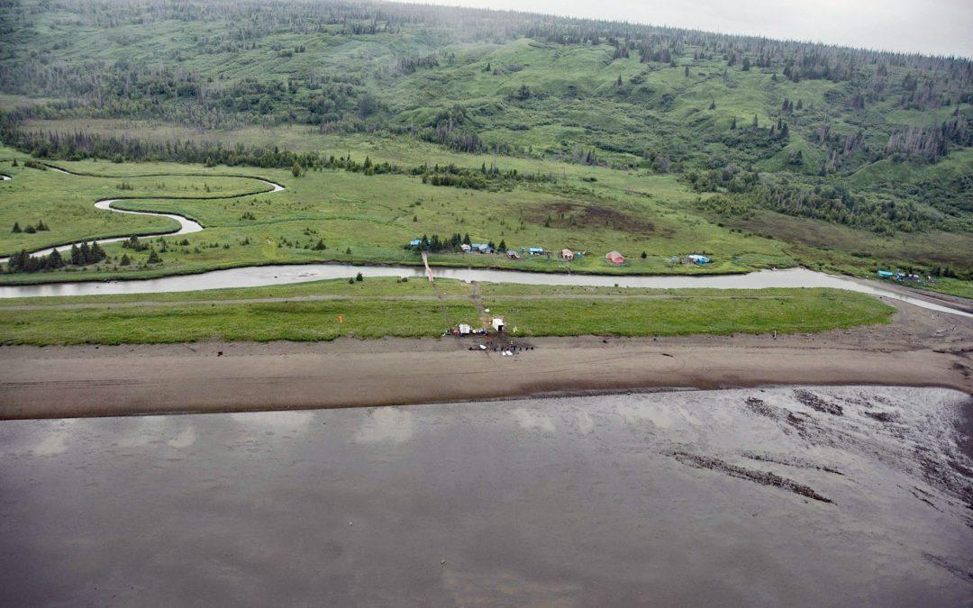
by CoastView | Jan 25, 2026 | 2026, Alaska, Coastal Features, January 2026, Land Use, Natural History, Parks, Rivers
Listen to the article here https://coastview.org/wp-content/uploads/2026/01/CrescentRiver.mp3 Crescent River is formed by the junction of the North Fork and Lake Fork tributaries, which start in Lake Clark National Park and Preserve, and flows south-east for 12 miles...
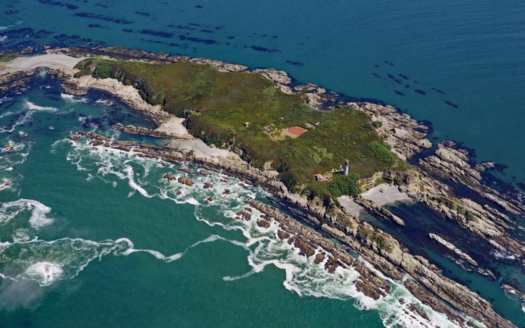
by CoastView | Jan 24, 2026 | 2026, Coastal Features, Islands, January 2026, Land Use, Lighthouses, Natural History, Parks, Washington
Listen to the article here https://coastview.org/wp-content/uploads/2026/01/DestructionIsland.mp3 Destruction Island is part of the Quillayute Needles National Wildlife Refuge, located 3.5 miles (5.6 km) offshore from the Olympic Peninsula, about 56 miles (90 km)...