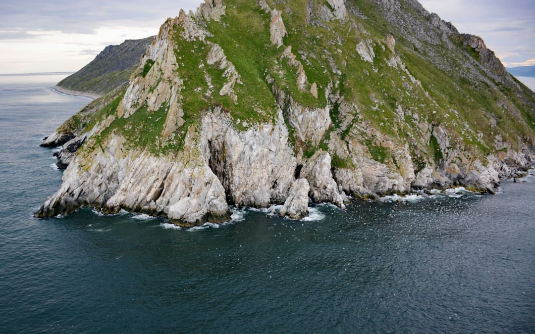
by CoastView | Jan 23, 2025 | 2025, Alaska, Biodiversity, Coastal Features, Communities, Historical, Islands, Land Use, Parks, Shipwrecks
Listen to the article here https://coastview.org/wp-content/uploads/2025/03/Sledge-Island.mp3 Sledge Island, 1.5 miles (2.4 km) across, lies in the Bering Sea, 5 miles (8 km) off the Seward Peninsula’s south coast, about 95 miles (153 km) southeast of Wales and 25...
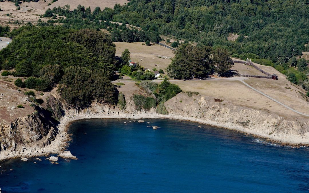
by CoastView | Jan 22, 2025 | 2025, California, Coastal Features, Communities, Developments, Embayments, Historical, Land Use, Parks
Listen to the article here https://coastview.org/wp-content/uploads/2025/03/Fort-Ross.mp3 Fort Ross, a historic Russian settlement and part of Fort Ross State Historic Park, lies on a small bight called Fort Ross Cove, south of Northwest Cape, about 24 miles (39 km)...
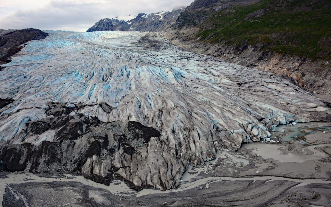
by CoastView | Jan 21, 2025 | 2025, Alaska, Climate Change, Embayments, Glaciers, Historical, Land Use, Mines, Parks
Listen to the article here https://coastview.org/wp-content/uploads/2025/03/Reid-Glacier.mp3 Reid Glacier flows north for 11 miles (18 km) from the Brady Icefield to Reid Inlet in Glacier Bay National Park and Preserve, about 113 miles (182 km) southeast of Yakutat...
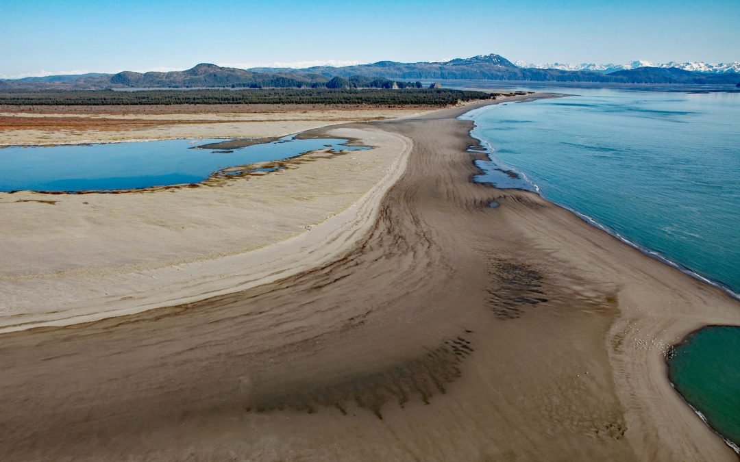
by CoastView | Jan 17, 2025 | 2025, Alaska, Beaches, Biodiversity, Chemical Pollution, Climate Change, Coastal Features, Developments, Historical, Islands, Land Use, Parks
Listen to the article here https://coastview.org/wp-content/uploads/2025/03/Strawberry-Hill.mp3 Strawberry Hill is a series of uplifted beach ridges on Point Bentinck, at the eastern tip of Hinchinbrook Island and the southern entrance to Strawberry Channel, which...
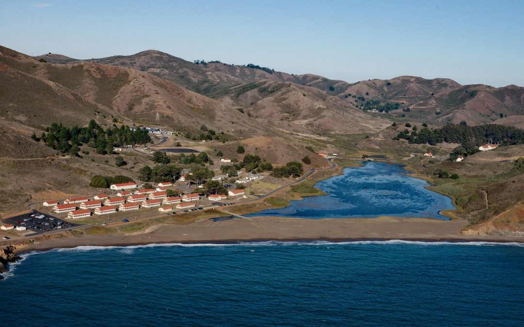
by CoastView | Jan 15, 2025 | 2025, Beaches, California, Developments, Headlands, Historical, Land Use, Parks
Listen to the article here https://coastview.org/wp-content/uploads/2025/03/Fort-Cronkhite.mp3 Fort Cronkhite, on the Marin Headlands, is a historic US Army facility that supported Battery Townsley, part of San Francisco Bay’s coastal artillery during World War...
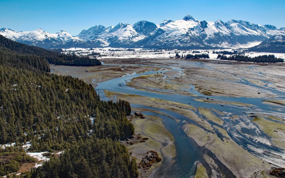
by CoastView | Jan 14, 2025 | 2025, Alaska, Biodiversity, Climate Change, Coastal Features, Glaciers, Historical, Land Use, Mines, Nitrogen Cycle, Parks, Phosphorus, Rivers
Listen to the article here https://coastview.org/wp-content/uploads/2025/03/Coghill-River-1.mp3 The Coghill River in Chugach National Forest flows southwest for 5 miles (8 km) from the terminus of Dartmouth Glacier to Coghill Lake, which is 4.7 miles (7.5 km) long,...