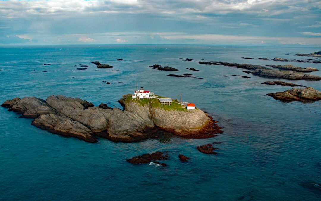
by CoastView | Apr 22, 2024 | 2024, Alaska, Coastal Features, Developments, Headlands, Islands, Land Use, Lighthouses, Natural History, Parks
Cape Spencer is a prominent headland in Glacier Bay National Park and Preserve marking the northern entrance to Cross Sound adjacent to an area with numerous offshore islets, rocks, and islands, one of which, near the entrance to Dicks Arm, is the site of a historic...
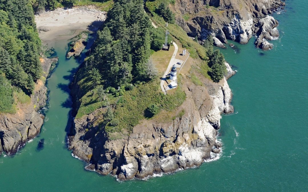
by CoastView | Apr 20, 2024 | 2024, Coastal Features, Developments, Land Use, Lighthouses, Natural History, Parks, Rivers, Washington
Cape Disappointment is a prominent headland and navigational landmark with a historic lighthouse on the north side of the Columbia River, 12 miles (19 km) northwest of Astoria, and 2.2 miles (3.5 km) south of Ilwaco, Washington. The cape was named in 1788 by British...

by CoastView | Apr 18, 2024 | 2024, Coastal Features, Headlands, Historical, Land Use, Natural History, Parks, Shipwrecks, Washington
Teahwhit Head is a rocky headland with a natural sea arch and the site of a historical shipwreck on the coast of Olympic National Park in the Olympic Coast National Marine Sanctuary, about 12 miles (19 km) southwest of Forks and 2.8 miles (4.5 km) south-southeast of...
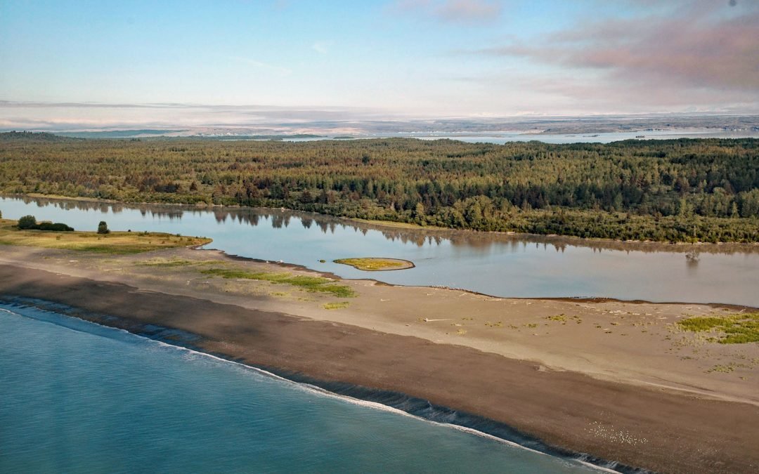
by CoastView | Apr 14, 2024 | 2024, Alaska, Beaches, Biodiversity, Coastal Features, Glaciers, Land Use, Natural History, Parks, Rivers
Sudden Stream drains the Malaspina Coastal Plain, flowing generally south for 2 miles (3.2 km) from the outlet of Malaspina Lake, a proglacial lake at the terminus of the Malaspina Glacier, to a lagoon formed by a barrier spit called Schooner Beach on Yakutat Bay,...
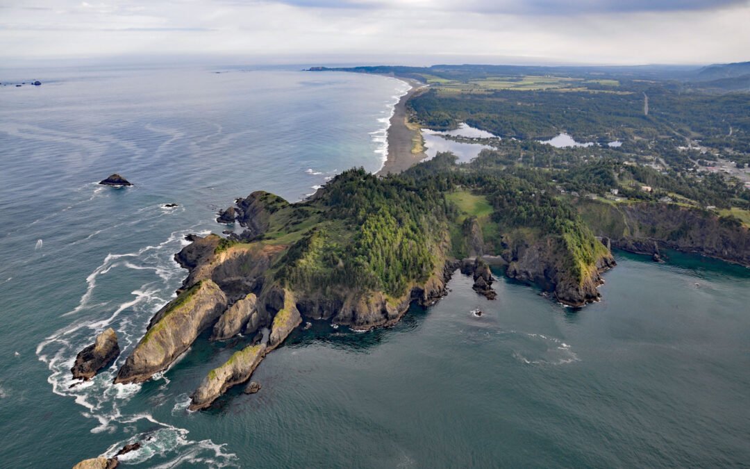
by CoastView | Apr 13, 2024 | 2024, Biodiversity, Coastal Features, Developments, Headlands, Land Use, Natural History, Oregon, Parks
Nellies Cove is situated on the south side of a rocky headland known as The Heads, between Agate Beach to the north and Port Orford to the south, and is the site of a historic lifeboat station in Port Orford Heads State Park, about 23 miles (37 km) north of Gold Beach...
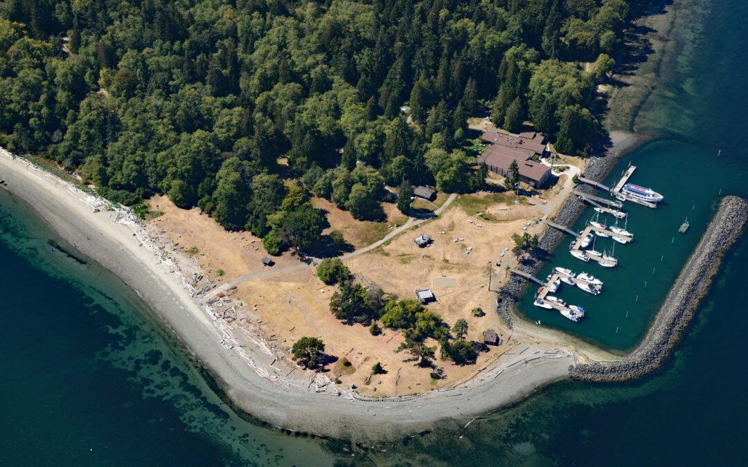
by CoastView | Apr 12, 2024 | 2024, Beaches, Coastal Features, Developments, Embayments, Islands, Land Use, Natural History, Parks, Washington
Blake Island is a Washington State Marine Park in Puget Sound situated between Bainbridge Island to the north and Vashon Island to the south, about 8 miles (13 km) southwest of downtown Seattle and 7 miles (11 km) east of Port Orchard, Washington. The island was named...