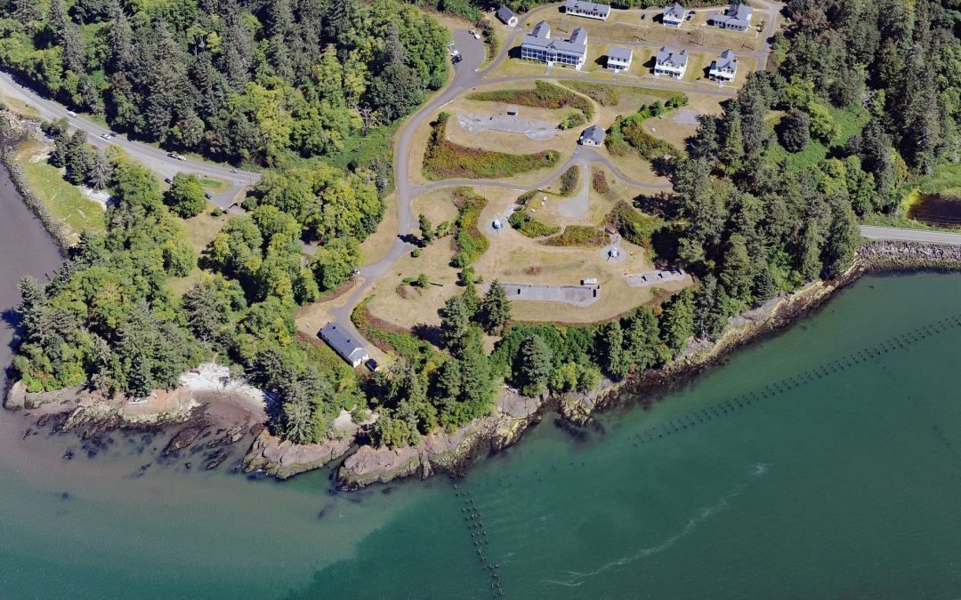
by CoastView | Jun 15, 2025 | 2025, Coastal Features, Developments, Embayments, Headlands, Historical, Land Use, Parks, Rivers, Washington
Listen to the article here https://coastview.org/wp-content/uploads/2025/05/Fort-Columbia.mp3 Fort Columbia, a historic military facility situated on Chinook Point, defended the entrance to the Columbia River from 1896 to 1947 and is now a state park, about 7 miles...
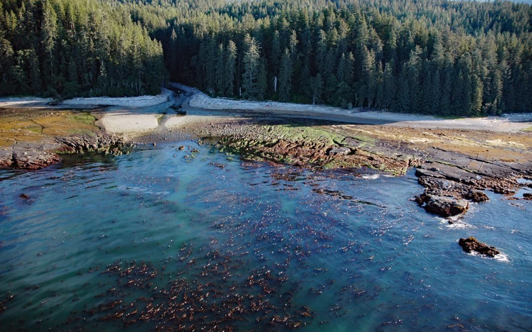
by CoastView | Jun 14, 2025 | 2025, British Columbia, Coastal Features, Embayments, Historical, Land Use, Natural History, Parks, Rivers
Listen to the article here https://coastview.org/wp-content/uploads/2025/05/Crab-River.mp3 Crab River flows into Devastation Channel near the entrance to Alan Reach of Gardner Canal, about 81 miles (130km) southeast of Prince Rupert and 28 miles (45km) south-southwest...
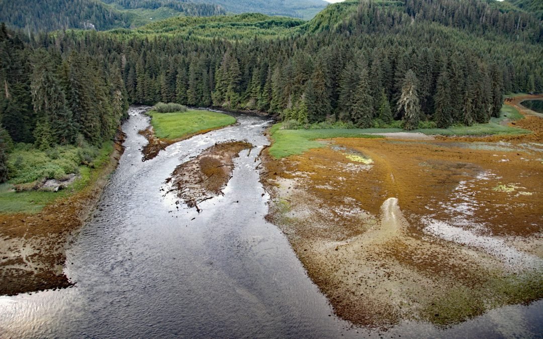
by CoastView | Jun 7, 2025 | 2025, British Columbia, Coastal Features, Historical, Land Use, Natural History, Parks, Rivers, Shipwrecks
Listen to the article here https://coastview.org/wp-content/uploads/2025/05/Darling-River.mp3 The wreck of the SS Uzbekistan is situated at the mouth of the Darling River, which flows south for 6 miles (10 km) through the heavily logged interior forests of...

by CoastView | Jun 1, 2025 | 2025, Biodiversity, Coastal Features, Communities, Developments, Embayments, Historical, Land Use, Natural History, Rivers, Washington
Listen to the article here https://coastview.org/wp-content/uploads/2025/05/Blyn.mp3 Blyn is a small community where Jimmycomelately Creek flows into Sequim Bay on the northern coast of the Olympic Peninsula, about 13 miles (21 km) southwest of Port Townsend and 7...

by CoastView | May 29, 2025 | 2025, Alaska, Biodiversity, Climate Change, Coastal Features, Communities, Developments, Historical, Land Use, Natural History, Rivers
Listen to the article here https://coastview.org/wp-content/uploads/2025/05/Emmonak.mp3 Emmonak is a Yup’ik community located in the Yukon River Delta, approximately 14 miles (23 km) upstream from the Bering Sea, about 92 miles (148 km) west-southwest of Saint...
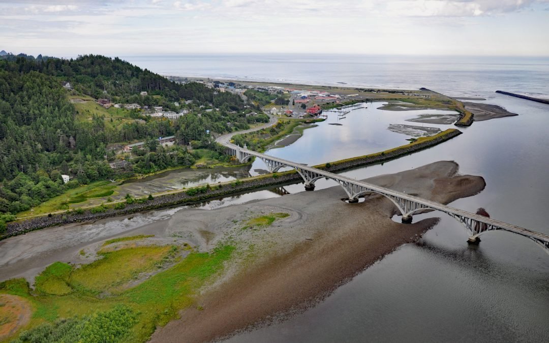
by CoastView | May 25, 2025 | 2025, Beaches, Biodiversity, Coastal Features, Communities, Developments, Historical, Land Use, Mines, Oregon, Rivers
Listen to the article here https://coastview.org/wp-content/uploads/2025/04/Gold-Beach.mp3 The Rogue River flows west for 215 miles (346 km) to the Pacific Ocean, about 23 miles (37 km) south-southeast of Port Orford and at Gold Beach, Oregon. It originates at...