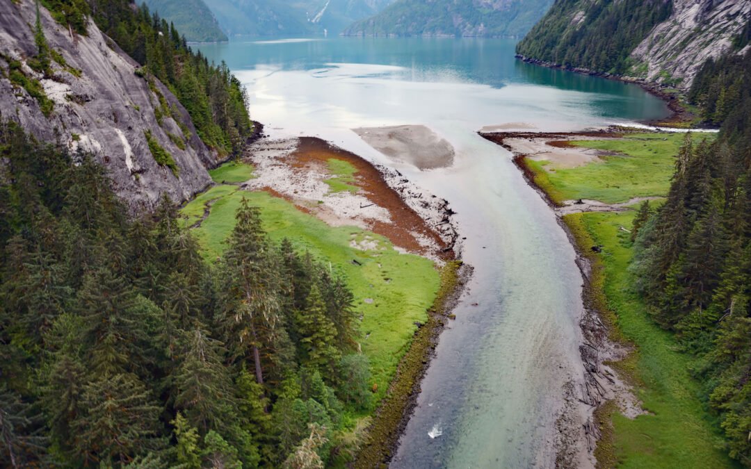
by CoastView | Apr 12, 2025 | 2025, Biodiversity, British Columbia, Coastal Features, Embayments, Historical, Land Use, Natural History, Rivers, Waterfalls
Listen to the article here https://coastview.org/wp-content/uploads/2025/04/Triumph-Bay.mp3 Triumph Bay is a deglaciated fjord extending south from the Alan Reach of Gardner Canal into the Kitimat Ranges of the Coast Mountains, and forms an estuary at the mouth of the...
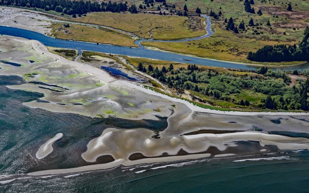
by CoastView | Apr 6, 2025 | 2025, Beaches, Biodiversity, Coastal Features, Communities, Headlands, Historical, Land Use, Natural History, Rivers, Washington
Listen to the article here https://coastview.org/wp-content/uploads/2025/03/Pysht-River.mp3 The Pysht River rises near Ellis Mountain on the Olympic Peninsula and flows 16 miles (26 km) northeast, draining a 29,632-acre (11,992 ha) watershed into the Strait of Juan de...
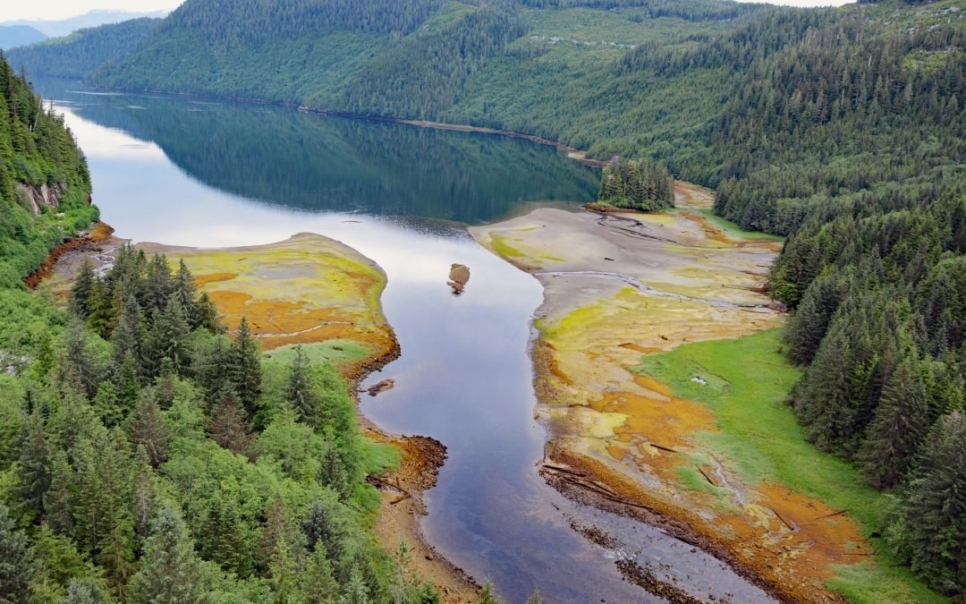
by CoastView | Apr 5, 2025 | 2025, Biodiversity, British Columbia, Climate Change, Coastal Features, Embayments, Historical, Land Use, Natural History, Parks, Rivers
Listen to the article here https://coastview.org/wp-content/uploads/2025/03/Brim-River.mp3 Brim River Hot Springs and adjoining Owyacumish River Park protect 2,488 acres (1,007 ha) at the head of Owyacumish Bay on the north shore of Gardner Canal, about 96 miles (155...
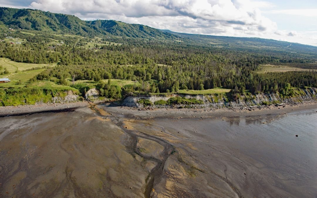
by CoastView | Apr 4, 2025 | 2025, Alaska, Biodiversity, Coastal Features, Communities, Embayments, Historical, Kachemak, Land Use, Mines, Natural History, Rivers
Listen to the article here https://coastview.org/wp-content/uploads/2025/05/Fritz-Creek.mp3 Fritz Creek is a stream on the Kenai Peninsula that starts from a watershed divide between Lookout Mountain to the south and Bald Mountain to the north and flows generally...
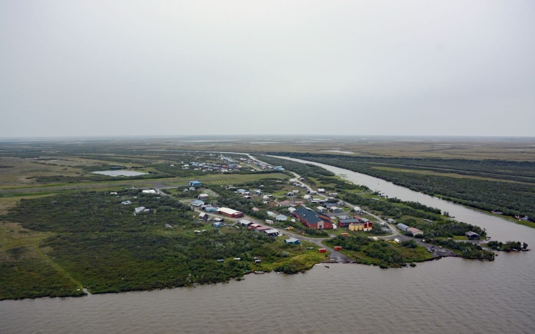
by CoastView | Apr 3, 2025 | 2025, Alaska, Biodiversity, Climate Change, Coastal Features, Communities, Developments, Historical, Land Use, Natural History, Rivers
Listen to the article here https://coastview.org/wp-content/uploads/2025/03/Napakiak.mp3 Napakiak is a village located on an island situated between the Kuskokwim River to the south and Johnson Slough to the north, about 167 miles (269 km) southeast of Emmonak and 10...
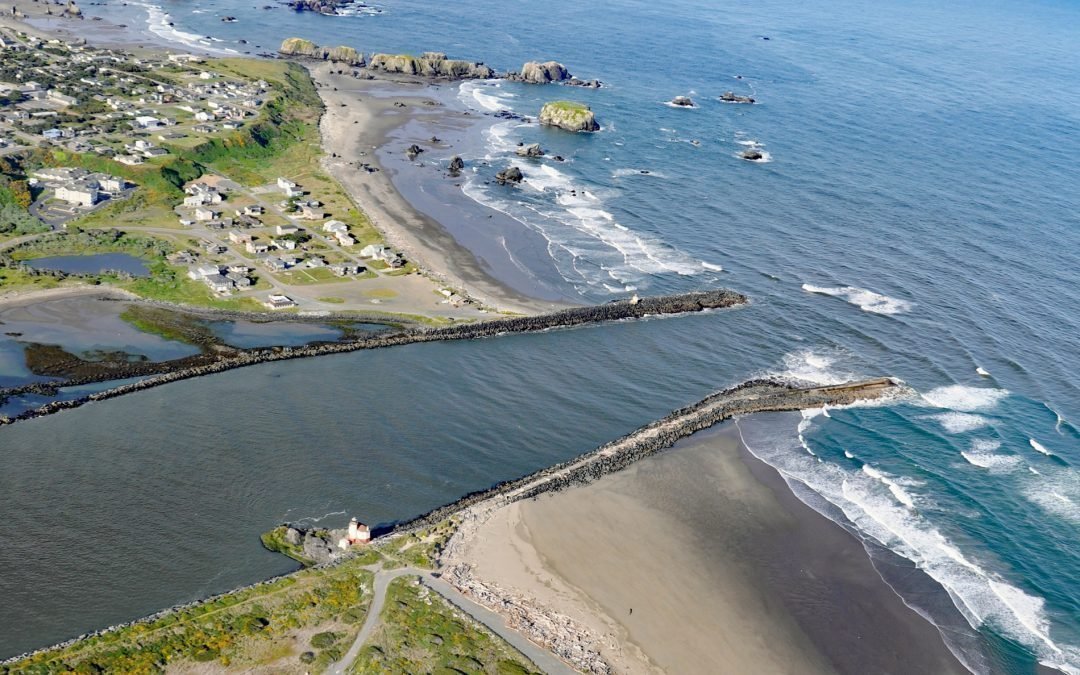
by CoastView | Mar 30, 2025 | 2025, Coastal Features, Communities, Developments, Embayments, Land Use, Lighthouses, Oregon, Parks, Rivers
Listen to the article here https://coastview.org/wp-content/uploads/2025/03/Coquille-River.mp3 The Coquille River drains a mountainous watershed of about 6.8 million acres (2.7 million ha), with at least 26 named tributaries, and flows for about 36 miles (58 km) from...