by CoastView | Feb 27, 2025 | 2025, Alaska, Biodiversity, Climate Change, Communities, Historical, Land Use, Natural History, Parks, Rivers
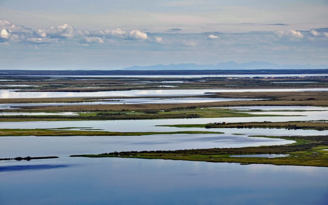
Listen to the article here https://coastview.org/wp-content/uploads/2025/03/Selawik-1.mp3 The Selawik River is about 140 miles (226 km) long, originating in the Purcell Mountains near the Zane Hills, and flows generally west through the Selawik National Wildlife...
by CoastView | Feb 10, 2025 | 2025, Alaska, Biodiversity, Coastal Features, Land Use, Natural History, Rivers
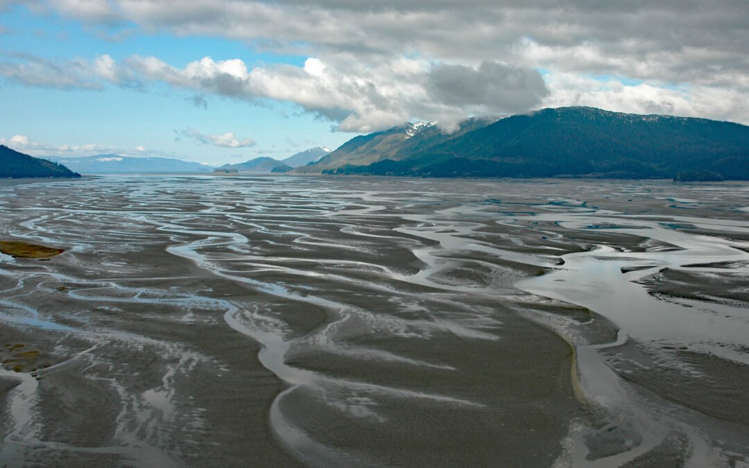
Listen to the article here https://coastview.org/wp-content/uploads/2025/03/Dry-Strait.mp3 Dry Strait is a tidal channel in the Stikine Flats, part of the Stikine River delta separating Mitkof Island to the west from Dry Island to the east in the Stikine-LeConte...
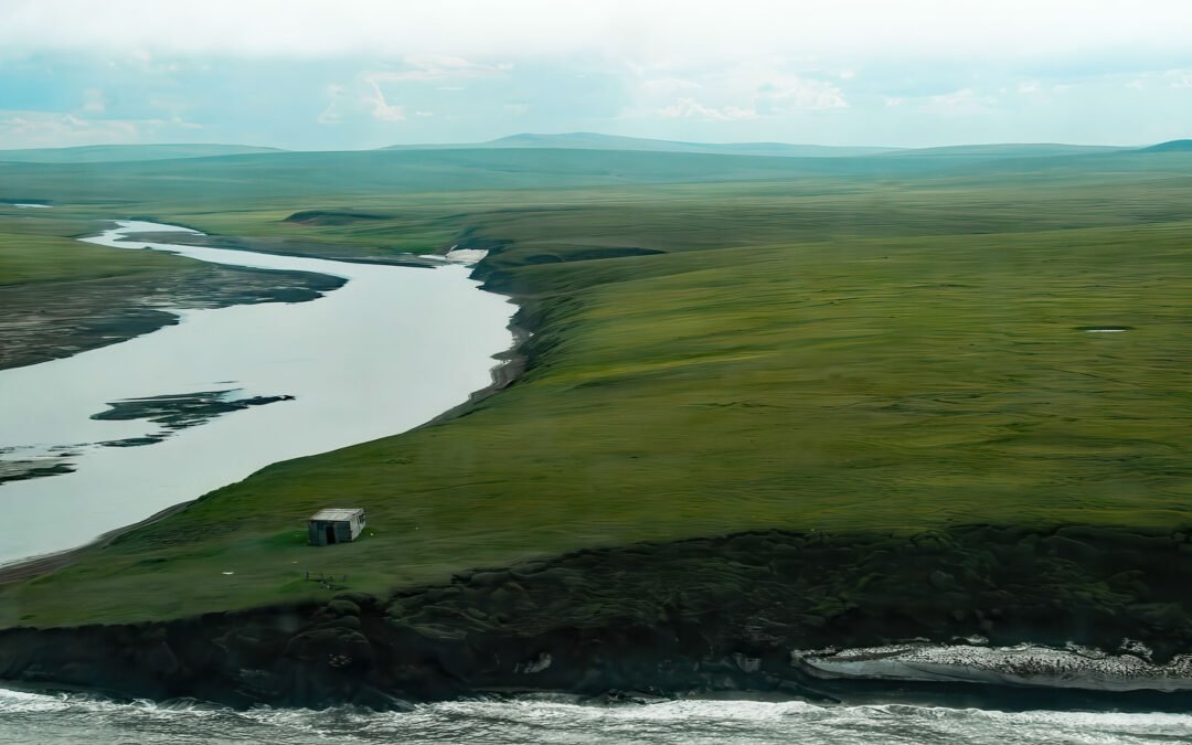
by CoastView | Feb 8, 2025 | 2025, Alaska, Beaches, Coastal Features, Historical, Mines, Rivers, Shelter Cabins
Listen to the article here https://coastview.org/wp-content/uploads/2025/03/Pitmegea.mp3 The Pitmegea River originates at an elevation of about 1,300 feet (396 m) in the De Long Mountains of the western Brooks Range, and flows northwest for 37 miles (60 km) to the...
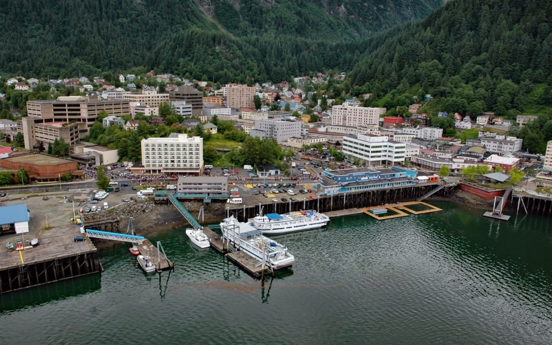
by CoastView | Feb 5, 2025 | 2025, Alaska, Climate Change, Coastal Features, Communities, Developments, Embayments, Historical, Land Use, Mines, Rivers
Listen to the article here https://coastview.org/wp-content/uploads/2025/03/Juneau.mp3 Juneau is the state capital, situated at the mouth of Gold Creek on Gastineau Channel, about 93 miles (150 km) northeast of Sitka and 87 miles (140 km) south-southeast of Skagway,...
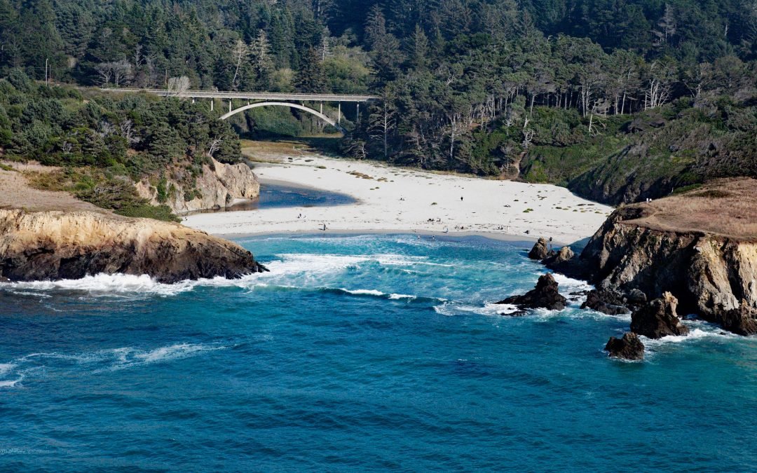
by CoastView | Feb 4, 2025 | 2025, Beaches, Biodiversity, California, Climate Change, Coastal Features, Embayments, Historical, Land Use, Parks, Rivers
Listen to the article here https://coastview.org/wp-content/uploads/2025/03/Jug-Handle-Cove.mp3 Jug Handle Cove is a California State Natural Preserve made up of a series of ancient marine terraces, known as the Ecological Staircase, which exhibit different stages of...
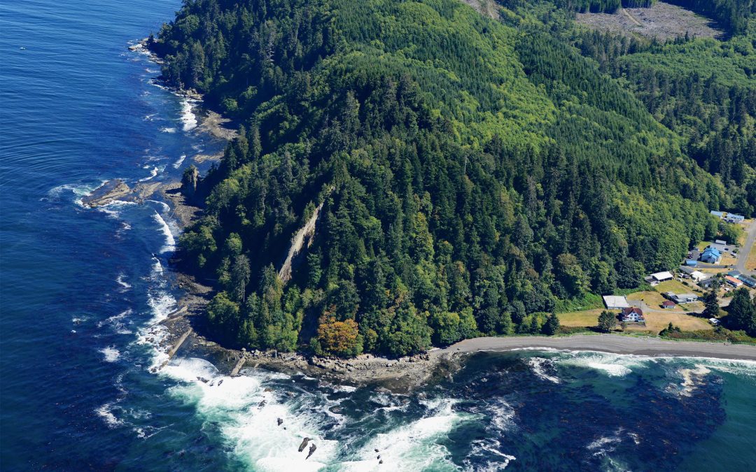
by CoastView | Feb 2, 2025 | 2025, Beaches, Biodiversity, Coastal Features, Communities, Embayments, Headlands, Historical, Land Use, Lighthouses, Mines, Rivers, Washington
Listen to the article here https://coastview.org/wp-content/uploads/2025/03/Slip-Point.mp3 Slip Point sits on the southern shore of the Strait of Juan de Fuca at the eastern end of Clallam Bay on the Olympic Peninsula, about 39 miles (63 km) west-northwest of Port...