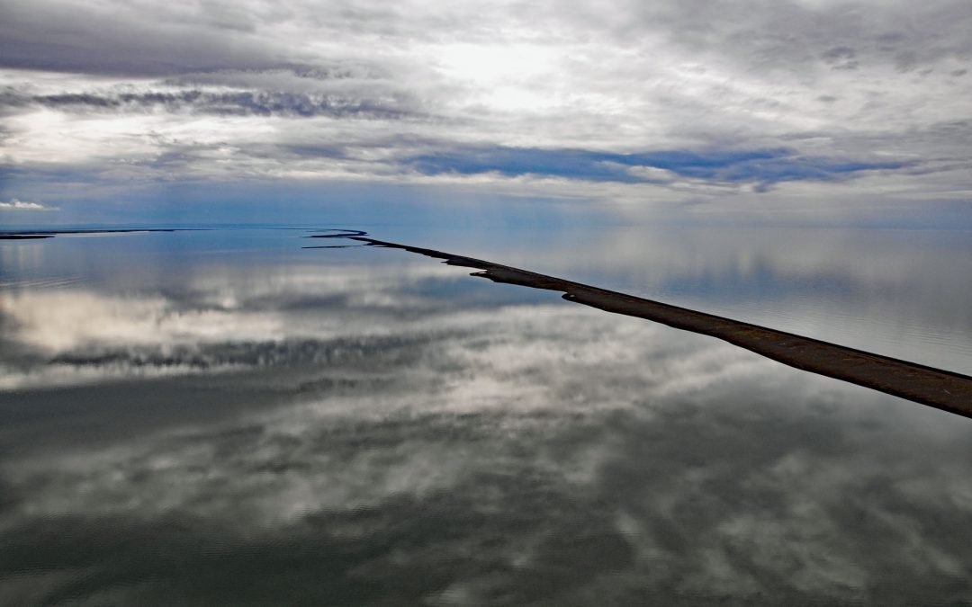
by CoastView | Apr 5, 2024 | Alaska, Beaches, Biodiversity, Coastal Features, Communities, Embayments, Land Use, Natural History, Rivers
Point Lay is a delta of the Kokolik River that flows into Kasegaluk Lagoon, a massive embayment separated from the Chukchi Sea by a series of unnamed barrier islands, about 143 miles (231 km) northeast of Point Hope and 96 miles (155 km) southwest of Wainwright,...
by CoastView | Mar 29, 2024 | 2024, Biodiversity, British Columbia, Coastal Features, Communities, Developments, Embayments, Land Use, Natural History, Rivers
Tahsis is a community on the west coast of Vancouver Island at the head of Tahsis Inlet which is the northern arm of Nootka Sound, about 50 miles (80 km) south-southeast of Port McNeill and 30 miles (48 km) west-northwest of Gold River, British Columbia. The name is...
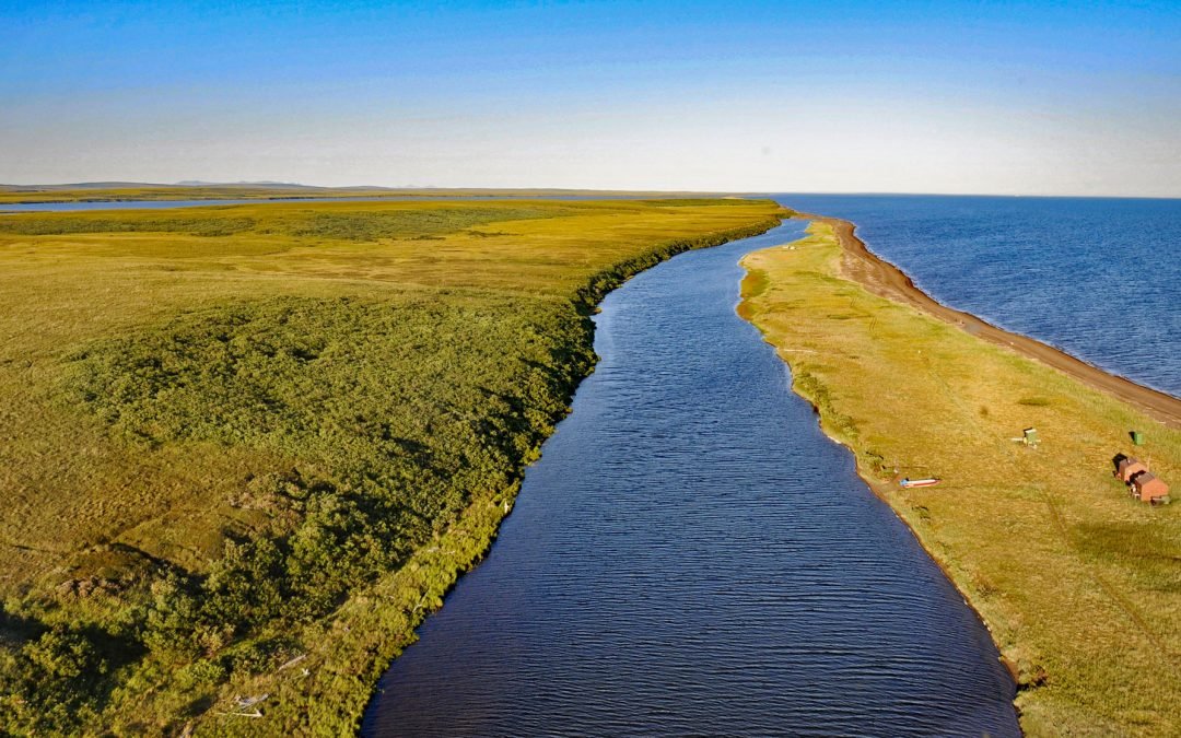
by CoastView | Mar 27, 2024 | 2024, Alaska, Beaches, Biodiversity, Coastal Features, Headlands, Historical, Land Use, Natural History, Parks, Rivers, Shelter Cabins
Tukrok River flows generally east-southeast for 7 miles (11 km) from Krusenstern Lagoon to Kotzebue Sound in Cape Krusenstern National Monument, about 166 miles (268 km) northeast of Wales and 23 miles (37 km) northwest of Kotzebue, Alaska. In the Iñupiat language,...
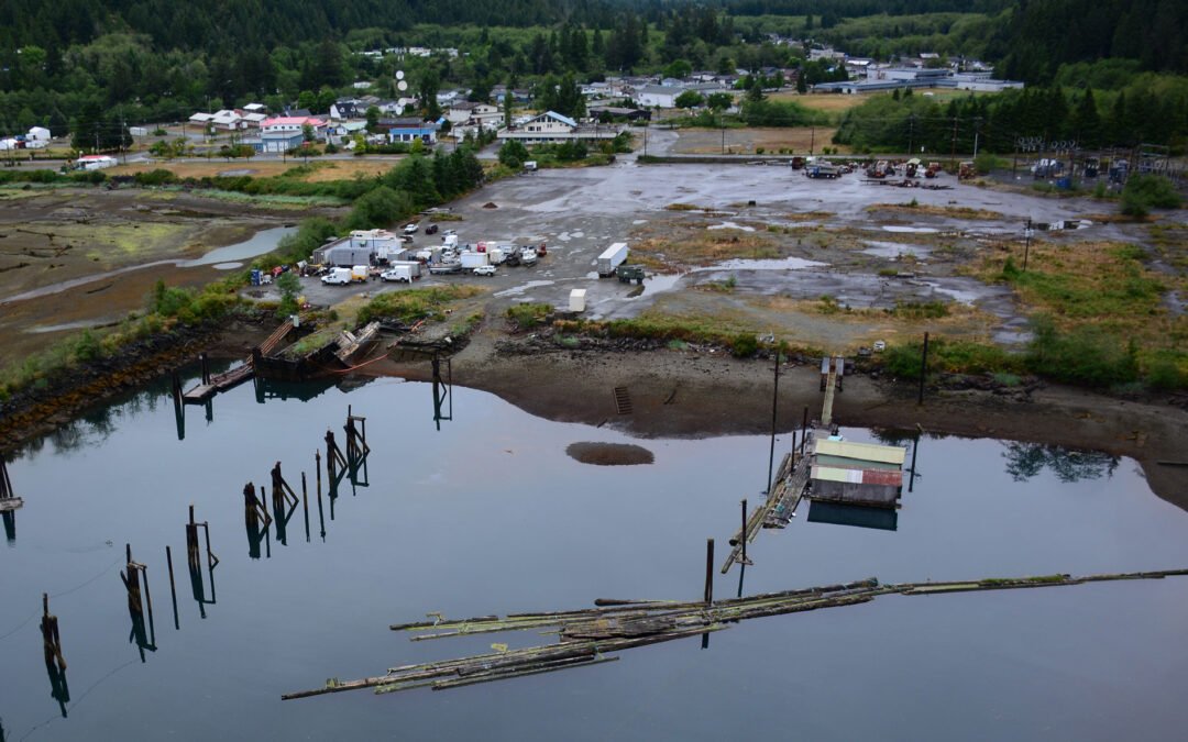
by CoastView | Mar 21, 2024 | 2024, Alaska, Biodiversity, Canneries, Coastal Features, Communities, Developments, Historical, Land Use, Natural History, Rivers
Diamond NN is a historic cannery in South Naknek at the mouth of the Naknek River that flows into Kvichak Bay, an arm of Bristol Bay, about 56 miles (90 km) southeast of Dillingham and 13 miles (21 km) west of King Salmon, Alaska. The salmon cannery was built by the...
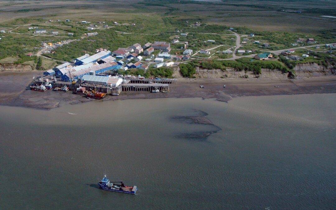
by CoastView | Mar 16, 2024 | 2024, Alaska, Biodiversity, Canneries, Coastal Features, Communities, Historical, Land Use, Natural History, Rivers
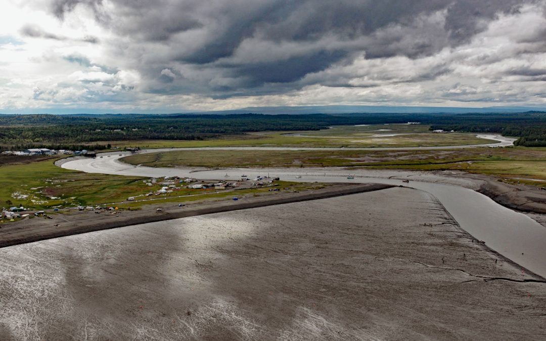
Kasilof River starts at the outlet of Tustumena Lake on the Kenai Peninsula and flows generally northwest for 17 miles (27 km) through the Kenai Lowland to Cook Inlet, draining a watershed of 93,275 acres (37,747 ha), about 51 miles (82 km) north-northeast of Homer...

by CoastView | Mar 8, 2024 | 2024, Beaches, Biodiversity, Coastal Features, Communities, Land Use, Natural History, Parks, Rivers, Washington
Hoh River starts from the terminus of the Hoh Glacier at an elevation of roughly 4,200 feet (1,280 m) on the northeast flank of Mount Olympus in Olympic National Park and flows generally west-southwest for 56 miles (90 km) draining a watershed of 191,360 acres (77,441...