by CoastView | Jul 29, 2024 | 2024, Alaska, Climate Change, Embayments, Glaciers, Historical, Islands, Parks, Shipwrecks
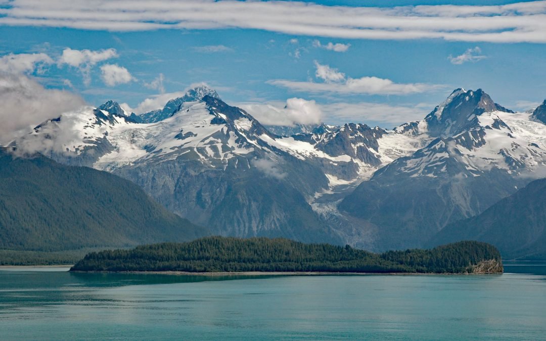
Cenotaph Island is approximately in the middle of Lituya Bay, a fjord formed primarily by the Crillon and Lituya glaciers in Glacier Bay National Park and Preserve, about 117 miles (189 km) west-northwest of Juneau and 97 miles (156 km) southeast of Yakutat, Alaska....

by CoastView | Jul 28, 2024 | 2024, Beaches, Biodiversity, Coastal Features, Historical, Land Use, Oregon, Rivers, Shipwrecks
Camp Castaway is a historical site on North Spit of Coos Bay, a sandy, vegetated peninsula separating the estuary of the Coos River from the Pacific Ocean, about 3.8 miles (6 km) west of North Bend and 1 mile (1.6 km) north of Charleston, Oregon. The spit was the site...
by CoastView | Jul 26, 2024 | 2024, British Columbia, Coastal Features, Developments, Historical, Islands, Lighthouses, Parks, Shipwrecks
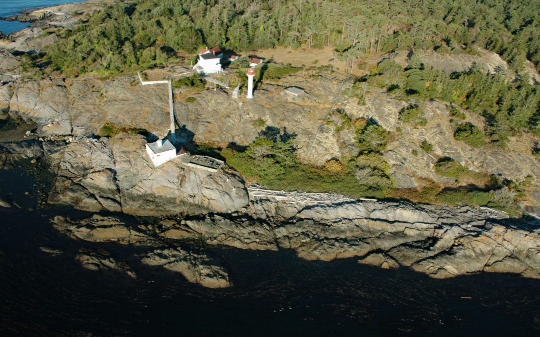
Discovery Island is part of a group of islands in Oak Bay off the southeastern tip of Vancouver Island at Sea Bird Point, about 17 miles (27 km) southeast of Sidney and 6.5 miles (10.5 km) east of downtown Victoria, British Columbia. Discovery Island is about 2.5...
by CoastView | Jul 22, 2024 | 2024, Alaska, Beaches, Coastal Features, Historical, Islands, Shipwrecks
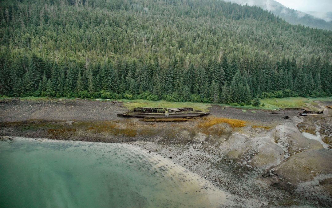
The remains of SS Islander and the salvage barge Griffson are in Green Cove on Stephens Passage, a waterway that separates the north shore of the Glass Peninsula on Admiralty Island from Douglas Island, about 86 miles (138 km) northeast of Sitka and 12 miles (19 km)...
by CoastView | Jul 20, 2024 | 2024, Alaska, Beaches, Communities, Developments, Embayments, Historical, Rivers, Shipwrecks
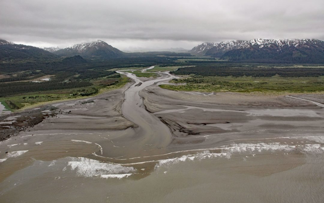
SS Portland is a shipwreck at the mouth of the Katalla River, near the abandoned oil prospecting community of Katalla, about 70 miles (113 km) west-northwest of Yakataga and 48 miles (77 km) southeast of Cordova, Alaska. The name for Katalla is derived from the Eyak...
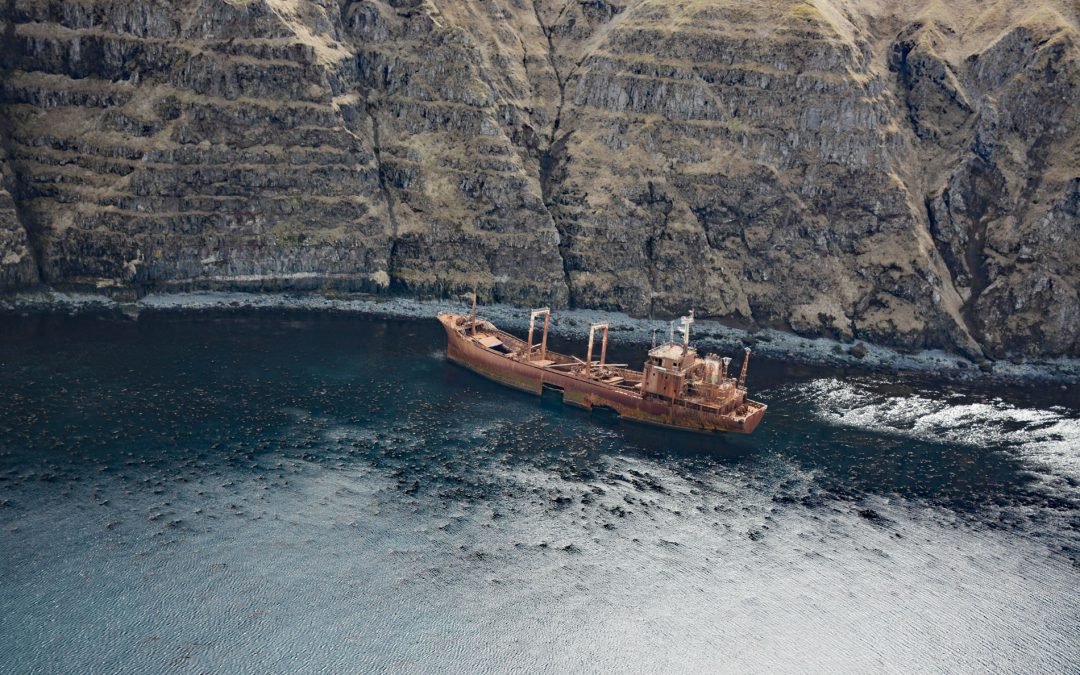
by CoastView | Jul 14, 2024 | 2024, Alaska, Chemical Pollution, Developments, Embayments, Historical, Islands, Mines, Shipwrecks
Aoyagi Maru is a Japanese flagged refrigerant ship that grounded on the south shore of Lost Harbor on Akun Island, about 135 miles (218 km) southwest of Cold Bay and 9 miles (14.5 km) northeast of Akutan, Alaska. Lost Harbor is a protected embayment about 1.5 miles...