
by CoastView | May 27, 2025 | 2025, Alaska, Biodiversity, Coastal Features, Embayments, Hatcheries, Historical, Land Use, Natural History, Waterfalls
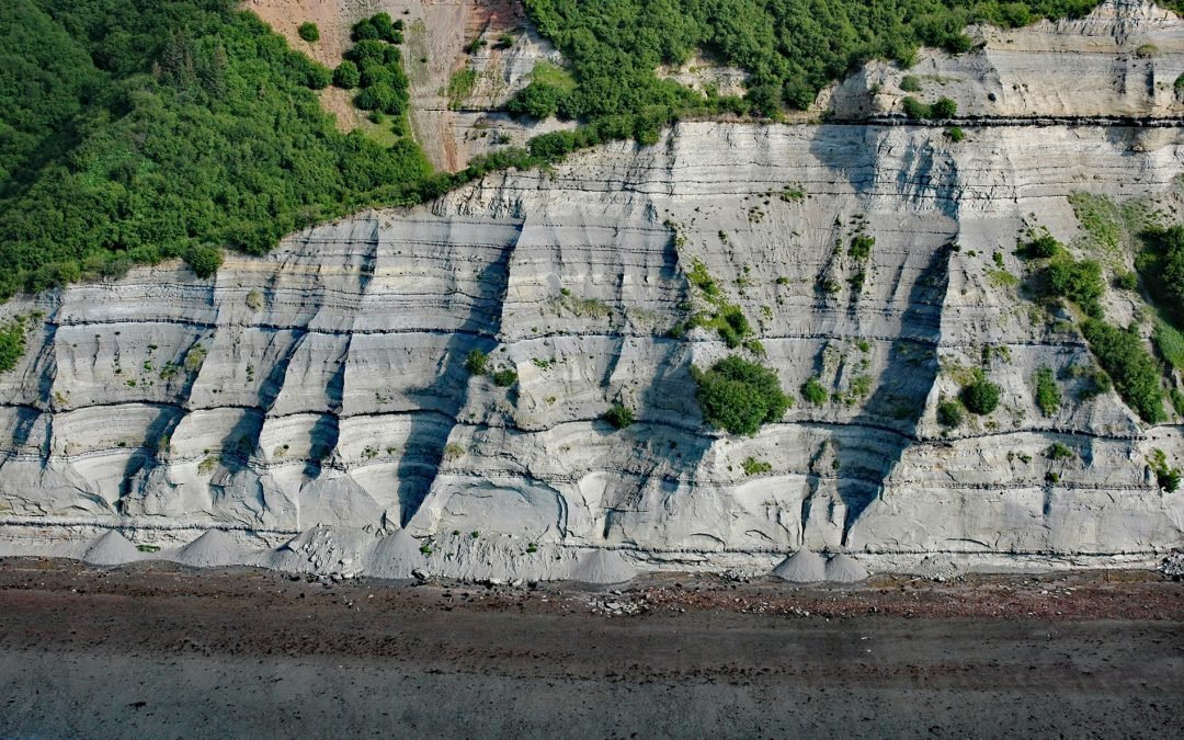
Listen to the article here https://coastview.org/wp-content/uploads/2025/04/Kirschner-Lake.mp3 Kirschner Lake is located on the northern shore of Kamishak Bay and the western coast of lower Cook Inlet at an elevation of approximately 80 feet (24 m), about 110 miles...
by CoastView | May 23, 2025 | 2025, Alaska, Beaches, Coastal Features, Embayments, Historical, Kachemak, Land Use, Mines, Natural History, Parks, Rivers, Waterfalls
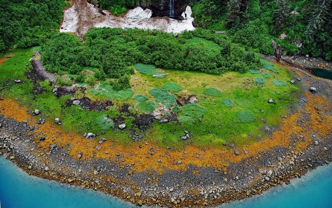
Listen to the article here https://coastview.org/wp-content/uploads/2025/04/Falls-Creek.mp3 Falls Creek is located on the Kenai Peninsula, flowing generally south for 3.2 miles (5 km) to the northwestern shore of Kachemak Bay, approximately 17 miles (27 km) northeast...
by CoastView | May 22, 2025 | 2025, Alaska, Biodiversity, Coastal Features, Developments, Embayments, Hatcheries, Historical, Land Use, Natural History, Waterfalls
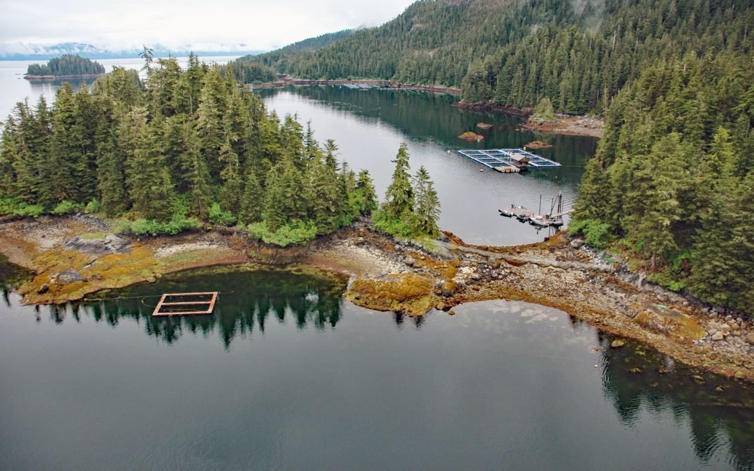
Listen to the article here https://coastview.org/wp-content/uploads/2025/04/Hidden-Falls.mp3 The Hidden Falls Fish Hatchery is located in the Tongass National Forest on the northeast coast of Baranof Island, at the head of Kasnyku Bay off Chatham Strait, about 22...
by CoastView | May 21, 2025 | 2025, Beaches, California, Coastal Features, Historical, Land Use, Natural History, Parks, Waterfalls
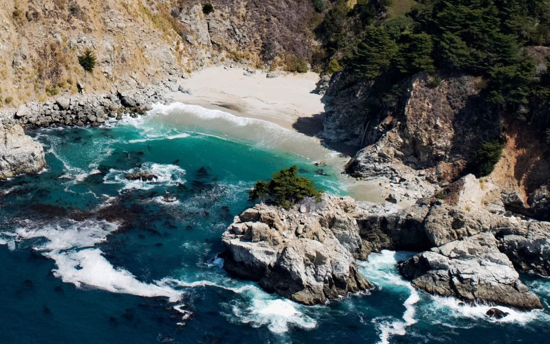
Listen to the article here https://coastview.org/wp-content/uploads/2025/04/McWay-Falls.mp3 McWay Creek drains a watershed of approximately 1,730 acres (700 ha) and flows southwest for 2.5 miles (4 km) through Julia Pfeiffer Burns State Park and McWay Canyon on the...
by CoastView | Apr 12, 2025 | 2025, Biodiversity, British Columbia, Coastal Features, Embayments, Historical, Land Use, Natural History, Rivers, Waterfalls
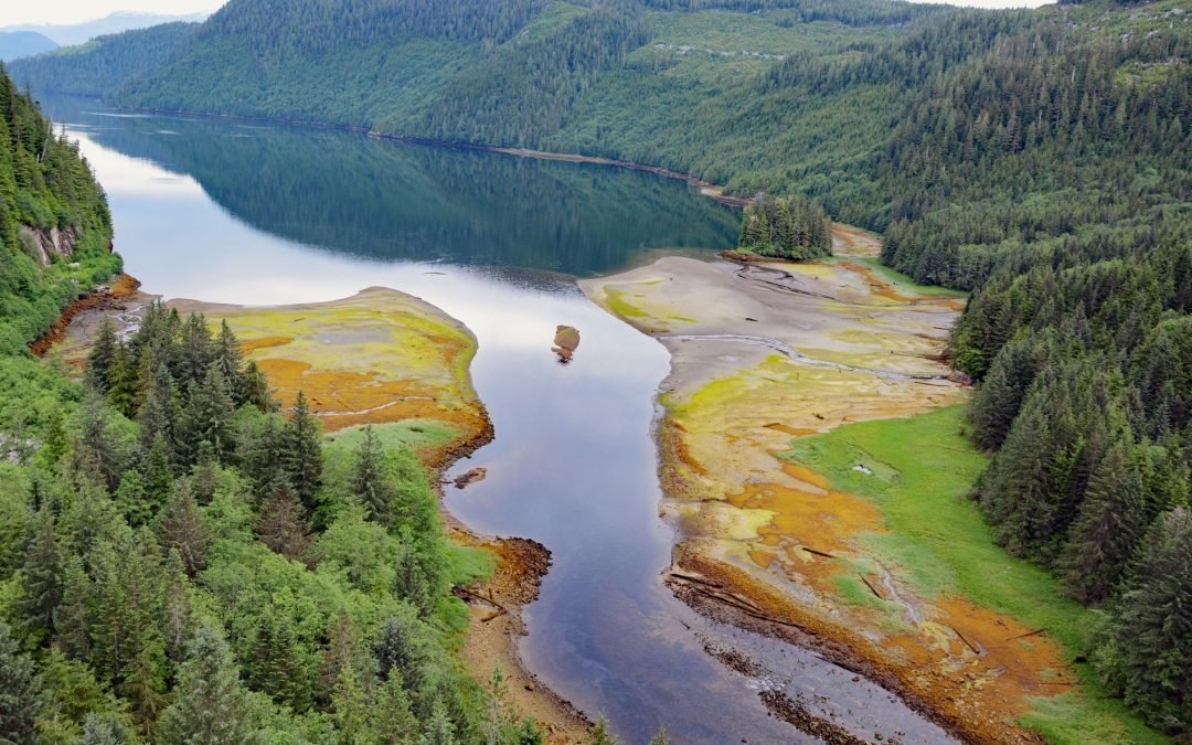
Listen to the article here https://coastview.org/wp-content/uploads/2025/04/Triumph-Bay.mp3 Triumph Bay is a deglaciated fjord extending south from the Alan Reach of Gardner Canal into the Kitimat Ranges of the Coast Mountains, and forms an estuary at the mouth of the...
by CoastView | Mar 28, 2025 | 2025, Alaska, Climate Change, Coastal Features, Embayments, Historical, Natural History, Waterfalls
Listen to the article here https://coastview.org/wp-content/uploads/2025/03/Trident-Akutan.mp3 Trident Seafoods operates the largest seafood processing facility in North America on Akutan Island, one of the Krenitzen Islands in the Fox Island group of the Eastern...