by CoastView | May 30, 2026 | 2026, Alaska, Coastal Features, Islands, Land Use, May 2026, Natural History, Parks
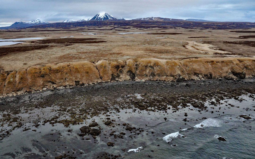
Listen to the article here https://coastview.org/wp-content/uploads/2026/02/UngaIsland.mp3 Unga Island is part of the Shumagin Islands, situated south of the Alaska Peninsula in the Gulf of Alaska, about 64 miles (103 km) north-east of King Cove and 11 miles (18 km)...
by CoastView | May 29, 2026 | 2026, Developments, Headlands, Historical, Land Use, May 2026, Mines, Natural History, Parks, Washington
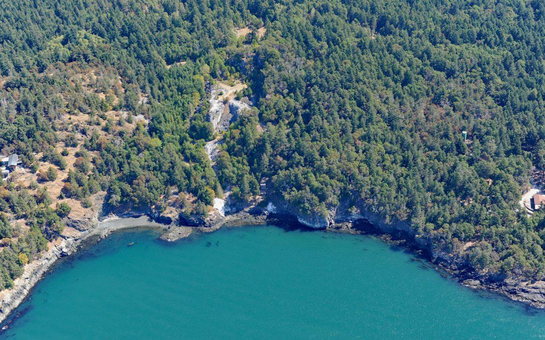
Listen to the article here https://coastview.org/wp-content/uploads/2026/02/LimeKilnPoint.mp3 Lime Kiln Point is a 42-acre (17 ha) state park and the site of a historic limestone quarry and kiln on the western shore of San Juan Island, about 6 miles (10 km) south of...

by CoastView | May 28, 2026 | 2026, Alaska, Biodiversity, Coastal Features, Embayments, Historical, Kachemak, Land Use, May 2026, Natural History
Listen to the article here https://coastview.org/wp-content/uploads/2026/02/NubblePoint.mp3 Nubble Point is a bedrock outcrop connected to the Kenai Peninsula mainland by MacDonald Spit, which forms and separates Kasitsna Bay from Kachemak Bay, about 11 miles (18 km)...
by CoastView | May 27, 2026 | 2026, British Columbia, Coastal Features, Communities, Islands, Land Use, May 2026, Natural History
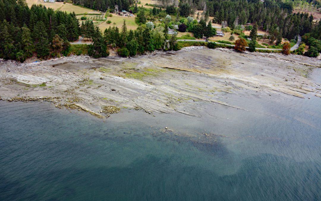
Listen to the article here https://coastview.org/wp-content/uploads/2026/02/FalseNarrows.mp3 False Narrows is a waterway 10 to 30 feet (3-9 m) deep, navigable only by small boats with local knowledge, and about 1.3 miles (2 km) long, separating Gabriola Island to the...
by CoastView | May 27, 2026 | 2026, Alaska, Communities, Developments, Embayments, Historical, Land Use, May 2026, Natural History
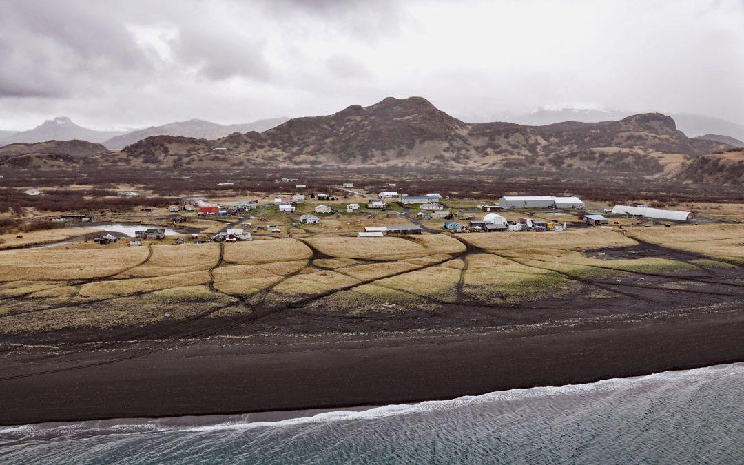
Listen to the article here https://coastview.org/wp-content/uploads/2026/02/Perryville.mp3 Perryville is an Alutiiq Sugpiaq community on the south coast of the Alaska Peninsula, between Three Star Point to the west and Coal Cape to the east, about 66 miles (106 km)...
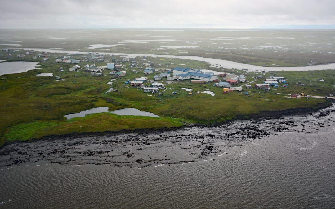
by CoastView | May 25, 2026 | 2026, Alaska, Coastal Features, Communities, Developments, Land Use, May 2026, Natural History, Rivers
Listen to the article here https://coastview.org/wp-content/uploads/2026/02/Newtok.mp3 Newtok is a Central Yup’ik community located between the Ningaluk River to the south and a tidal slough to the north, 19 miles (31 km) upstream from the Bering Sea in the...
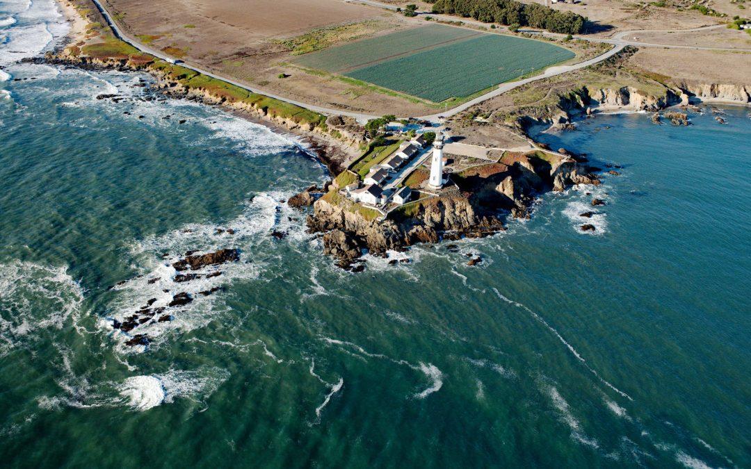
by CoastView | May 24, 2026 | 2026, Biodiversity, California, Coastal Features, Developments, Historical, Land Use, Lighthouses, May 2026, Natural History, Parks
Listen to the article here https://coastview.org/wp-content/uploads/2026/02/PigeonPoint.mp3 Pigeon Point is a prominent headland and historic lighthouse site between Bolsa Point to the north and Franklin Point to the south, roughly 25 miles (40 km) north-west of Santa...
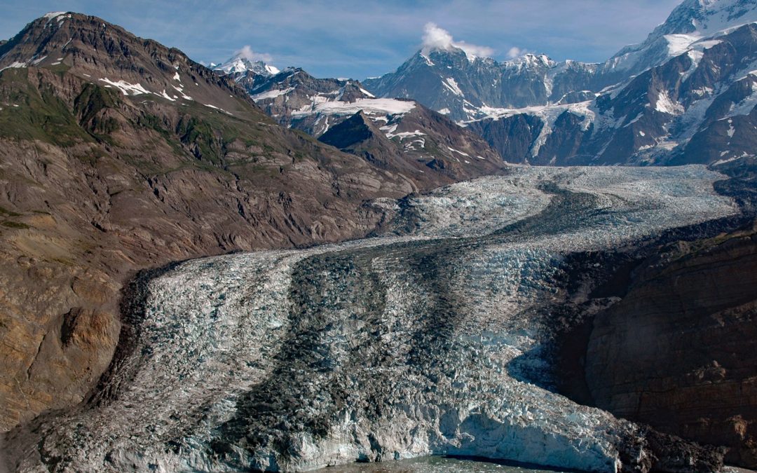
by CoastView | May 23, 2026 | 2026, Alaska, Coastal Features, Glaciers, Land Use, May 2026, Natural History, Parks
Listen to the article here https://coastview.org/wp-content/uploads/2026/02/TyndallGlacier.mp3 Tyndall Glacier flows generally south-southwest for 13 miles (21 km) to the head of Taan Fjord in Icy Bay, about 160 miles (258 km) east-southeast of Cordova and 68 miles...

by CoastView | May 22, 2026 | 2026, Biodiversity, Coastal Features, Embayments, Land Use, May 2026, Natural History, Oregon, Parks
Listen to the article here https://coastview.org/wp-content/uploads/2026/02/SouthSlough.mp3 South Slough is a tidal embayment designated as a National Estuarine Research Reserve that extends six miles (10 km) south from Coos Bay, an estuary of the Coos River, about 13...

by CoastView | May 21, 2026 | 2026, Alaska, Biodiversity, Embayments, Islands, Kachemak, Land Use, May 2026, Natural History
Listen to the article here https://coastview.org/wp-content/uploads/2026/02/GullIsland.mp3 Gull Island is roughly 633 feet (193 m) long and 93 feet (28 m) high and is located about 0.6 miles (1 km) northwest of Moosehead Point near the entrance to Peterson Bay on the...