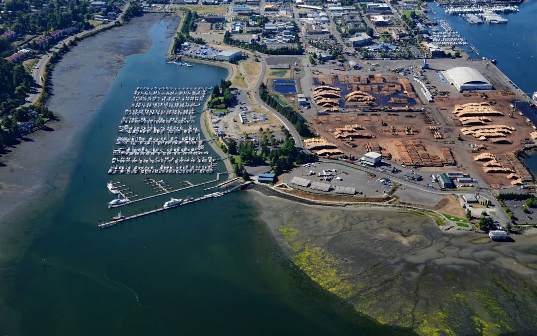
by CoastView | Jan 20, 2025 | 2025, Biodiversity, Coastal Features, Communities, Developments, Embayments, Historical, Land Use, Washington
Listen to the article here https://coastview.org/wp-content/uploads/2025/03/Swantown.mp3 Swantown is a historic neighborhood at the southern end of Budd Inlet in South Puget Sound, about 26 miles (42 km) southwest of Tacoma and now part of downtown Olympia,...
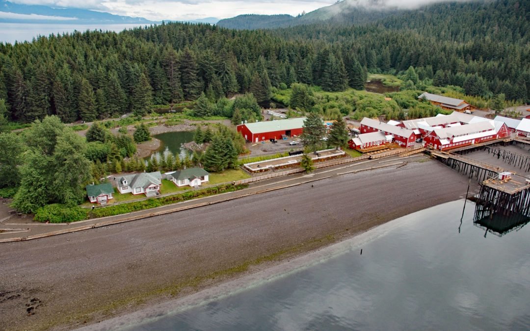
by CoastView | Jan 19, 2025 | 2025, Alaska, Beaches, Biodiversity, Canneries, Developments, Embayments, Historical, Land Use
Listen to the article here https://coastview.org/wp-content/uploads/2025/03/Icy-Strait-Point.mp3 Icy Strait Point is a restored salmon cannery on Cannery Point, located on the south shore of Icy Strait and at the eastern mouth of Port Frederick—a deep embayment on the...

by CoastView | Jan 18, 2025 | 2025, British Columbia, Chemical Pollution, Climate Change, Coastal Features, Communities, Developments, Embayments, Glaciers, Historical, Land Use, Mines, Rivers
Listen to the article here https://coastview.org/wp-content/uploads/2025/03/Stewart.mp3 Stewart is a Canadian border community at the mouth of the Bear River and the head of Portland Canal, about 99 miles (159 km) east‑southeast of Wrangell, Alaska and 114 miles (184...
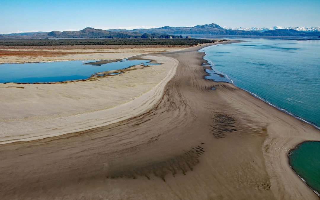
by CoastView | Jan 17, 2025 | 2025, Alaska, Beaches, Biodiversity, Chemical Pollution, Climate Change, Coastal Features, Developments, Historical, Islands, Land Use, Parks
Listen to the article here https://coastview.org/wp-content/uploads/2025/03/Strawberry-Hill.mp3 Strawberry Hill is a series of uplifted beach ridges on Point Bentinck, at the eastern tip of Hinchinbrook Island and the southern entrance to Strawberry Channel, which...
by CoastView | Jan 16, 2025 | 2025, Alaska, Chemical Pollution, Coastal Features, Developments, Embayments, Headlands, Historical, Land Use
Listen to the article here https://coastview.org/wp-content/uploads/2025/03/Ankau-Salt.mp3 The Ankau Saltchucks form a network of tidal lagoons in a complex estuary about 1.2 miles (1.9 km) across at the northwestern tip of the Phipps Peninsula, at the entrance to...
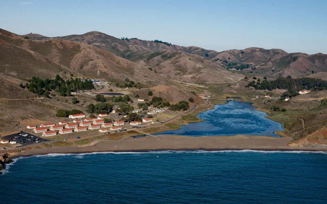
by CoastView | Jan 15, 2025 | 2025, Beaches, California, Developments, Headlands, Historical, Land Use, Parks
Listen to the article here https://coastview.org/wp-content/uploads/2025/03/Fort-Cronkhite.mp3 Fort Cronkhite, on the Marin Headlands, is a historic US Army facility that supported Battery Townsley, part of San Francisco Bay’s coastal artillery during World War...
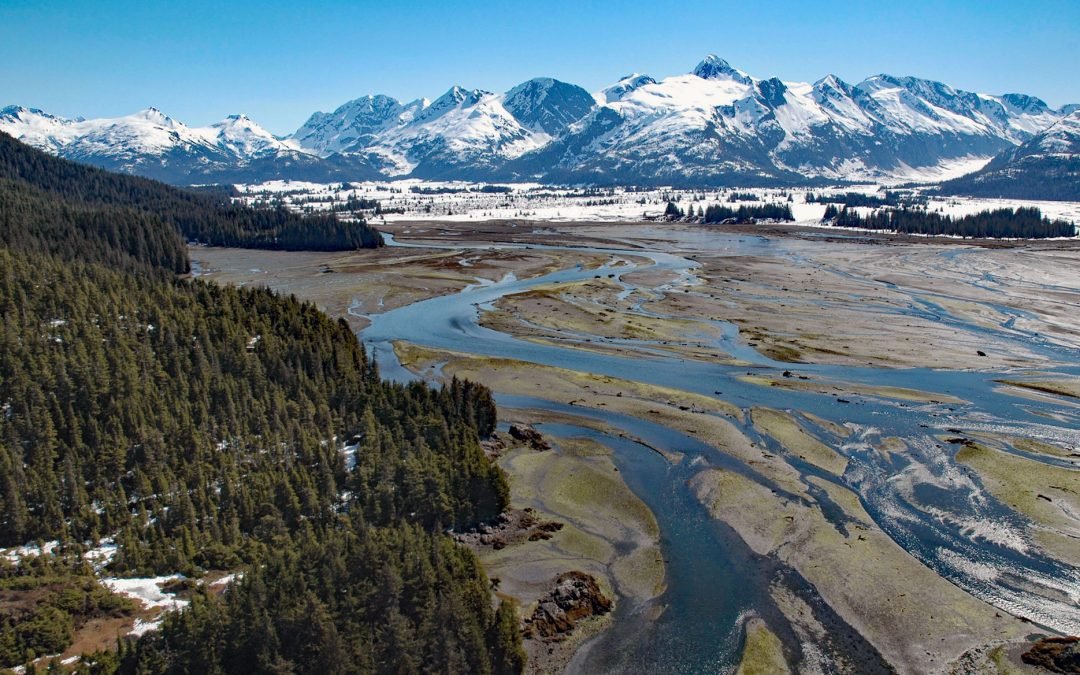
by CoastView | Jan 14, 2025 | 2025, Alaska, Biodiversity, Climate Change, Coastal Features, Glaciers, Historical, Land Use, Mines, Nitrogen Cycle, Parks, Phosphorus, Rivers
Listen to the article here https://coastview.org/wp-content/uploads/2025/03/Coghill-River-1.mp3 The Coghill River in Chugach National Forest flows southwest for 5 miles (8 km) from the terminus of Dartmouth Glacier to Coghill Lake, which is 4.7 miles (7.5 km) long,...
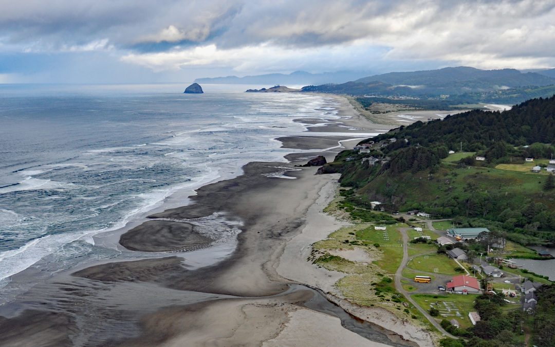
by CoastView | Jan 13, 2025 | 2025, Beaches, Biodiversity, Canneries, Coastal Features, Communities, Developments, Historical, Land Use, Oregon, Shipwrecks
Listen to the article here https://coastview.org/wp-content/uploads/2025/03/Winema.mp3 Winema Beach, a coastal strip adjacent to Winema Lake, was once the site of a town platted as Wi‑Ne‑Ma near Oretown in southern Tillamook County, about 15 miles (24 km) north of...

by CoastView | Jan 12, 2025 | 2025, Alaska, Climate Change, Coastal Features, Embayments, Glaciers, Natural History
Listen to the article here https://coastview.org/wp-content/uploads/2025/03/Le-Conte.mp3 Le Conte Glacier starts from the Stikine Icefield in the Coast Mountains of British Columbia, at an elevation of about 8,500 feet (2,591 m) between Devils Thumb and Mount Gilroy,...

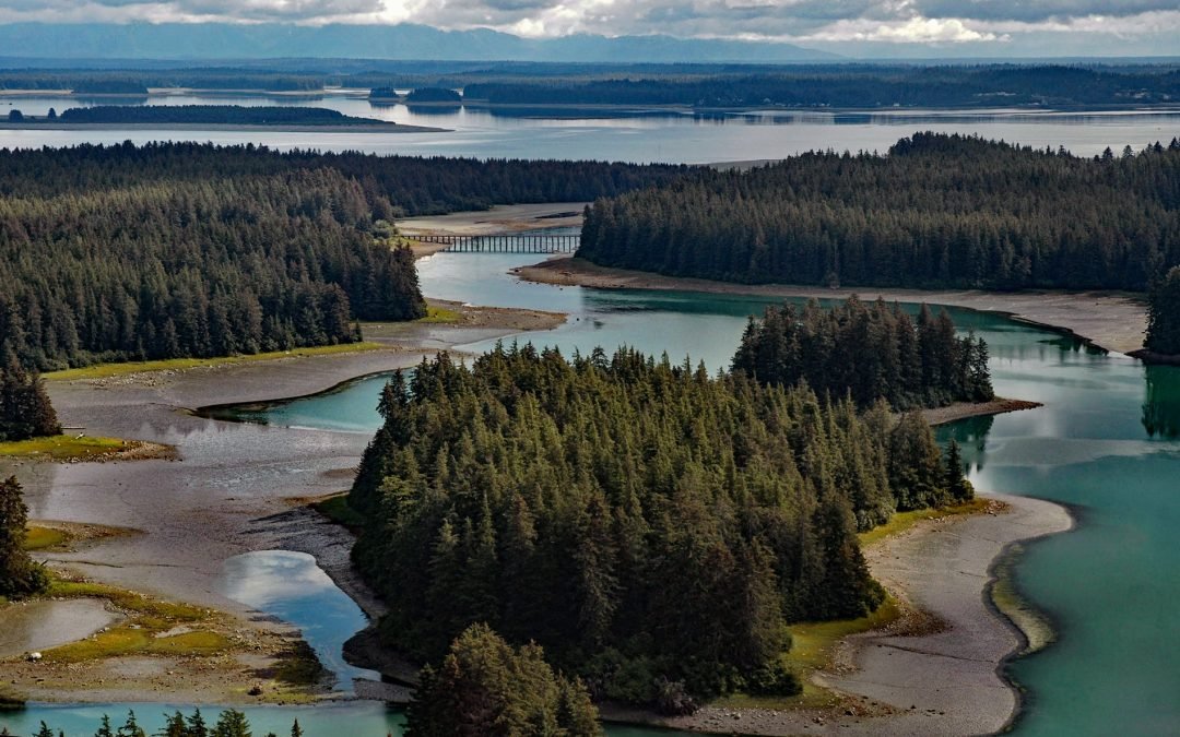
by CoastView | Jan 11, 2025 | 2025, Biodiversity, British Columbia, Climate Change, Coastal Features, Communities, Embayments, Historical, Land Use, Parks, Rivers
Listen to the article here https://coastview.org/wp-content/uploads/2025/03/Gilltoyees-Creek.mp3 Gilttoyees Creek originates in a series of cirque basins on the east and south flanks of Tentacle Peak in the Kitimat Ranges, and flows generally southeast for about 20...