by CoastView | Oct 1, 2024 | 2024, California, Coastal Features, Communities, Developments, Embayments, Headlands, Historical, Land Use, Lighthouses
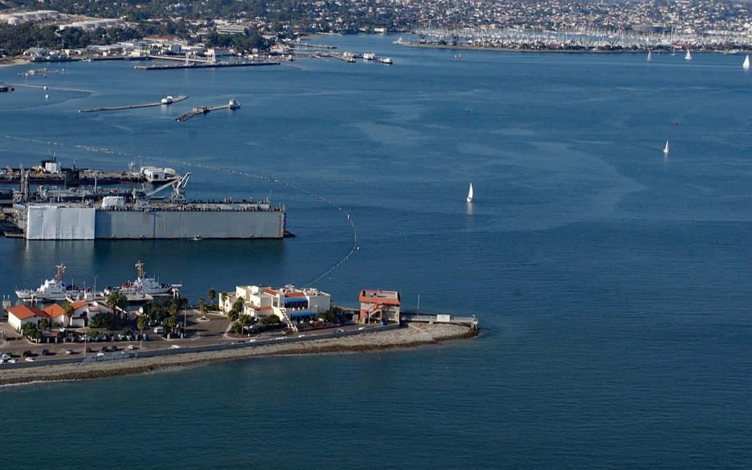
Ballast Point is a peninsula that extends northwest for 0.44 miles (0.7 km) from the Point Loma Peninsula at the mouth of San Diego Bay, about 11 miles (18 km) south of La Jolla and 4 miles (6 km) southwest of downtown San Diego, California. The Spanish called the...
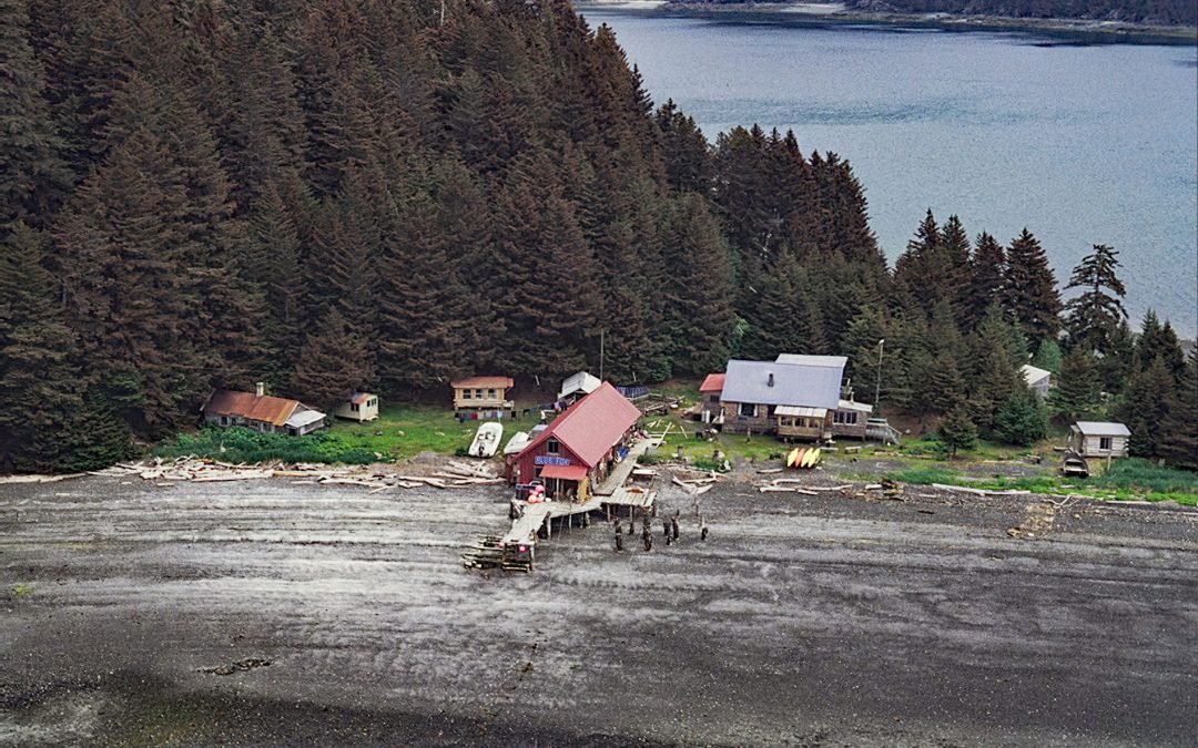
by CoastView | Sep 30, 2024 | 2024, Alaska, Biodiversity, Chemical Pollution, Communities, Developments, Embayments, Historical, Land Use, Mines
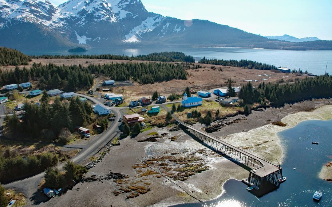
Tatitlek is a small Chugach Alutiiq community located on the northeastern shore of Tatitlek Narrows across from Bligh Island and at the mouth of Boulder Bay on the eastern shore of Prince William Sound, about 24 miles (38 km) southwest of Valdez and 39 miles (63 km)...
by CoastView | Sep 29, 2024 | 2024, Coastal Features, Headlands, Historical, Islands, Land Use, Natural History, Oregon, Parks
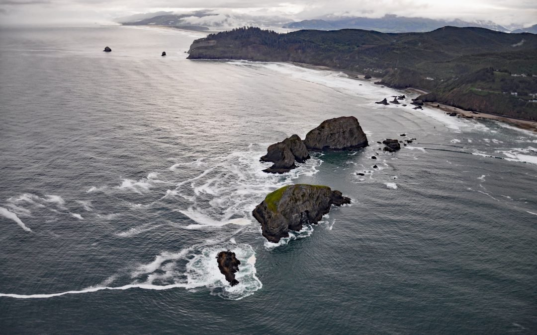
Listen to the article here https://coastview.org/wp-content/uploads/2026/01/ThreeArchRocks.mp3 Three Arch Rocks are massive arched basalt sea stacks located south of Cape Meares and 0.5 miles (0.9 km) offshore from Maxwell Point at the community of Oceanside, about 8...
by CoastView | Sep 28, 2024 | 2024, Alaska, Coastal Features, Communities, Embayments, Historical, Islands, Land Use, Parks
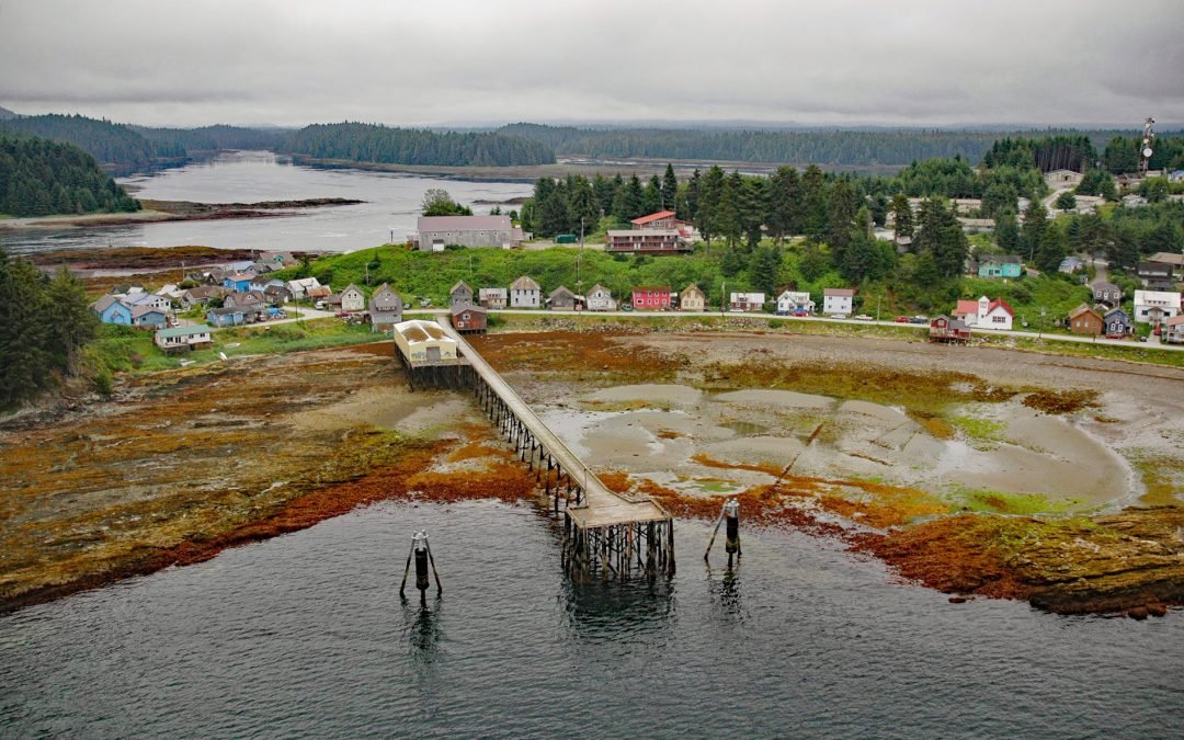
Angoon is a historic Tlingit village located on an isthmus at the mouth of Kootznahoo Inlet on the eastern shore of Chatham Strait and the west coast of Admiralty Island, about 77 miles (124 km) northwest of Petersburg and 60 miles (97 km) southwest of Juneau, Alaska....
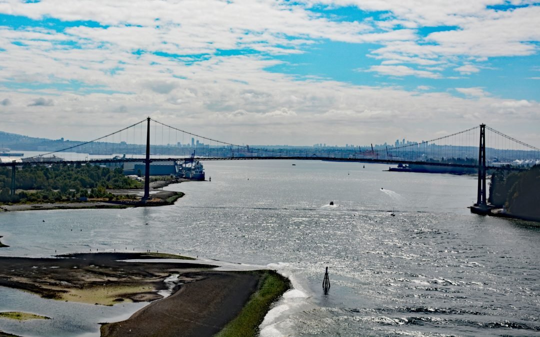
by CoastView | Sep 27, 2024 | 2024, British Columbia, Chemical Pollution, Coastal Features, Communities, Developments, Embayments, Historical, Land Use, Parks, Rivers
Lions Gate Bridge spans Burrard Inlet at the First Narrows, a strait about 1,312 feet (400 m) wide between Prospect Point in Stanley Park to the south and the sandy shoals of the Capilano River mouth to the north, about 2 miles (3.2 km) southeast of West Vancouver and...
by CoastView | Sep 26, 2024 | 2024, Alaska, Coastal Features, Developments, Embayments, Historical, Islands, Land Use, Parks
Hogg Island is the site of a historical fox farm and herring reduction plant situated in Bluefox Bay on Shelikof Strait and the northwest coast of Afognak Island, about 91 miles (147 km) southwest of Homer and 47 miles (76 km) north-northwest of Kodiak, Alaska....
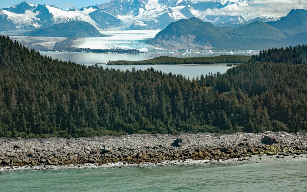
by CoastView | Sep 25, 2024 | 2024, Alaska, Biodiversity, Climate Change, Coastal Features, Freshwater, Glaciers, Historical, Land Use, Parks, Rivers
Grand Plateau Glacier starts on the north flank of Mount Fairweather in the Fairweather Range of the Saint Elias Mountains and flows generally northwest for 19 miles (31 km) where it splits into two terminal lobes, with the southern lobe flowing 6 miles (10 km) to...
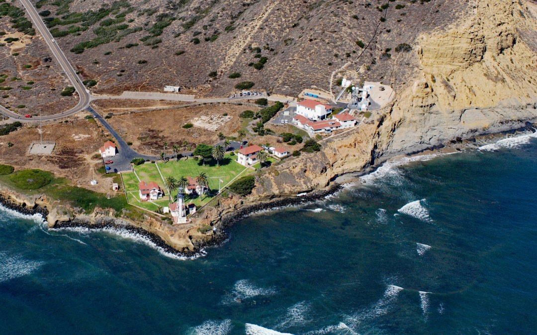
by CoastView | Sep 24, 2024 | 2024, California, Coastal Features, Developments, Headlands, Historical, Land Use, Lighthouses
New Point Loma Light is a station at the southern tip of Point Loma, a peninsula with a prominent headland that forms the western shore of San Diego Bay, about 12 miles (19 km) south of La Jolla and 5.6 miles (9 km) southwest of downtown San Diego, California. The...
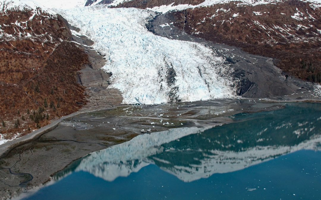
by CoastView | Sep 23, 2024 | 2024, Alaska, Climate Change, Coastal Features, Embayments, Glaciers, Historical
Wellesley Glacier flows for about 4.5 miles (7 km) from the Chugach Mountains and terminates at a lagoon on the west side of College Fjord, about 55 miles (89 km) west of Valdez and 40 miles (64 km) northeast of Whittier, Alaska. It was named for Wellesley College in...
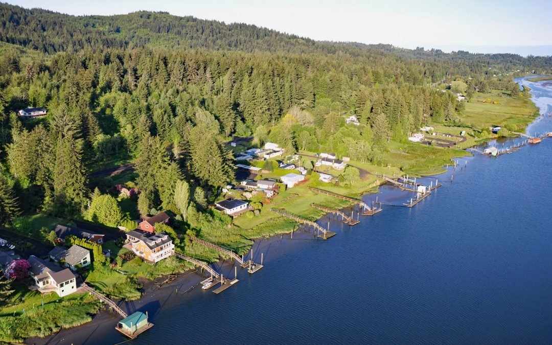
by CoastView | Sep 22, 2024 | 2024, Biodiversity, Communities, Developments, Freshwater, Historical, Land Use, Oregon, Rivers
Drift Creek Landing is a community on the south bank of the Alsea River, opposite the confluence of Drift Creek, a major Coast Range tributary joining the Alsea about 3.4 miles (5.5 km) east of Waldport, about 16 miles (26 km) south-southeast of Newport and 9 miles...