
by CoastView | Apr 30, 2026 | 2026, April 2026, Beaches, Communities, Land Use, Natural History, Oregon, Rivers, Shipwrecks
Listen to the article here https://coastview.org/wp-content/uploads/2026/01/SiuslawRiver.mp3 The Siuslaw River flows generally west-northwest for 110 miles (177 km) to the Pacific Ocean at Florence, about 53 miles (85 km) west of Eugene and 43 miles (69 km) south of...
by CoastView | Apr 29, 2026 | 2026, April 2026, Beaches, Biodiversity, Developments, Historical, Land Use, Natural History, Shipwrecks
Listen to the article here https://coastview.org/wp-content/uploads/2026/01/CoreaCreek.mp3 Corea Creek drains a fen at an elevation of 200 feet (60 m) on the Kenai Peninsula and flows generally south-west for 2.4 miles (4 km) to the eastern shore of Cook Inlet, about...
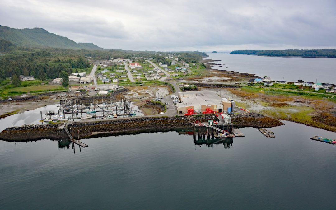
by CoastView | Apr 28, 2026 | 2026, April 2026, British Columbia, Communities, Developments, Embayments, Historical, Land Use, Natural History
Listen to the article here https://coastview.org/wp-content/uploads/2026/01/LaxKwalaams.mp3 Lax Kw’alaams is a Tsimshian community on Port Simpson, an embayment on the eastern coast of Chatham Sound between Flewin Point to the north and Finlayson Island to the...
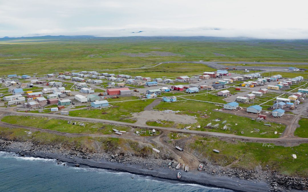
by CoastView | Apr 27, 2026 | 2026, Alaska, April 2026, Best of 2024, Communities, Developments, Islands, Land Use, Natural History
Listen to the article here https://coastview.org/wp-content/uploads/2026/01/Savoonga.mp3 Savoonga is a Siberian Yupik community on the northern flank of the Kookooligit Mountains at Savoonga Point on the north coast of Saint Lawrence Island in the Bering Sea, about...
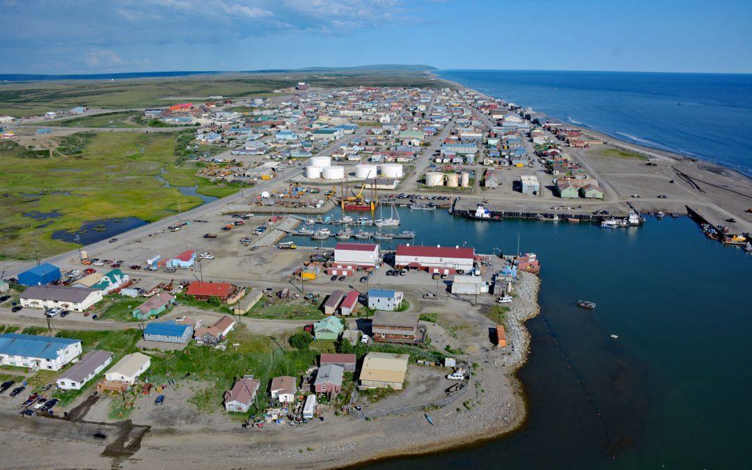
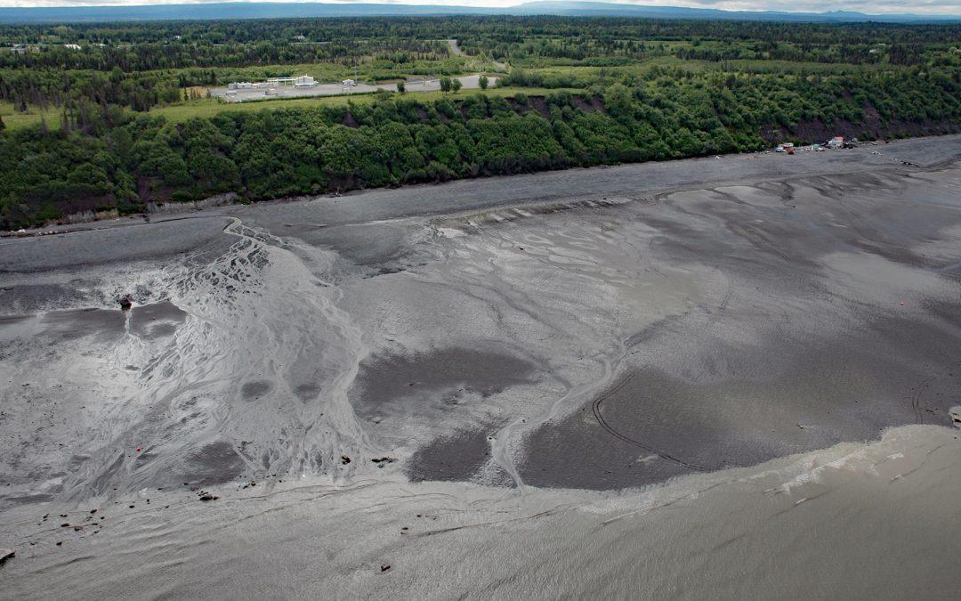
by CoastView | Apr 26, 2026 | 2026, Alaska, April 2026, Communities, Developments, Historical, Land Use, Natural History
Listen to the article here https://coastview.org/wp-content/uploads/2026/01/Nome.mp3 Nome is a community at the mouth of the Snake River on the south coast of the Seward Peninsula on Norton Sound, about 289 miles (466 km) north-west of Bethel and 185 miles (298 km)...
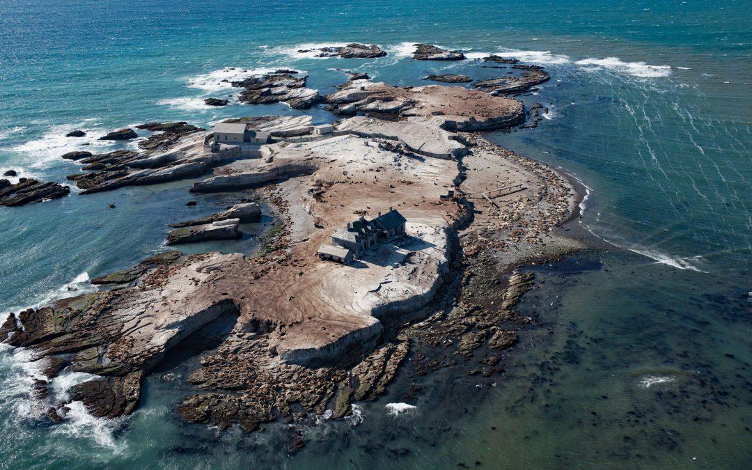
by CoastView | Apr 25, 2026 | 2026, April 2026, Biodiversity, California, Coastal Features, Historical, Islands, Land Use, Lighthouses, Natural History, Parks
Listen to the article here https://coastview.org/wp-content/uploads/2026/01/AnoNuevoIsland.mp3 Año Nuevo Island, a historic site featuring a light tower and fog signal, occupies about 9 acres (3.6 ha) separated from Point Año Nuevo by a shallow channel within Año...

by CoastView | Apr 24, 2026 | 2026, Alaska, April 2026, Embayments, Historical, Land Use, Natural History, Shelter Cabins
Listen to the article here https://coastview.org/wp-content/uploads/2026/01/SafetySound.mp3 Safety Sound is a lagoon along the Nome-Council Highway, formed by barrier beaches up to 14 feet (4.2 m) high that extend for 15 miles (24 km) along the north coast of Norton...
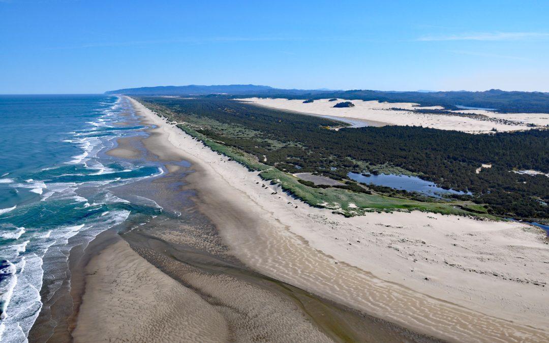
by CoastView | Apr 23, 2026 | 2026, April 2026, Beaches, Coastal Features, Land Use, Natural History, Oregon, Parks
Listen to the article here https://coastview.org/wp-content/uploads/2026/01/SiltcoosRiver.mp3 The Siltcoos River begins at the outlet of Siltcoos Lake and meanders generally west for three miles (4.8 km) through the Oregon Coastal Dunes to the Pacific Ocean, about...

by CoastView | Apr 22, 2026 | 2026, Alaska, April 2026, Biodiversity, Coastal Features, Embayments, Kachemak, Land Use, Natural History
Listen to the article here https://coastview.org/wp-content/uploads/2026/01/BelugaSlough.mp3 Beluga Slough is formed by Bishops Beach and is the tidal estuary of a historical stream called Palmer Creek that drained a watershed on the southern flank of Diamond Ridge on...
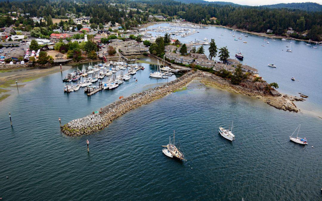
by CoastView | Apr 21, 2026 | 2026, April 2026, British Columbia, Communities, Embayments, Historical, Islands, Land Use, Natural History
Listen to the article here https://coastview.org/wp-content/uploads/2026/01/GangesHarbour.mp3 Ganges Harbour is an embayment on the eastern coast of Salt Spring Island that extends five miles northwest from Captain Passage, about 35 miles (57 km) southwest of...