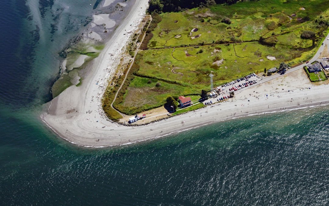
by CoastView | Jun 20, 2022 | 2022, Beaches, Coastal Features, Embayments, Headlands, Historical, Land Use, Lighthouses, Natural History, Parks, Washington
Point No Point is a sand spit on the northern end of the Kitsap Peninsula, between Norwegian Point to the northwest and Pilot Point to the southeast, near the southern end of Admiralty Inlet that connects the Salish Sea with Puget Sound, about 8 miles (13 km) north of...
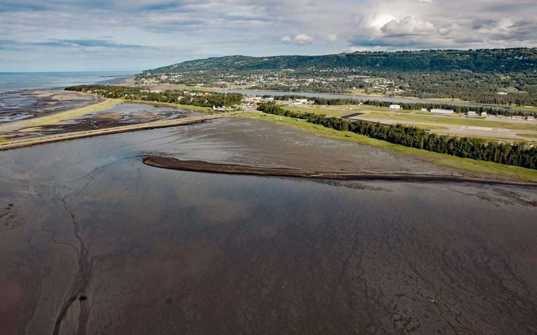
by CoastView | Jun 19, 2022 | 2022, Alaska, Beaches, Biodiversity, Coastal Features, Embayments, Kachemak, Land Use, Natural History
Mud Bay is a tidal flat about 0.6 miles (1 km) wide, partially enclosed by sand spits and situated at the sheltered base of the Homer Spit on the northwest shore of Kachemak Bay, about 2.7 miles (4 km) southwest of Millers Landing and 1.5 miles (2.4 km) southeast of...
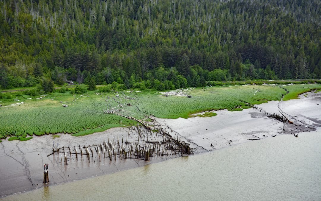
by CoastView | Jun 18, 2022 | 2022, Biodiversity, British Columbia, Canneries, Historical, Land Use, Natural History, Rivers
Haysport is the site of a historical community and salmon cannery on the north shore of the Skeena River adjacent to the Grand Trunk Railroad, about 61 miles (100 km) southwest of Terrace and 16 miles (26 km) southeast of Prince Rupert, British Columbia. The word...
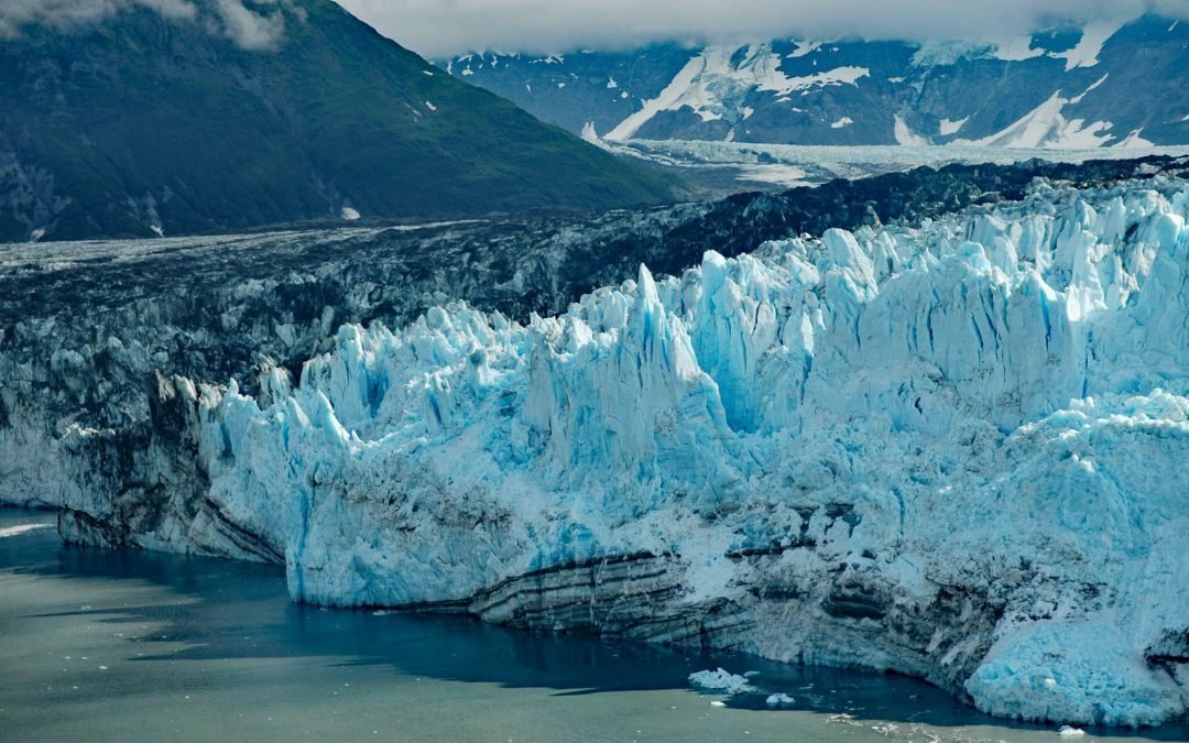
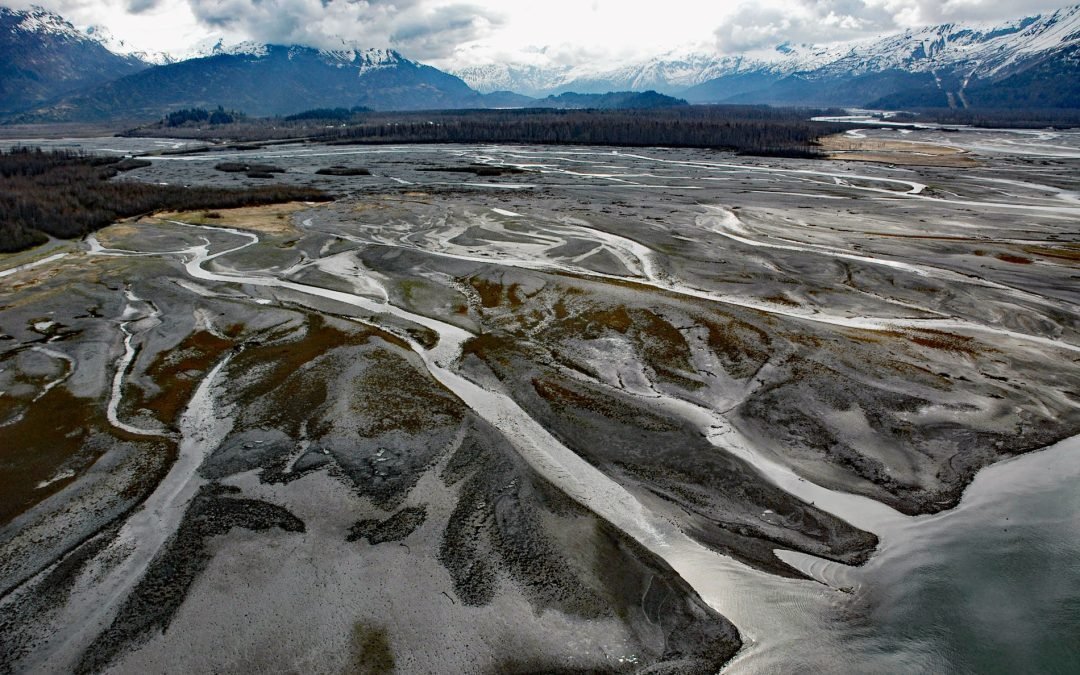
by CoastView | Jun 17, 2022 | 2022, Alaska, Climate Change, Coastal Features, Embayments, Glaciers, Historical, Natural History, Parks
Valerie Glacier is formed by several tributary glaciers that flow from the south flank of Mount Vancouver in the Saint Elias Mountains of the Icefield Ranges, and the merged ice streams flow generally southeast for about 14 miles (22.5 km) to laterally join with the...
by CoastView | Jun 16, 2022 | 2022, Alaska, Coastal Features, Developments, Glaciers, Historical, Land Use, Mines, Natural History, Rivers
Old Valdez was the original townsite of Valdez built on the outwash plain formed by Valdez Glacier which is drained by Valdez Glacier Stream that flows generally south-southeast for 4.5 miles (7 km) to Port Valdez in Prince William Sound, about 43 miles (69 km)...