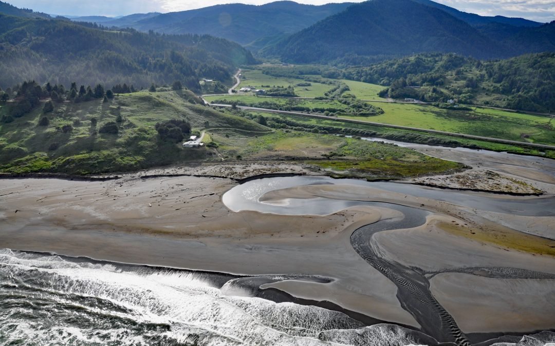
by CoastView | Sep 14, 2022 | 2022, Coastal Features, Communities, Historical, Land Use, Natural History, Oregon, Rivers
Ophir is a small community on Euchre Creek in Curry County, about 0.5 miles (0.8 km) upstream from the Pacific Ocean, and 4 miles (6.5 km) northeast of the community of Nesika Beach, Oregon. Nesika Beach is also a strand about 6 miles (10 km) long between the...
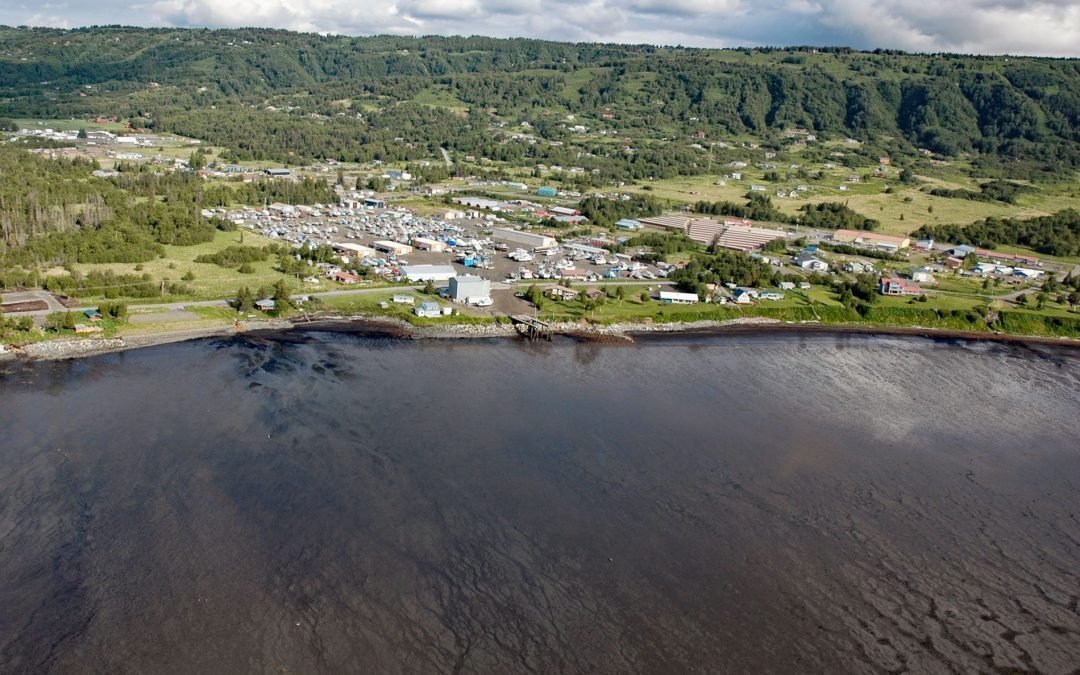
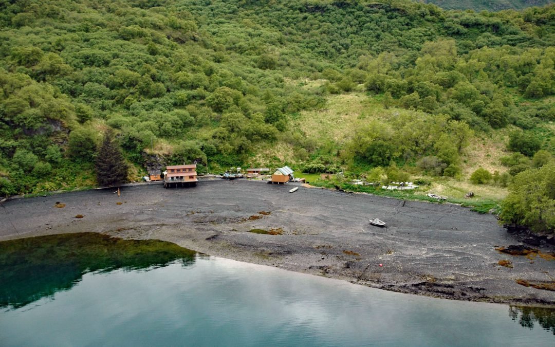
by CoastView | Sep 13, 2022 | 2022, Alaska, Coastal Features, Communities, Developments, Historical, Kachemak, Land Use
Millers Landing is on the north shore of Kachemak Bay, on the Kenai Peninsula, about 4 miles (6.5 km) northwest of Homer, Alaska. The local name was first reported and published by the U.S. Geological Survey in the 1950s. Millers Landing is named after Charles Miller...
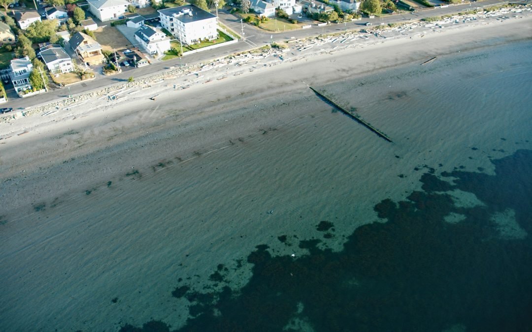
by CoastView | Sep 12, 2022 | 2022, Beaches, British Columbia, Coastal Features, Communities, Embayments, Historical, Land Use, Natural History
Willows Beach is a beachfront neighborhood between Bowker Creek and Cattle Point at the head of Oak Bay in Victoria, British Columbia. It takes its name from the Willows Fairground, built in 1891, that was the main horse-racing venue in Victoria during the early 20th...
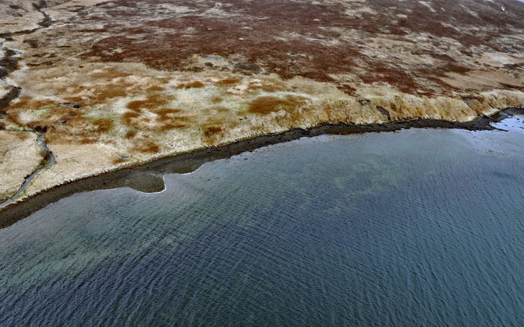
by CoastView | Sep 11, 2022 | 2022, Alaska, Communities, Embayments, Historical, Land Use
Morzhovoi is an abandoned village on the southern shore of Trader Cove and the eastern shore of Bechevin Bay, on the Alaska Peninsula, about 5.5 miles (8.9 km) northeast of False Pass, Alaska. The name was adopted from the ancient Aleut village of Qaxatix, located on...
by CoastView | Sep 10, 2022 | 2022, Alaska, Biodiversity, Canneries, Coastal Features, Communities, Embayments, Historical, Islands, Land Use, Natural History
Mush Bay is the local name for a shallow embayment on the western shore of East Arm Uganik Bay, probably named after Mush Lake, on the west coast of Kodiak Island, 22 miles (35 km) northeast of Larsen Bay and 40 miles (65 km) west-southwest of Kodiak, Alaska. Mush...