Shipwrecks
Recent Articles
More Articles
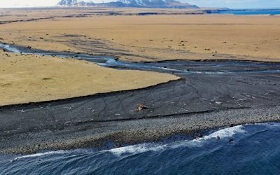
Cape Tanak, Umnak Island
Cape Tanak is a headland on the north coast of Umnak Island in the Eastern Aleutian Islands between Cape Idak to the east and Ashishik Point to the west, about 64 miles (103 km) southwest of Dutch Harbor and 56 miles (90 km) northeast of Nikolski, Alaska.
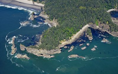
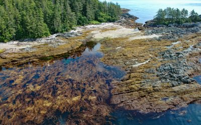
Teahwhit Head, La Push
Teahwhit Head is a rocky headland with a natural sea arch and the site of a historical shipwreck on the coast of Olympic National Park in the Olympic Coast National Marine Sanctuary, about 12 miles (19 km) southwest of Forks and 2.8 miles (4.5 km) south-southeast of La Push, Washington.
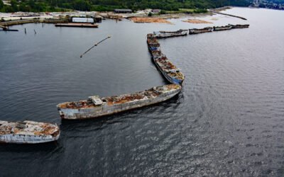
The Hulks, Powell River
The Hulks is a floating breakwater consisting of ship hulls anchored off the mouth of Powell River originally to protect a log pond for a pulp and paper mill, about 28 miles (45 km) southeast of Campbell River and 2 miles (3.2 km) north-northwest of the community of Powell River, British Columbia.
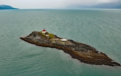
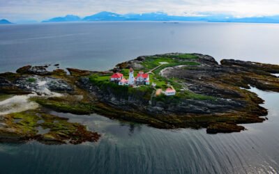
Eldred Rock Lighthouse, Lynn Canal
Eldred Rock is a small island and site of a historic lighthouse situated adjacent to Sullivan Island in Lynn Canal, between the Chilkat Range to the west and the Kakuhan Range to the east, about 55 miles (89 km) northwest of Juneau and 20 miles (32 km) south-southeast of Haines, Alaska.
Green Island, Chatham Sound
Green Island is part of the Dundas Island Archipelago situated on the west side of Chatham Sound and is the site of a historic lighthouse, about 65 miles (105 km) south-southeast of Ketchikan and 24 miles (39 km) northwest of Prince Rupert, British Columbia.
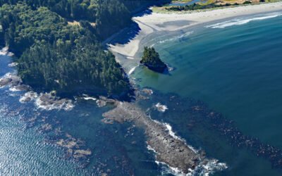
Cape Alava, Olympic National Park
Cape Alava is a point of land on the outer coast of the Olympic Peninsula in Olympic National Park, and bordering the Olympic Coast National Marine Sanctuary, about 22 miles (35 km) northwest of Forks and 15 miles (24 km) southwest of Neah Bay, Washington.
Tugidak Island, Trinity Island Group
Tugidak Island is the westernmost of the Trinity Island Group, which includes Sitkinak Island, and is part of the Kodiak Archipelago situated off the southern tip of Kodiak Island in the Gulf of Alaska, about 145 miles (233 km) east of Chignik and 124 miles (200 km) south-southwest of Kodiak, Alaska.
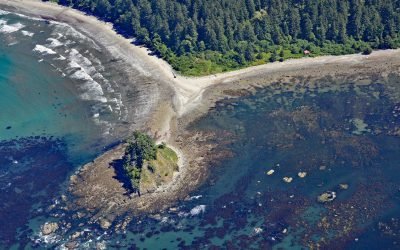
Tongue Point, Crescent Bay
Tongue Point is a rocky ledge in the Strait of Juan de Fuca that projects from a peninsula forming the eastern shore of Crescent Bay on the north coast of the Olympic Peninsula and the site of a historical port and shipwreck, about 44 miles (71 km) east-southeast of Neah Bay and 13 miles (21 km) west-northwest of Port Angeles, Washington.
Kaigani Point, Long Island
Kaigani Point is at the southwest tip of Long Island between Kaigani Strait to the west and Cordova Bay to the east, about 100 miles (161 km) northwest of Prince Rupert and 56 miles (90 km) southwest of Ketchikan, Alaska.
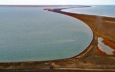
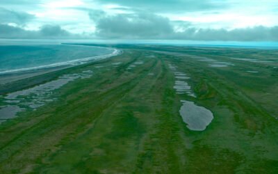
Point Barrow, Elson Lagoon
Point Barrow is a spit that extends northeast from the mainland for 4 miles (6.4 km) into the Arctic Ocean forming Elson Lagoon to the southeast, about 150 miles (242 km) northwest of Nuiqsut and 9.8 miles (16 km) northeast of Utqiaġvik, Alaska.
About the background graphic
This ‘warming stripe’ graphic is a visual representation of the change in global temperature from 1850 (top) to 2019 (bottom). Each stripe represents the average global temperature for one year. The average temperature from 1971-2000 is set as the boundary between blue and red. The colour scale goes from -0.7°C to +0.7°C. The data are from the UK Met Office HadCRUT4.6 dataset.
Click here for more information about the #warmingstripes.