by CoastView | Mar 20, 2024 | 2024, Alaska, Beaches, Climate Change, Coastal Features, Embayments, Glaciers, Land Use, Natural History, Parks
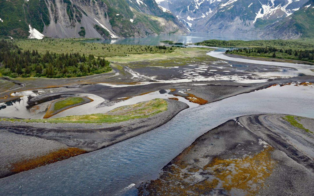
Pedersen Lagoon receives freshwater from proglacial lakes of the Addison and Pedersen glaciers that descend from the Harding Icefield in Kenai Fjords National Park on the western shore of Aialik Bay, about 64 miles (103 km) east-northeast of Homer and 19 miles (31 km)...
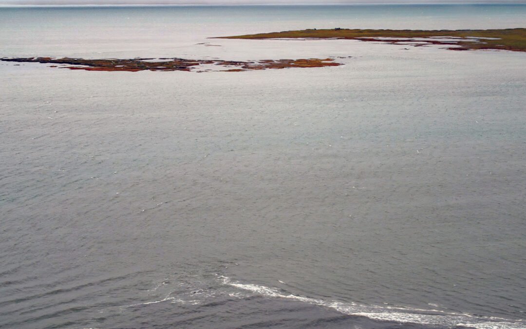
by CoastView | Mar 18, 2024 | 2024, Alaska, Beaches, Climate Change, Embayments, Islands, Natural History
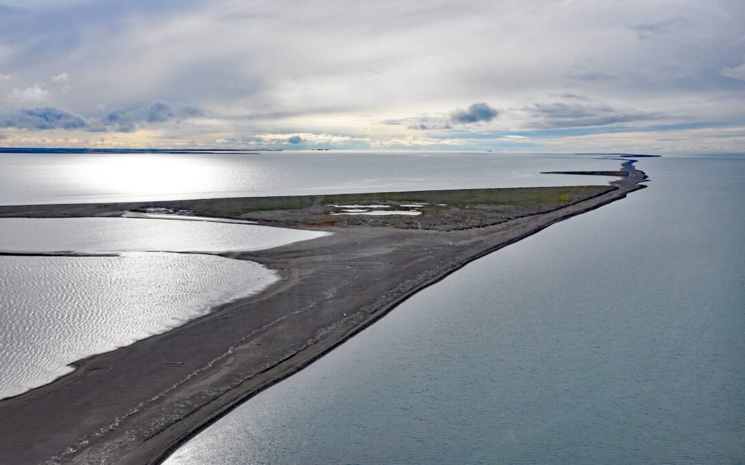
Bodfish Island is part of the Jones Island barrier chain between Cottle Island to the east and Bertoncini Island to the west, separating Simpson Lagoon from the Beaufort Sea, about 178 miles (286 km) southeast of Utqiagvik and 30 miles (48 km) northwest of Deadhorse,...
by CoastView | Mar 16, 2024 | 2024, Alaska, Biodiversity, Canneries, Coastal Features, Communities, Historical, Land Use, Natural History, Rivers
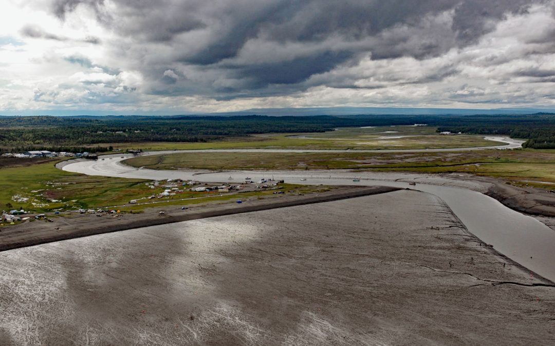
Kasilof River starts at the outlet of Tustumena Lake on the Kenai Peninsula and flows generally northwest for 17 miles (27 km) through the Kenai Lowland to Cook Inlet, draining a watershed of 93,275 acres (37,747 ha), about 51 miles (82 km) north-northeast of Homer...

by CoastView | Mar 13, 2024 | 2024, Alaska, Biodiversity, Coastal Features, Embayments, Glaciers, Natural History, Parks
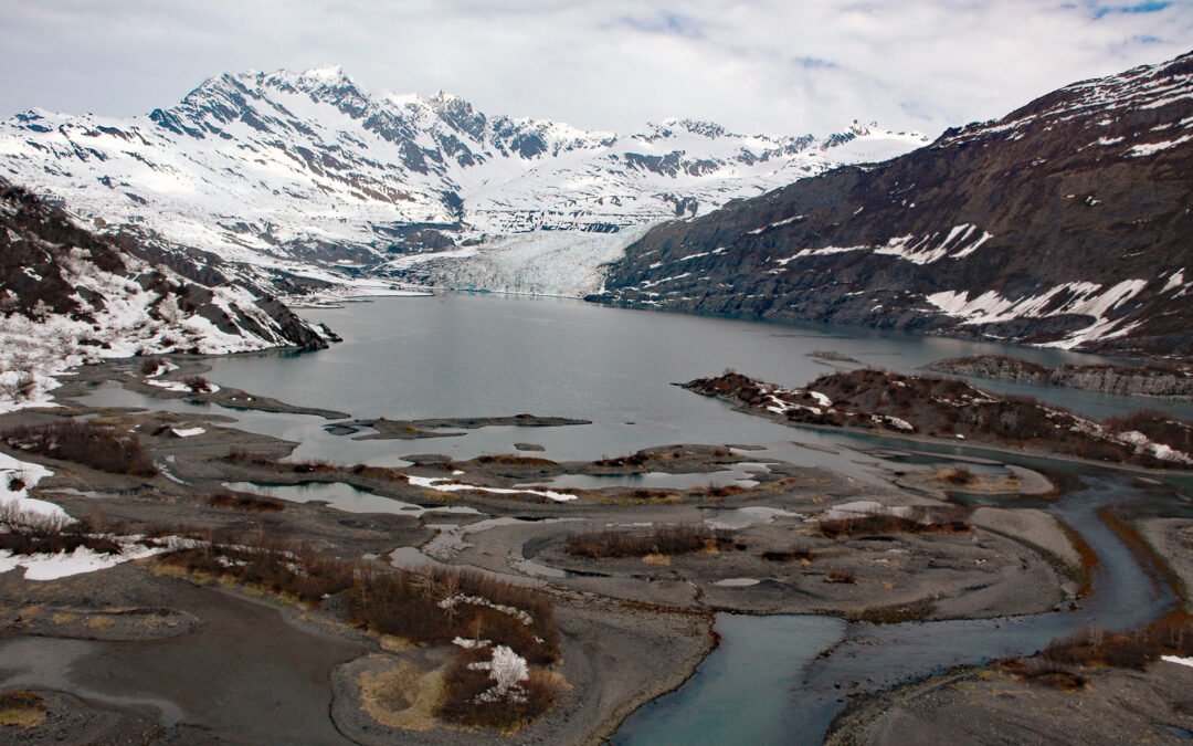
Gilman Glacier starts at an elevation of roughly 6,000 feet (1,828 m)in the Fairweather Range of the Saint Elias Mountains and flows generally northwest for 7.5 miles (12 km) to Johns Hopkins Inlet in Glacier Bay National Park and Preserve, about 105 miles (169 km)...
by CoastView | Mar 12, 2024 | 2024, Alaska, Climate Change, Coastal Features, Embayments, Glaciers, Natural History
Shoup Glacier starts at an elevation of roughly 6,800 feet (2,073 m) in the Chugach Mountains between Mount Shouplina to the west and Mount Logan to the east, and flows 16 miles (26 km) generally south-southwest to Shoup Bay on the northwest shore of Port Valdez in...
by CoastView | Mar 7, 2024 | 2024, Alaska, Beaches, Climate Change, Coastal Features, Embayments, Historical, Islands, Land Use, Natural History, Rivers
Leffingwell Camp is situated on Flaxman Island, a shape-shifting barrier island separating the Beaufort Sea to the north and Lion Bay to the south, about 58 miles (94 km) east of Deadhorse and 58 miles (94 km) west of Kaktovik, Alaska. Barrier islands stretch across...