by CoastView | Oct 16, 2023 | 2023, Alaska, Beaches, Biodiversity, Coastal Features, Historical, Islands, Land Use, Natural History
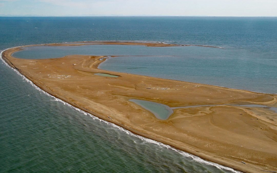
Reindeer Island is about 2 miles (3.2 km) long and is the westernmost of the six Midway Islands in Stefansson Sound on the Beaufort Sea coast, about 196 miles (316 km) southeast of Utqiaġvik and 21 miles (34 km) north of Deadhorse, Alaska. The island was named in 1910...
by CoastView | Oct 14, 2023 | 2023, Alaska, Developments, Headlands, Islands, Land Use, Natural History
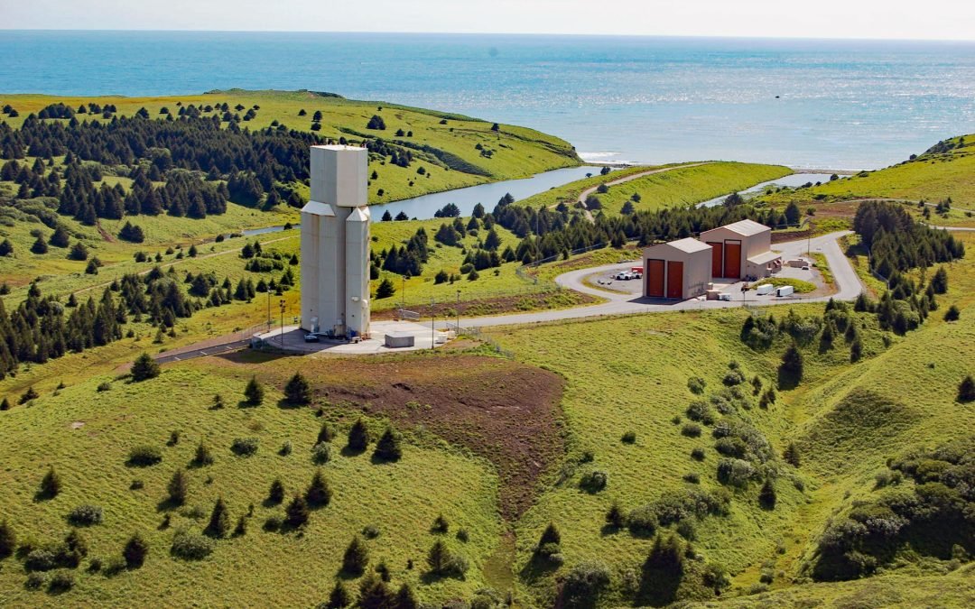
The Pacific Spaceport Complex is a launch facility for sub-orbital and orbital launch vehicles located on Kodiak Island, about 180 miles (290 km) southeast of King Salmon and 25.5 miles (41 km) south of Kodiak, Alaska. The facility is owned and operated by the Alaska...
by CoastView | Oct 12, 2023 | 2023, Alaska, Communities, Developments, Historical, Land Use, Rivers
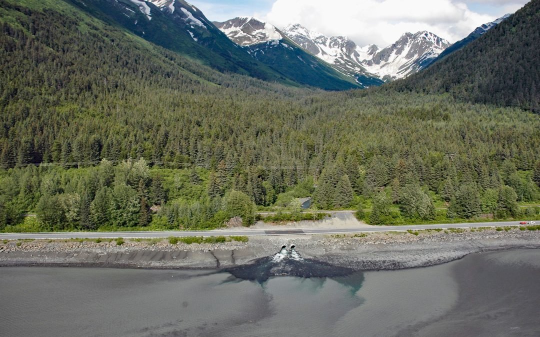
Kern Creek is between Portage and Girdwood on the northern shore of Turnagain Arm, about 35 miles (56 km) southeast of Anchorage and 16 miles (26 km) northwest of Whittier, Alaska. The stream flows southwest for 3.5 miles (5.6 km) from the Chugach Mountains. The name...
by CoastView | Oct 11, 2023 | 2023, Alaska, Beaches, Biodiversity, Coastal Features, Embayments, Land Use, Mines, Natural History, Parks, Rivers
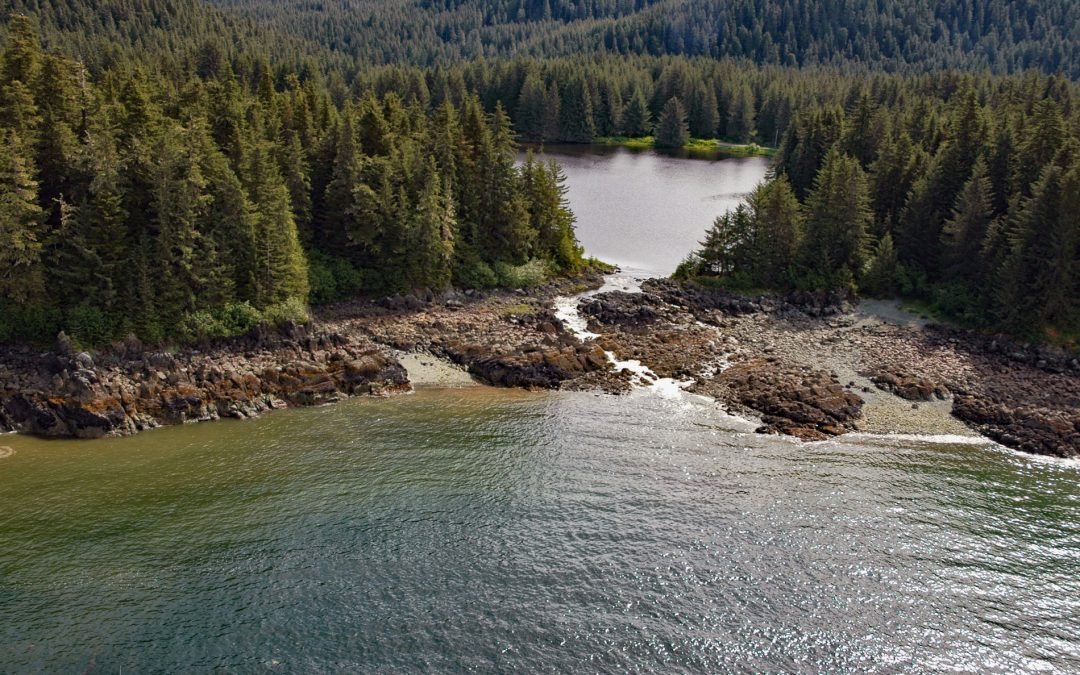
Peterson Lagoon is the estuary of Peterson Creek that starts from the outlet of Peterson Lake at an elevation of 734 feet (224 m) on Auke Mountain and flows north-northwest for 4 miles (7 km) to the lagoon that connects to Eagle Harbor, about 56 miles (90 km)...

by CoastView | Oct 10, 2023 | 2023, Alaska, Beaches, Biodiversity, Coastal Features, Land Use, Natural History, Parks, Rivers, Shelter Cabins
Rabbit Creek starts in the Mulgrave Hills and flows southwest for 23 miles (37 km) through the File Mountains, also known as the Tahinichok Mountains, to the Chukchi Sea at the southern end of Imik Lagoon in Cape Krusenstern National Monument, about 96 miles (155 km)...

by CoastView | Oct 8, 2023 | 2023, Alaska, Beaches, Coastal Features, Historical, Land Use, Natural History, Parks, Rivers, Shelter Cabins
Aitiligauraq Shelter Cabin is in the Cape Krusenstern National Monument in northwestern Alaska and is situated on the south bank of an unnamed creek that flows west for 5 miles (8 km) from Eigaloruk Mountain to a coastal lagoon, about 110 miles (177 km) southeast of...