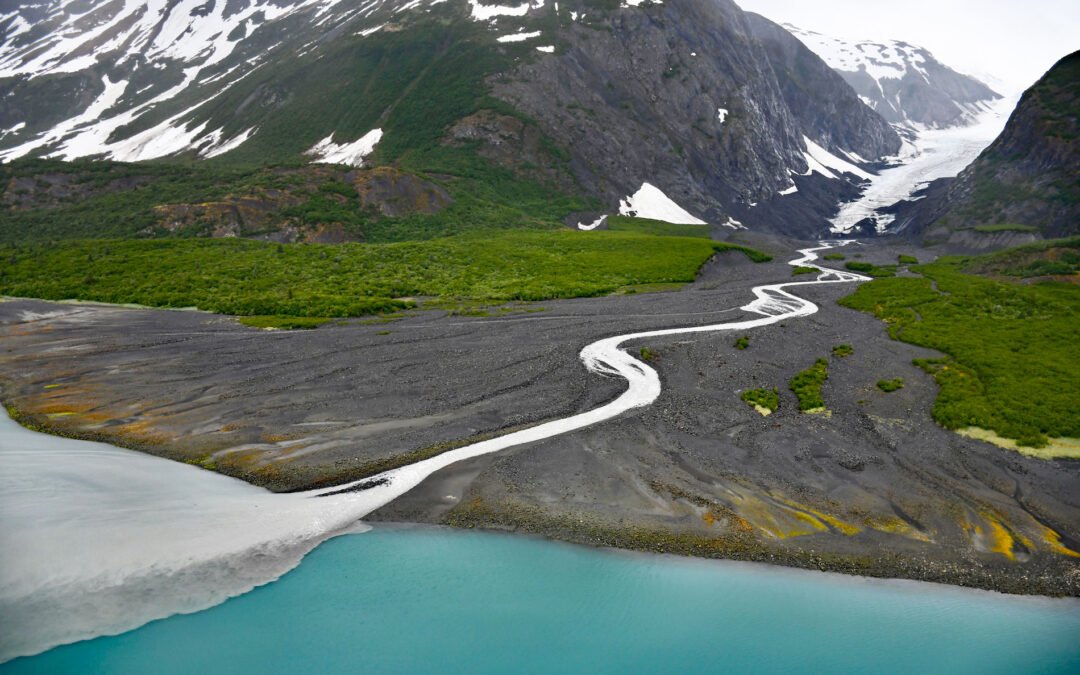
by CoastView | Mar 4, 2024 | 2024, Alaska, Beaches, Biodiversity, Climate Change, Coastal Features, Embayments, Glaciers, Land Use, Natural History, Parks
Dinglestadt Glacier has two land terminating lobes that straddle a watershed divide in the Kenai Mountains, with a minor lobe descending southeast for 4 miles (6 km) from an elevation of roughly 3300 feet (1006 m) to a tidal delta on the western shore of McCarty...
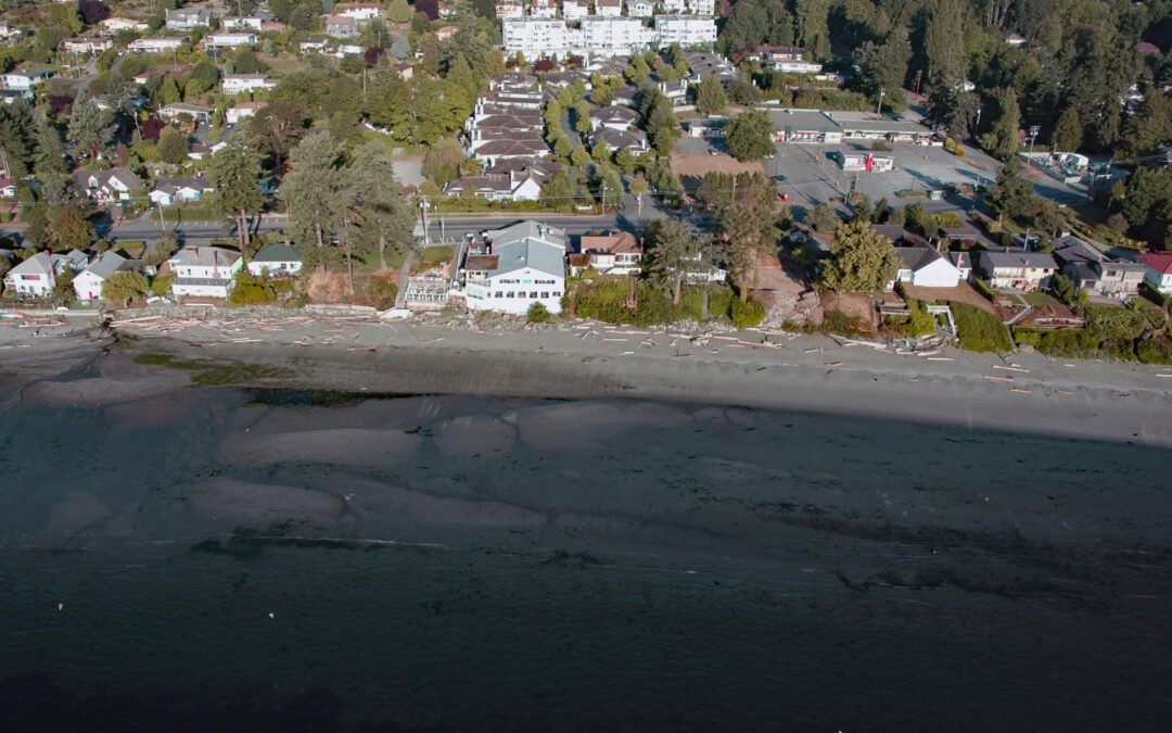
by CoastView | Mar 3, 2024 | 2024, Beaches, Biodiversity, British Columbia, Communities, Developments, Embayments, Islands, Land Use, Natural History
Cordova Bay is a shallow bight and a community located on the eastern shore of the Saanich Peninsula in the municipality of Saanich, one of the 13 cities comprising the Greater Victoria Region on Vancouver Island, about 9 miles (14.5 km) south-southeast of Sidney and...

by CoastView | Feb 29, 2024 | 2024, Beaches, Biodiversity, Coastal Features, Land Use, Natural History, Oregon, Rivers
Floras Creek starts from an elevation of roughly 2,786 feet (849 m) on the north flank of Edson Butte in the Oregon Coast Range and flows generally west for 13 miles (21 km), draining a watershed of 51,652 acres (20,903 ha) to the outlet of Floras Lake where the...
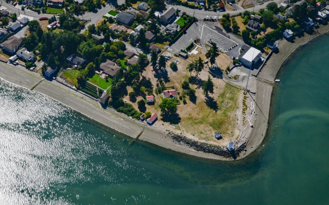
by CoastView | Feb 24, 2024 | 2024, Beaches, Coastal Features, Developments, Embayments, Headlands, Land Use, Lighthouses, Parks, Washington
Browns Point is a conspicuous landmark in Puget Sound located at the southern end of East Passage and at the entrance to Commencement Bay, about 21 miles (34 km) south-southwest of Seattle and 4 miles (6.5 km) north of Tacoma, Washington. In May 1841, the U.S....

by CoastView | Feb 23, 2024 | 2024, Beaches, Biodiversity, California, Coastal Features, Communities, Land Use, Natural History, Rivers
Mad River starts in the Coast Range at an elevation of 4,845 ft (1,477 m) and flows generally northwest for 113 miles (182 km), draining a watershed of 318,080 acres (128,722 ha), and enters the Pacific Ocean about 12 miles (19 km) north of Eureka and 1.8 miles (3 km)...
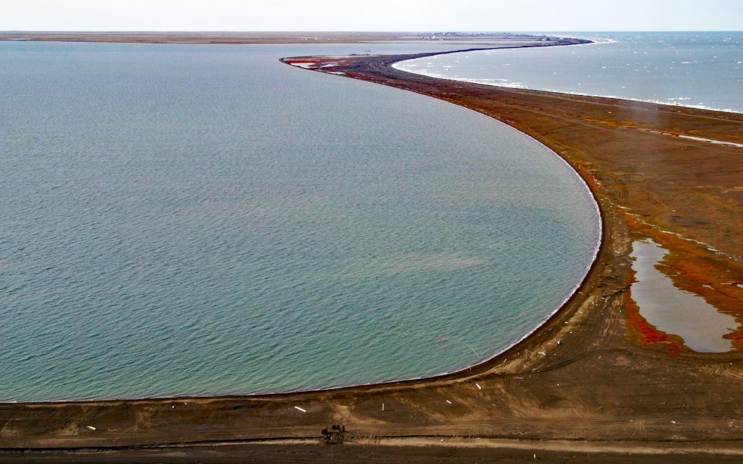
by CoastView | Feb 19, 2024 | 2024, Alaska, Beaches, Coastal Features, Communities, Embayments, Historical, Land Use, Natural History, Shipwrecks
Point Barrow is a spit that extends northeast from the mainland for 4 miles (6.4 km) into the Arctic Ocean forming Elson Lagoon to the southeast, about 150 miles (242 km) northwest of Nuiqsut and 9.8 miles (16 km) northeast of Utqiaġvik, Alaska. The point is a spit...