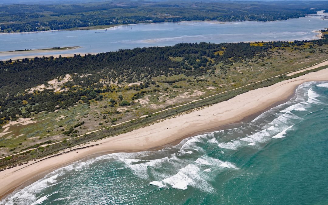
by CoastView | Jul 9, 2021 | 2021, Beaches, Best of 2021, Biodiversity, Coastal Features, Historical, Land Use, Oregon, Rivers, Shipwrecks
North Spit of Coos Bay is a sandy, vegetated peninsula separating the estuary of the Coos River from the Pacific Ocean, and the site of Camp Castaway, about 3.8 miles (6 km) west of North Bend and 1 mile (1.6 km) north of Charleston, Oregon. The spit was the site of a...
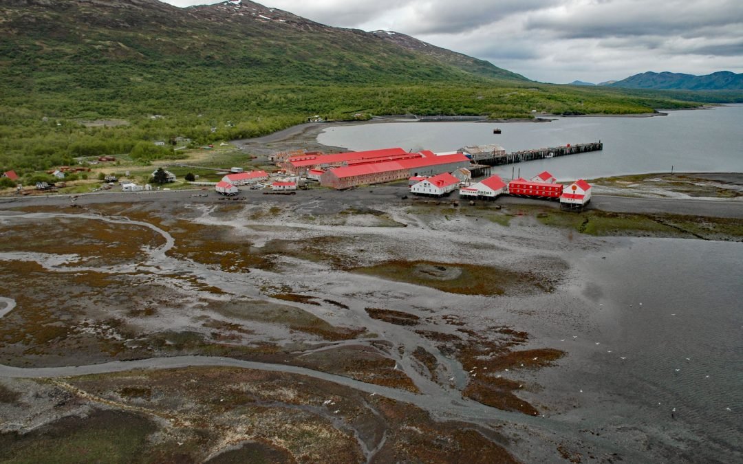
by CoastView | Jul 8, 2021 | 2021, Alaska, Best of 2021, Canneries, Communities, Developments, Embayments, Historical, Islands
Larsen Bay is a small village and historical salmon cannery on Larsen Bay, an embayment that extends 6 miles (9.6 km) off of Uyak Bay on the west coast of Kodiak Island, about 125 miles (202 km) southeast of King Salmon and 58 miles (94 km) west-southwest of Kodiak,...
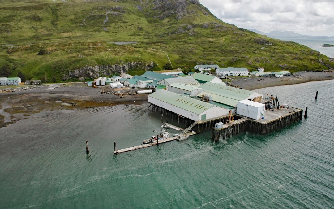
by CoastView | Jun 11, 2021 | 2021, Alaska, Best of 2021, Canneries, Developments, Embayments, Headlands, Historical, Islands
Alitak is a historical salmon cannery and fish processing plant located on Lazy Bay at the southern end of Kodiak Island, about 152 miles (245 km) southeast of King Salmon and 92 miles (148 km) southwest of Kodiak, Alaska. The cannery is named after Cape Alitak, a...
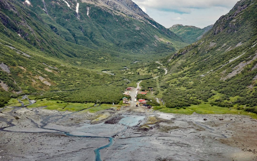
by CoastView | May 11, 2021 | 2021, Alaska, Best of 2021, Communities, Developments, Embayments
Williamsport is a boat landing and seasonal community at the mouth of Williams Creek in the Chigmit Mountains on the west shore of Iliamna Bay on Cook Inlet, about 75 miles (121 km) west of Homer and 43 miles (70 km) east of Iliamna, Alaska. The community is located...
by CoastView | Apr 30, 2021 | 2021, Alaska, Best of 2021, Embayments, Historical, Islands
Winter Harbor is an embayment about 0.3 miles (0.5 km) wide on the west coast of Prince of Wales Island, near the south entrance to Tuxekan Passage, about 66 miles (106 km) northwest of Ketchikan and 15 miles (24 km) north-northwest of Klawock, Alaska. The name was...
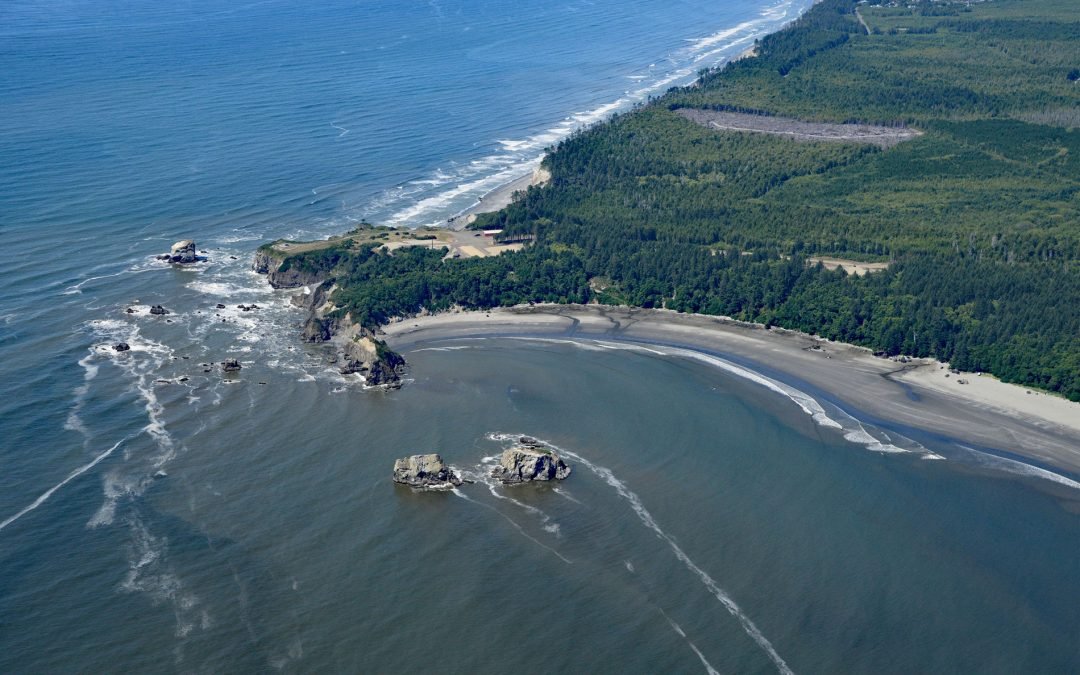
by CoastView | Apr 26, 2021 | 2021, Best of 2021, Coastal Features, Headlands, Historical, Washington
Point Grenville is a headland with cliffs 120 feet (37 m) high, located on the Quinault Nation lands about 5.6 miles (9 km) north of Moclips and 3 miles (5 km) south-southeast of Taholah, Washington. On July 12, 1775, Bruno de Heceta, Juan Perez Hernández, and others...