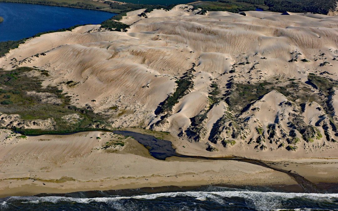
by CoastView | Mar 19, 2025 | 2025, Beaches, Biodiversity, California, Chemical Pollution, Coastal Features, Developments, Freshwater, Historical, Land Use, Natural History, Parks, Rivers
Listen to the article here https://coastview.org/wp-content/uploads/2025/03/Oso-Flaco.mp3 Oso Flaco Creek drains a watershed of approximately 7,400 acres (2,995 ha) consisting mostly of agricultural land before forming Oso Flaco Lake, now part of the Oso Flaco Lake...

by CoastView | Mar 17, 2025 | 2025, Biodiversity, British Columbia, Chemical Pollution, Climate Change, Coastal Features, Embayments, Historical, Land Use, Mines
Listen to the article here https://coastview.org/wp-content/uploads/2025/03/Hastings.mp3 Hastings Arm extends 14 miles (23 km) north from Observatory Inlet into the Coast Mountains and terminates at the mouth of the Kshwan River, about 23 miles (37 km) south‐southeast...
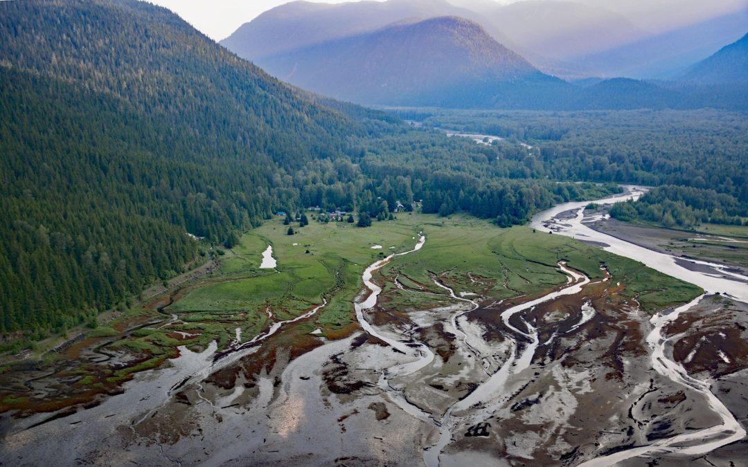
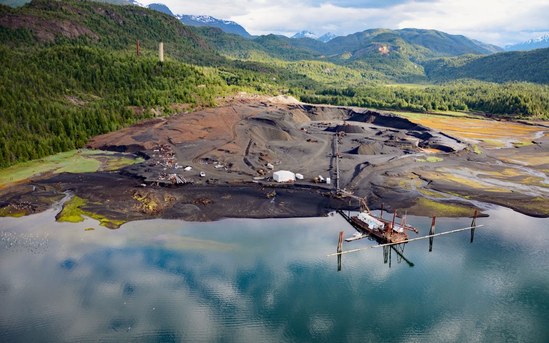
by CoastView | Mar 10, 2025 | 2025, Biodiversity, British Columbia, Chemical Pollution, Climate Change, Communities, Developments, Embayments, Historical, Land Use, Mines, Rivers
Listen to the article here https://coastview.org/wp-content/uploads/2025/03/Alice-Arm.mp3 Kitsault River drains a watershed of about 113,668 acres (46,000 ha), that includes the Kitsault Glacier and several smaller glaciers that flow out of the Cambria Icefield, and...
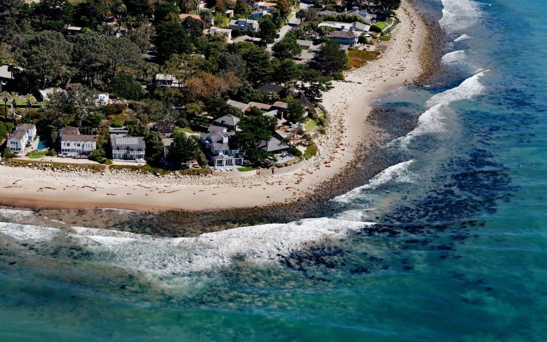
by CoastView | Mar 2, 2025 | 2025, Biodiversity, California, Chemical Pollution, Coastal Features, Communities, Developments, Land Use, Natural History, Rivers
Listen to the article here https://coastview.org/wp-content/uploads/2025/03/Rincon-Creek-1.mp3 Rincon Creek is a stream that begins in the Santa Ynez Mountains near Divide Peak, at an elevation of 4,800 feet (1,463 m), and drains a watershed of 9,352 acres (3,785-ha)...
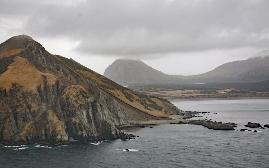
by CoastView | Feb 24, 2025 | 2025, Alaska, Biodiversity, Chemical Pollution, Climate Change, Coastal Features, Historical, Islands, Land Use
Listen to the article here https://coastview.org/wp-content/uploads/2025/03/Barren-Islands.mp3 Barren Islands are the northernmost of the Kodiak Archipelago, located near Lower Cook Inlet, between Stevenson Entrance to the south and Kennedy Entrance to the north,...
by CoastView | Feb 20, 2025 | 2025, British Columbia, Chemical Pollution, Coastal Features, Communities, Developments, Embayments, Historical, Land Use, Mines
Listen to the article here https://coastview.org/wp-content/uploads/2025/03/Anyox.mp3 Anyox, an abandoned mining community in the Coast Mountains, lies at the mouth of Anyox Creek on Granby Bay in Observatory Inlet, about 79 miles (127 km) north-northeast of Prince...