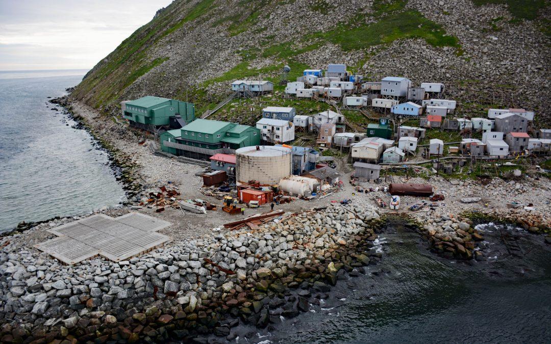
by CoastView | Mar 4, 2026 | 2026, Alaska, Best of 2025, Communities, Developments, Islands, Land Use, March 2026, Natural History
Listen to the article here https://coastview.org/wp-content/uploads/2026/01/Diomede.mp3 Diomede is an Iñupiaq village on the west coast of Little Diomede Island, located less than 1 mile (1.6 km) from the International Date Line, 2.4 miles (3.9 km) east of Big Diomede...

by CoastView | Feb 26, 2026 | 2026, Best of 2025, British Columbia, Developments, Embayments, February 2026, Land Use, Mines, Natural History
Listen to the article here https://coastview.org/wp-content/uploads/2026/01/IslandCopperMine.mp3 Island Copper was an open pit mine at the northern end of Vancouver Island on Rupert Inlet at the head of Quatsino Sound, about 4.6 miles (7.4 km) east of Coal Harbour and...

by CoastView | Feb 24, 2026 | 2026, Alaska, Coastal Features, Developments, Embayments, February 2026, Islands, Land Use, Rivers
Listen to the article here https://coastview.org/wp-content/uploads/2026/01/TerrorBay.mp3 Terror Bay lies on Kodiak Island’s northern coast and extends about 7 miles (11 km) south from Uganik Passage to the mouth of Terror River in Kodiak National Wildlife...
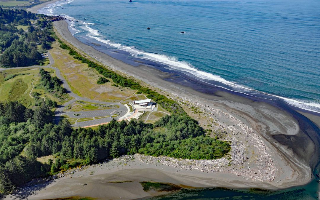
by CoastView | Feb 21, 2026 | 2026, Beaches, Coastal Features, Developments, February 2026, Land Use, Natural History, Oregon, Parks, Rivers
Listen to the article here https://coastview.org/wp-content/uploads/2026/01/Crissey-Field.mp3 The Winchuck River starts at an elevation of about 2,000 feet (610 m) and flows generally south-west for 19 miles (31 km) through the Rogue River–Siskiyou National Forest to...

by CoastView | Feb 18, 2026 | 2026, Alaska, Coastal Features, Developments, Embayments, February 2026, Historical, Islands, Land Use
Listen to the article here https://coastview.org/wp-content/uploads/2026/01/MuttonCove.mp3 Mutton Cove is an embayment on Unalaska Island, about 0.3 miles (0.5 km) across, on the northern shore of Chernofski Harbor, about 64 miles (103 km) north-east of Nikolski and...
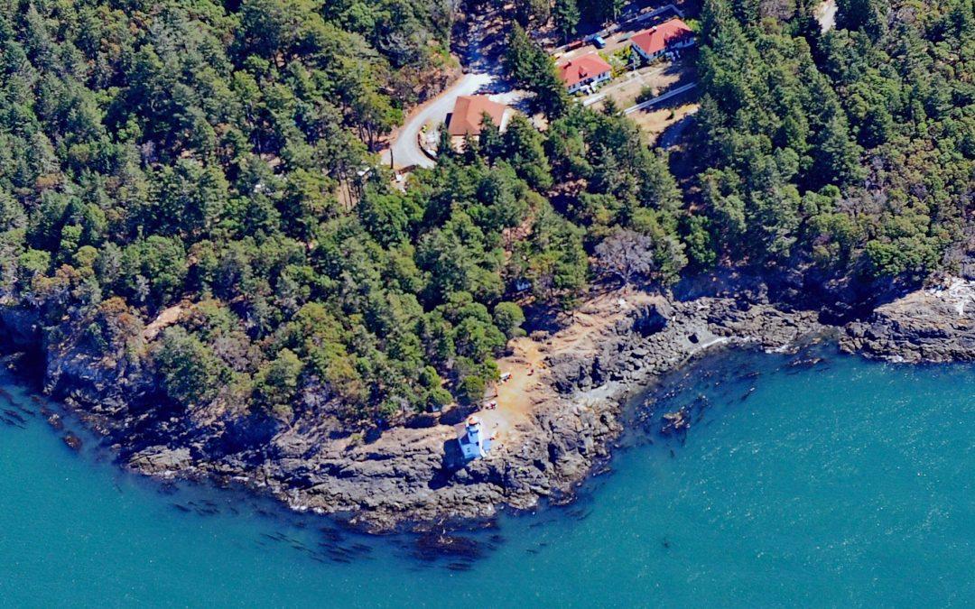
by CoastView | Feb 14, 2026 | 2026, Coastal Features, Developments, February 2026, Historical, Islands, Land Use, Lighthouses, Washington
Listen to the article here https://coastview.org/wp-content/uploads/2026/01/LimeKilnLighthouse.mp3 Lime Kiln Lighthouse was established in 1919 on Lime Kiln Point, a 36-acre (15 ha) day-use park overlooking Deadman Bay to the south and Haro Strait to the west on San...