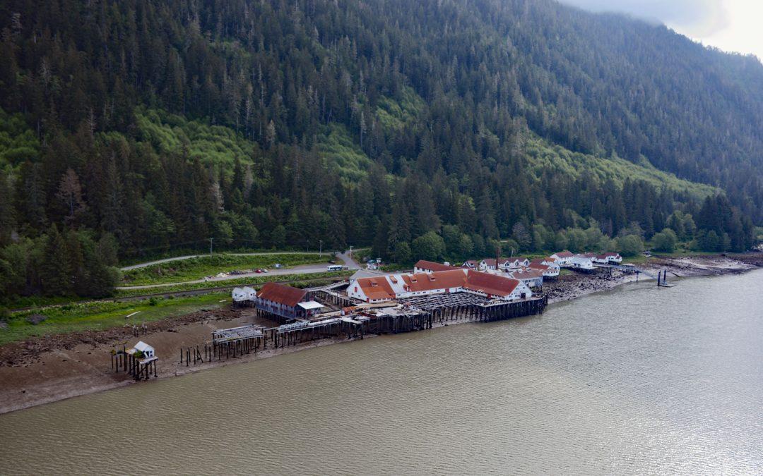
by CoastView | Apr 7, 2026 | 2026, April 2026, Biodiversity, British Columbia, Canneries, Developments, Embayments, Historical, Land Use, Natural History, Rivers
Listen to the article here https://coastview.org/wp-content/uploads/2026/01/NorthPacificCannery.mp3 North Pacific Cannery was built in 1889 on 183 acres (74 ha) of Crown land on the north shore of Inverness Passage, across from Smith Island and near the mouth of the...
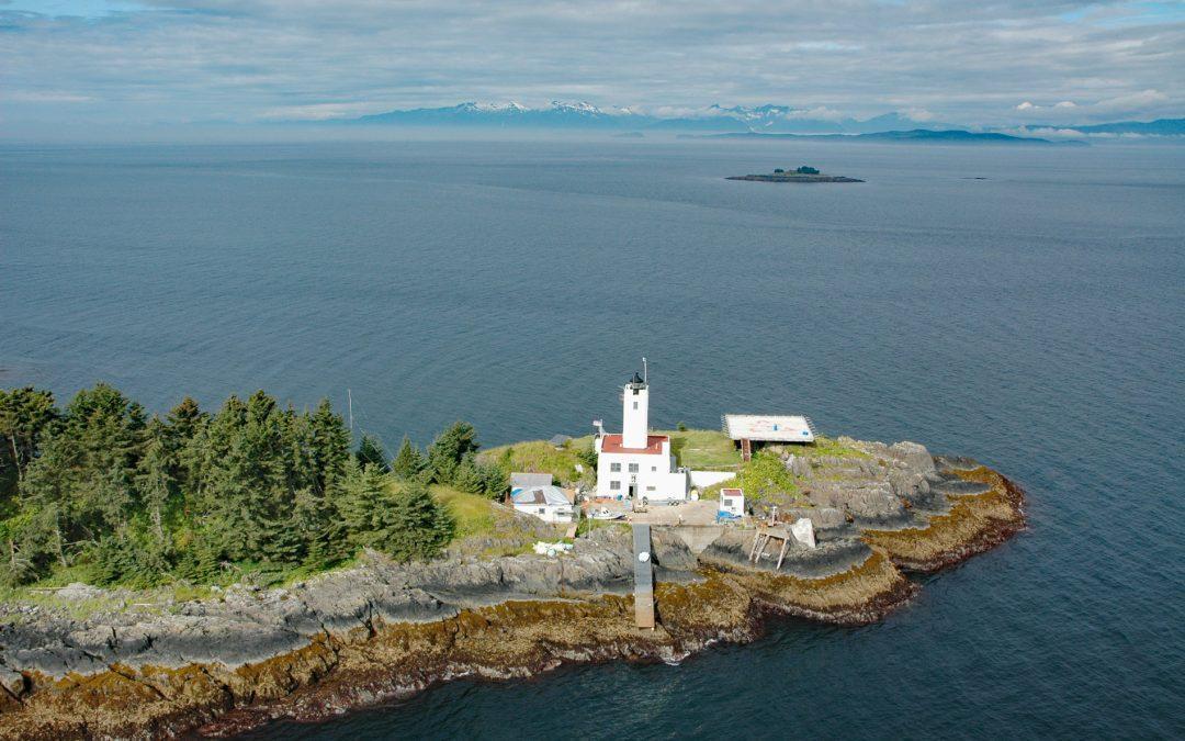
by CoastView | Apr 5, 2026 | 2026, Alaska, April 2026, Coastal Features, Developments, Islands, Lighthouses, Natural History
Listen to the article here https://coastview.org/wp-content/uploads/2026/01/FiveFingers.mp3 Five Fingers is a group of islets and the site of a historic lighthouse in Frederick Sound at the southern entrance to Stephens Passage, about 67 miles (108 km) east-northeast...

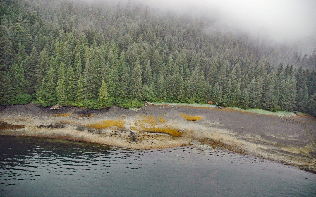
by CoastView | Apr 2, 2026 | 2026, Alaska, April 2026, Beaches, Developments, Embayments, Historical, Kachemak, Land Use, Mines
Listen to the article here https://coastview.org/wp-content/uploads/2026/01/CoalCove.mp3 Coal Cove is the site of a historic Russian coal mine at Dangerous Cape on the north shore entrance to Port Graham, near the southern end of the Kenai Peninsula, about 7 miles (11...
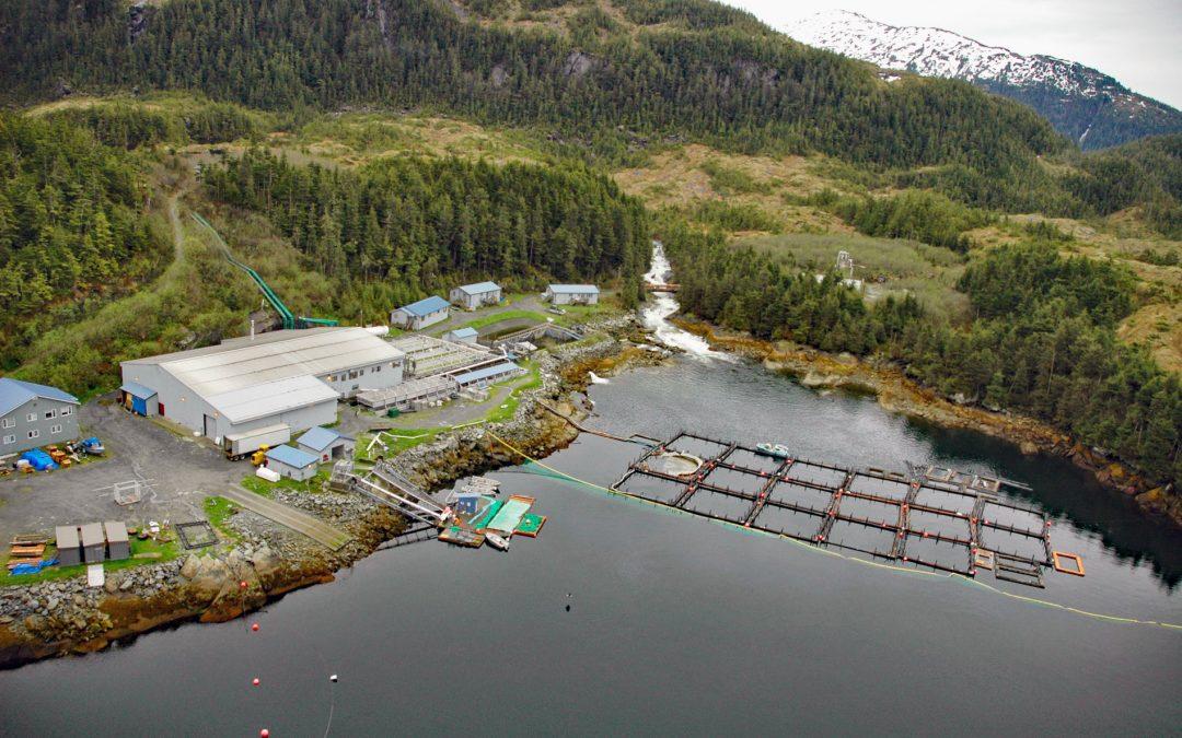
by CoastView | Mar 31, 2026 | 2026, Alaska, April 2026, Biodiversity, Developments, Embayments, Hatcheries, Islands, Natural History
Listen to the article here https://coastview.org/wp-content/uploads/2026/01/LakeBay.mp3 Lake Bay is the site of a salmon hatchery on the southern coast of Esther Island in northwestern Prince William Sound, about 63 miles (101km) west-southwest of Valdez and 20 miles...
by CoastView | Mar 30, 2026 | 2026, Alaska, April 2026, Canneries, Developments, Embayments, Historical, Islands, Land Use, Natural History, Shipwrecks
Listen to the article here https://coastview.org/wp-content/uploads/2026/01/GambierBay.mp3 Gambier Bay is the site of an infamous shipwreck and historical salmon cannery operated by Admiralty Trading Company near Stephens Passage on the east coast of Admiralty Island,...

by CoastView | Mar 28, 2026 | 2026, Alaska, Canneries, Developments, Embayments, Land Use, March 2026, Natural History
Listen to the article here https://coastview.org/wp-content/uploads/2026/01/WaterfallCannery.mp3 Waterfall is a historic cannery on the west coast of Prince of Wales Island on Ulloa Channel, adjacent to Port Refugio on Suemez Island, approximately 145 miles (234 km)...