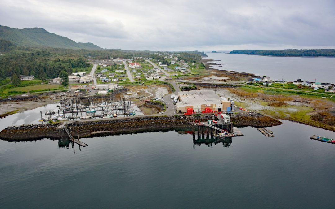
by CoastView | Apr 28, 2026 | 2026, April 2026, British Columbia, Communities, Developments, Embayments, Historical, Land Use, Natural History
Listen to the article here https://coastview.org/wp-content/uploads/2026/01/LaxKwalaams.mp3 Lax Kw’alaams is a Tsimshian community on Port Simpson, an embayment on the eastern coast of Chatham Sound between Flewin Point to the north and Finlayson Island to the...
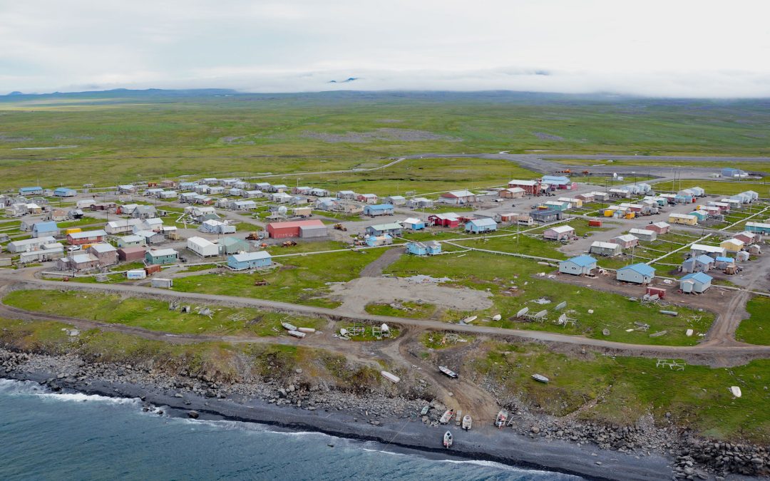
by CoastView | Apr 27, 2026 | 2026, Alaska, April 2026, Best of 2024, Communities, Developments, Islands, Land Use, Natural History
Listen to the article here https://coastview.org/wp-content/uploads/2026/01/Savoonga.mp3 Savoonga is a Siberian Yupik community on the northern flank of the Kookooligit Mountains at Savoonga Point on the north coast of Saint Lawrence Island in the Bering Sea, about...
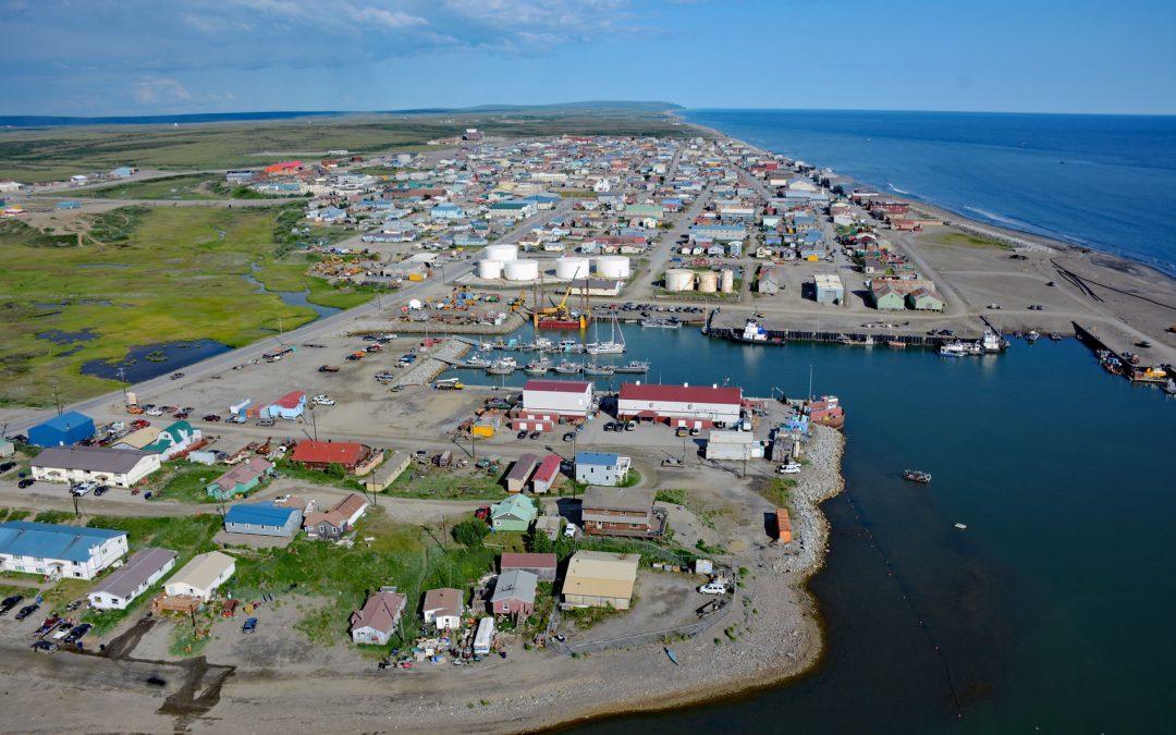
by CoastView | Apr 26, 2026 | 2026, Alaska, April 2026, Communities, Developments, Historical, Land Use, Natural History
Listen to the article here https://coastview.org/wp-content/uploads/2026/01/Nome.mp3 Nome is a community at the mouth of the Snake River on the south coast of the Seward Peninsula on Norton Sound, about 289 miles (466 km) north-west of Bethel and 185 miles (298 km)...
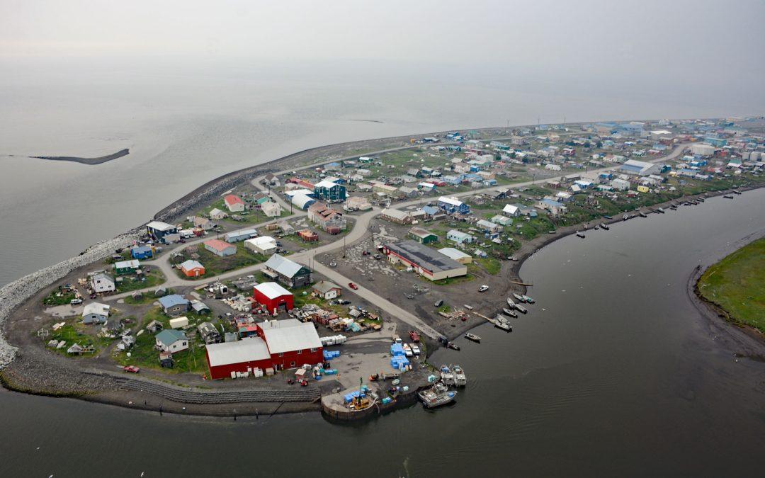
by CoastView | Apr 20, 2026 | 2026, Alaska, April 2026, Coastal Features, Communities, Developments, Land Use, Natural History
Listen to the article here https://coastview.org/wp-content/uploads/2026/01/Unalakleet.mp3 Unalakleet is an Iñupiaq-Yup’ik community built on an ancient beach ridge at an elevation of 7 feet (2 m) at the mouth of the Unalakleet River on the eastern coast of...
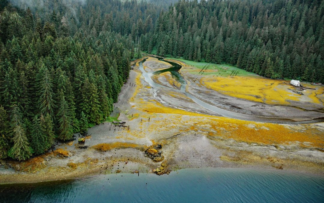
by CoastView | Apr 19, 2026 | 2026, Alaska, April 2026, Biodiversity, Canneries, Developments, Embayments, Historical, Land Use, Natural History
Listen to the article here https://coastview.org/wp-content/uploads/2026/01/Chomley.mp3 Chomly is the site of a historic cannery and settlement on the south shore of West Arm Cholmondeley Sound on Prince of Wales Island, 28 miles (45 km) west-south-west of Ketchikan...
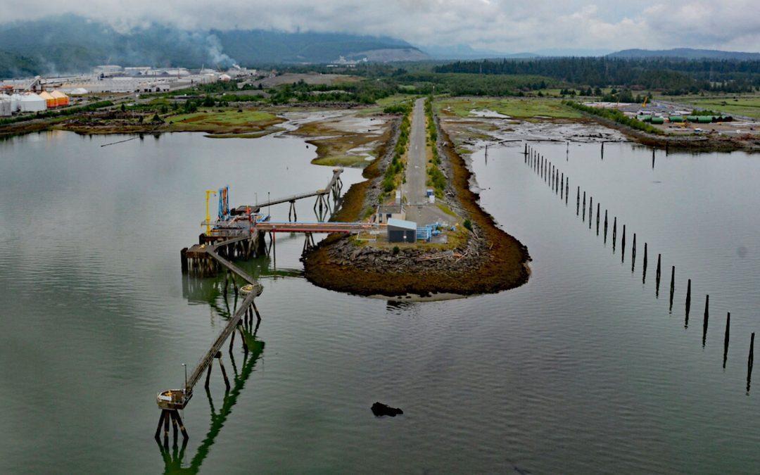
by CoastView | Apr 14, 2026 | 2026, April 2026, British Columbia, Communities, Developments, Embayments, Land Use, Natural History
Listen to the article here https://coastview.org/wp-content/uploads/2026/01/Kitimat.mp3 Kitimat is a planned community for employees of an aluminum smelter situated on the alluvial fan of the Kitimat river at the head of Douglas Channel, about 71 miles (115 km)...