by CoastView | Mar 20, 2024 | 2024, Alaska, Beaches, Climate Change, Coastal Features, Embayments, Glaciers, Land Use, Natural History, Parks
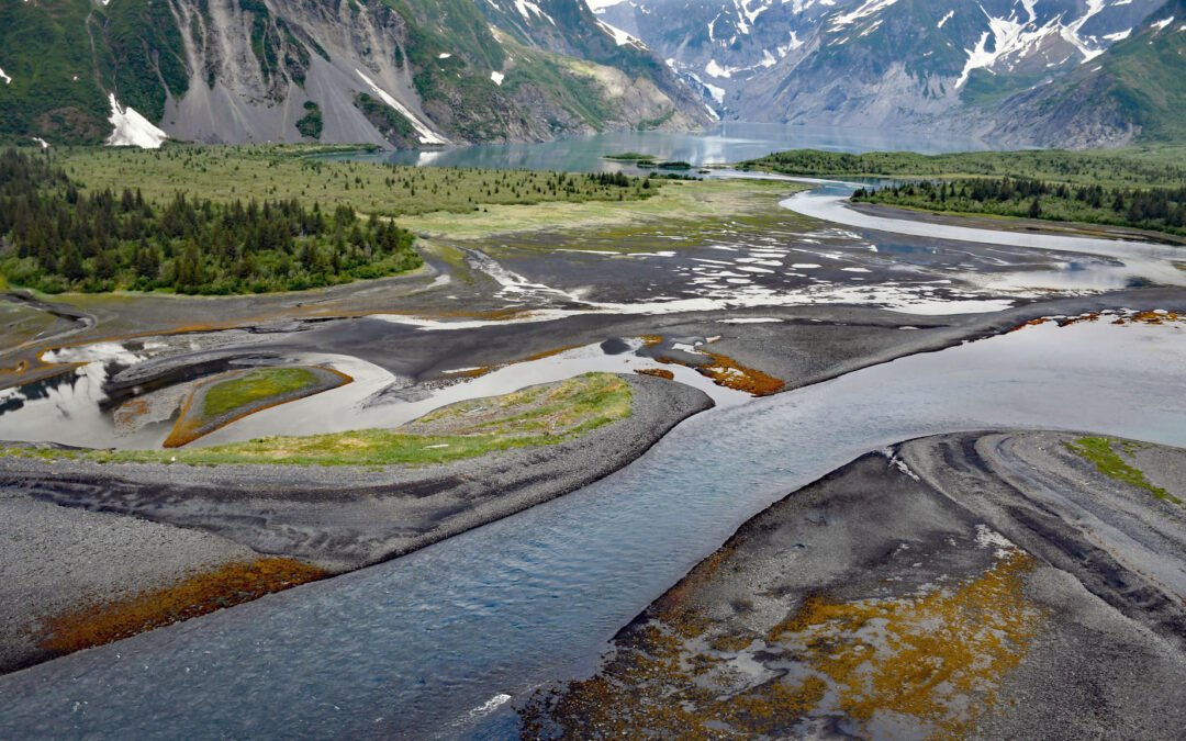
Pedersen Lagoon receives freshwater from proglacial lakes of the Addison and Pedersen glaciers that descend from the Harding Icefield in Kenai Fjords National Park on the western shore of Aialik Bay, about 64 miles (103 km) east-northeast of Homer and 19 miles (31 km)...

by CoastView | Mar 13, 2024 | 2024, Alaska, Biodiversity, Coastal Features, Embayments, Glaciers, Natural History, Parks
Gilman Glacier starts at an elevation of roughly 6,000 feet (1,828 m)in the Fairweather Range of the Saint Elias Mountains and flows generally northwest for 7.5 miles (12 km) to Johns Hopkins Inlet in Glacier Bay National Park and Preserve, about 105 miles (169 km)...
by CoastView | Mar 12, 2024 | 2024, Alaska, Climate Change, Coastal Features, Embayments, Glaciers, Natural History
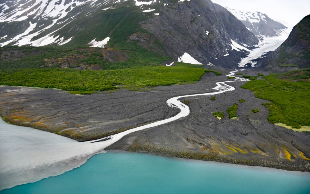
Shoup Glacier starts at an elevation of roughly 6,800 feet (2,073 m) in the Chugach Mountains between Mount Shouplina to the west and Mount Logan to the east, and flows 16 miles (26 km) generally south-southwest to Shoup Bay on the northwest shore of Port Valdez in...
by CoastView | Mar 4, 2024 | 2024, Alaska, Beaches, Biodiversity, Climate Change, Coastal Features, Embayments, Glaciers, Land Use, Natural History, Parks
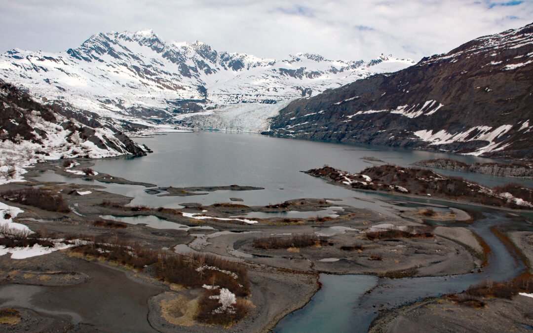
Dinglestadt Glacier has two land terminating lobes that straddle a watershed divide in the Kenai Mountains, with a minor lobe descending southeast for 4 miles (6 km) from an elevation of roughly 3300 feet (1006 m) to a tidal delta on the western shore of McCarty...

by CoastView | Feb 27, 2024 | 2024, Alaska, Coastal Features, Embayments, Glaciers, Land Use, Natural History, Parks
McBride Glacier starts from a series of cirques at elevations near 5500 feet (1676 m) on the southern flank of the Takhinsha Mountains in Glacier Bay National Park and Preserve and flows generally south for roughly 10 miles (16 km) to McBride Inlet which connects to...
by CoastView | Feb 26, 2024 | 2024, Alaska, Biodiversity, Canneries, Coastal Features, Embayments, Glaciers, Land Use, Natural History, Rivers
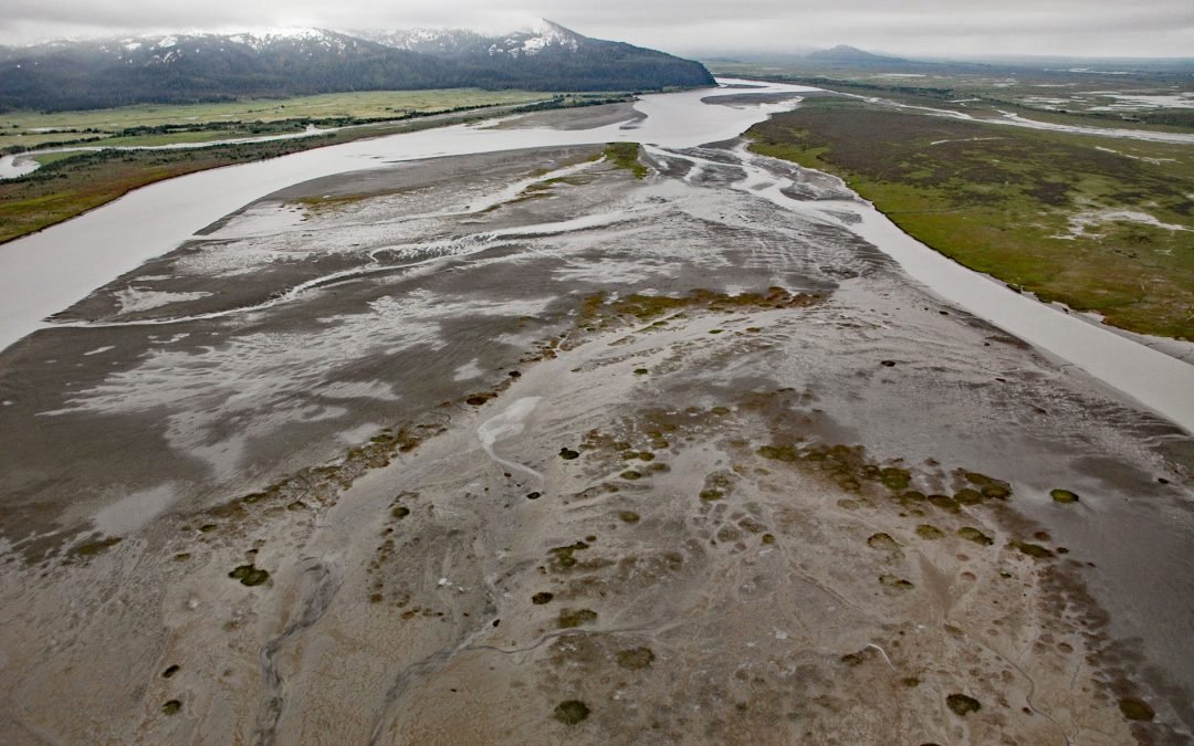
Bering River starts from a series of ice-marginal lakes and streams draining from the Martin River, Steller, and Bering glaciers, and flows generally south-southwest for 18 miles ( km) to Controller Bay on the Gulf of Alaska, about 63 miles (102 km) west of Cape...