
by CoastView | Dec 20, 2024 | 2024, Alaska, Biodiversity, Climate Change, Coastal Features, Embayments, Freshwater, Glaciers, Land Use, Parks
Johns Hopkins Inlet is a fjord in Glacier Bay National Park and Preserve that starts at the terminus of the Johns Hopkins Glacier and extends for about 10 miles (16 km) to the head of Glacier Bay, about 106 miles (171 km) southeast of Yakutat and 58 miles (93 km)...

by CoastView | Dec 18, 2024 | 2024, Alaska, Biodiversity, Climate Change, Coastal Features, Embayments, Glaciers, Historical, Land Use, Parks, Rivers
Beartrack Cove is an estuary about 3 miles (4.8 km) long and 1.6 miles (2.6 km) wide situated at the mouth of the Beartrack River in Glacier Bay National Park and Preserve, about 46 miles (74 km) south-southwest of Haines and 14 miles (23 km) north-northwest of...

by CoastView | Dec 17, 2024 | 2024, Alaska, Climate Change, Coastal Features, Embayments, Freshwater, Glaciers, Historical, Land Use, Parks
Fords Terror is a fjord in the Coast Mountains of Southeast Alaska that trends generally south for 8 miles (13 km) to Endicott Arm, about 64 miles (103 km) southeast of Juneau and 57 miles (92 km) north-northwest of Petersburg, Alaska. The fjord was named in 1889 by...
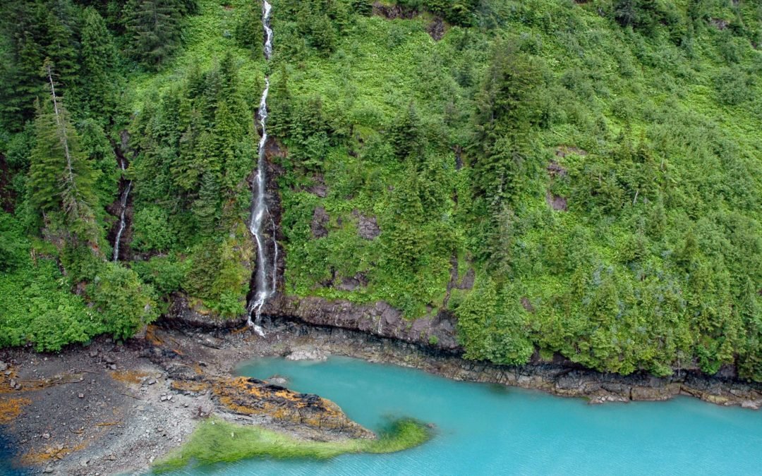
by CoastView | Dec 15, 2024 | 2024, Alaska, Climate Change, Coastal Features, Embayments, Freshwater, Glaciers, Historical, Land Use, Nitrogen Cycle, Rivers, Waterfalls
Ultramarine Glacier is located at the head of Blue Fjord, a glacial estuary that trends generally north for 4.5 miles (7.3 km) to Port Nellie Juan in western Prince William Sound on the east coast of the Kenai Peninsula, about 87 miles (140 km) west of Cordova and 26...

by CoastView | Dec 10, 2024 | 2024, Alaska, Climate Change, Coastal Features, Embayments, Freshwater, Glaciers, Parks
Lamplugh Glacier is situated on the western shore of Glacier Bay at the entrance to Johns Hopkins Inlet in Glacier Bay National Park and Preserve, about 109 miles (175 km) southeast of Yakutat and 55 miles (89 km) northwest of Gustavus, Alaska. The Lamplugh Glacier...
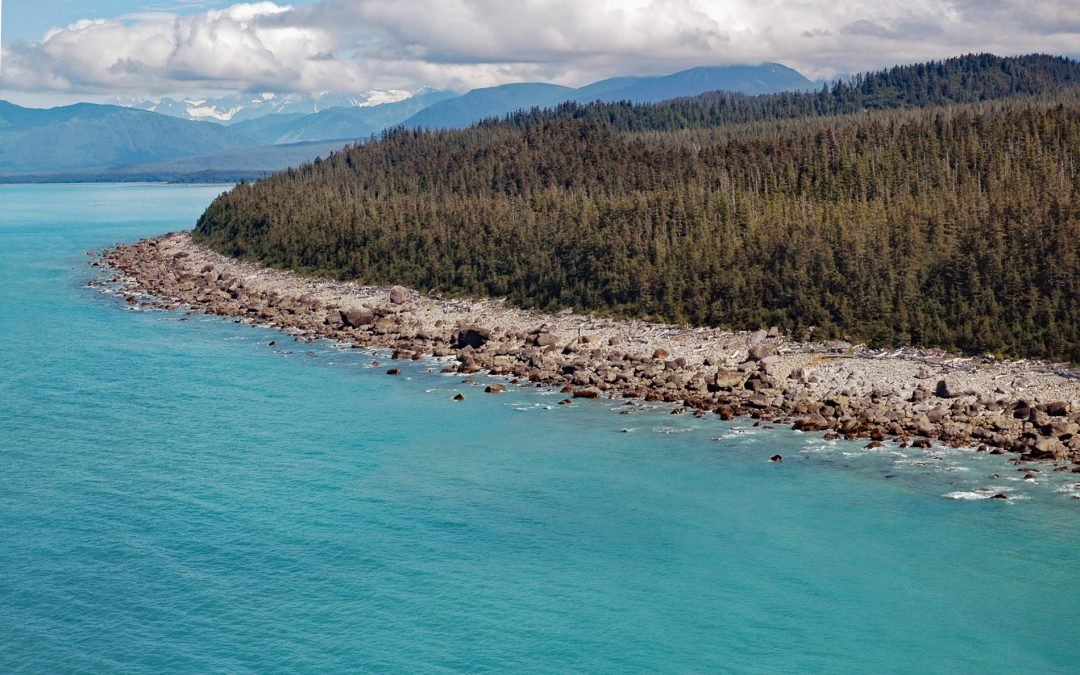
by CoastView | Nov 27, 2024 | 2024, Alaska, Beaches, Climate Change, Coastal Features, Glaciers, Headlands, Historical, Land Use, Parks, Rivers
Cape Fairweather is a point of land created by an ancient terminal moraine at the base of the Fairweather Glacier in Glacier Bay National Park and Preserve, about 131 miles (211 km) west-northwest of Juneau and 82 miles (132 km) southeast of Yakutat, Alaska....