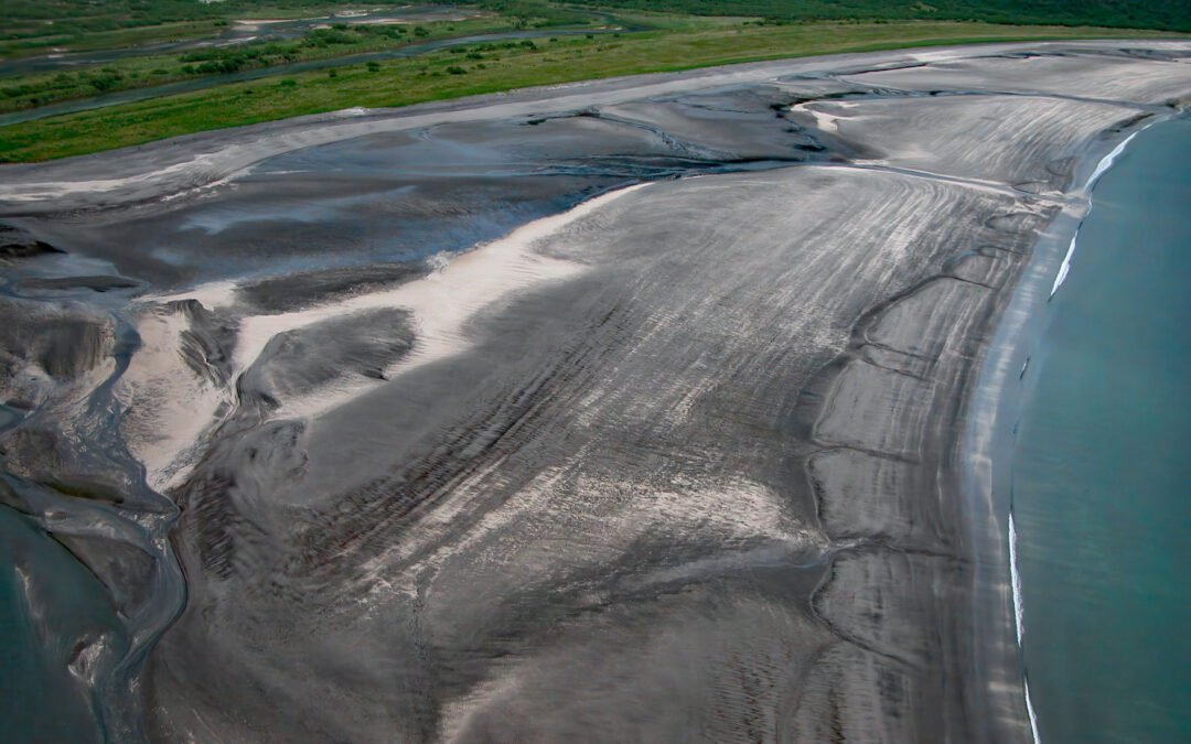
by CoastView | Mar 14, 2025 | 2025, Alaska, Beaches, Coastal Features, Embayments, Historical, Land Use, Natural History, Parks, Rivers
Listen to the article here https://coastview.org/wp-content/uploads/2025/03/Dakavak-Bay.mp3 Dakavak Bay is a 3.4-mile (5.5 km) wide inlet on the southeastern coast of the Alaska Peninsula in Katmai National Park and Preserve, that extends north from Shelikof Strait...
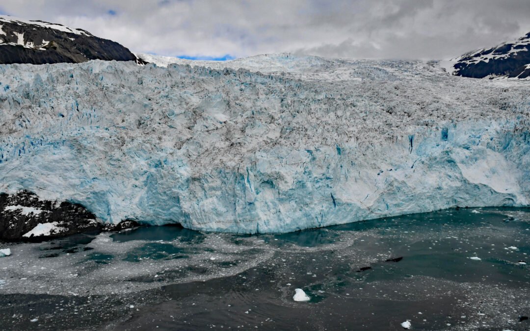
by CoastView | Mar 13, 2025 | 2025, Alaska, Biodiversity, Climate Change, Coastal Features, Embayments, Glaciers, Historical, Land Use, Natural History, Parks
Listen to the article here https://coastview.org/wp-content/uploads/2025/03/Aialik-Glacier.mp3 Aialik Glacier flows southeast for 8 miles (13 km) from the Harding Icefield in the Kenai Mountains to tidewater at Aialik Bay in Kenai Fjords National Park, about 66 miles...
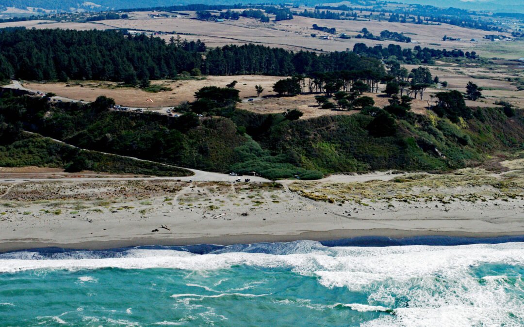
by CoastView | Mar 12, 2025 | 2025, Beaches, Biodiversity, California, Headlands, Historical, Lighthouses, Natural History, Parks
Listen to the article here https://coastview.org/wp-content/uploads/2025/03/Table-Bluff-1.mp3 Table Bluff is a promontory and coastal plateau less than 1 mile (1.6 km) wide, with an elevation of 163 feet (50 m), at the base of South Spit, which encloses the southern...
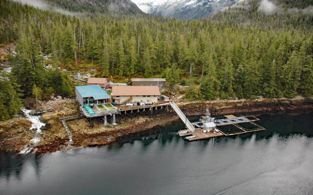
by CoastView | Mar 11, 2025 | 2025, Alaska, Biodiversity, Coastal Features, Developments, Embayments, Hatcheries, Historical, Islands, Land Use, Natural History
Listen to the article here https://coastview.org/wp-content/uploads/2025/03/Burnett-Bay.mp3 Burnett Inlet is a narrow, estuarine fjord that extends about 9 miles (15 km) north from Clarence Strait into the southwest coast of Etolin Island, roughly 63 miles (101 km)...
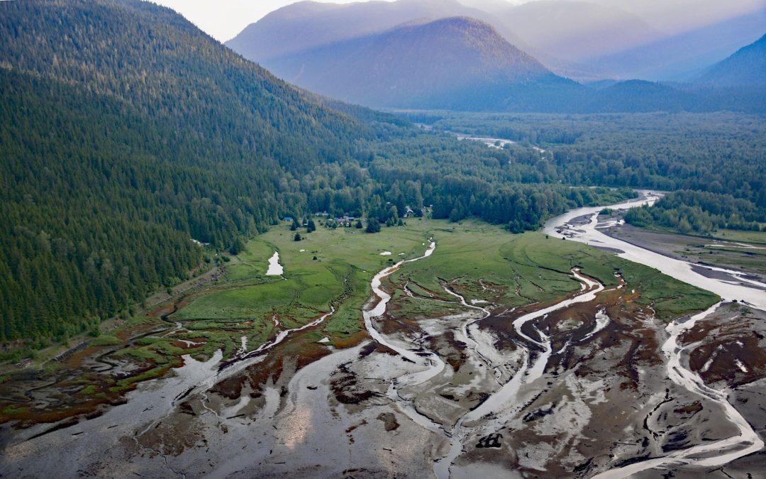
by CoastView | Mar 10, 2025 | 2025, Biodiversity, British Columbia, Chemical Pollution, Climate Change, Communities, Developments, Embayments, Historical, Land Use, Mines, Rivers
Listen to the article here https://coastview.org/wp-content/uploads/2025/03/Alice-Arm.mp3 Kitsault River drains a watershed of about 113,668 acres (46,000 ha), that includes the Kitsault Glacier and several smaller glaciers that flow out of the Cambria Icefield, and...
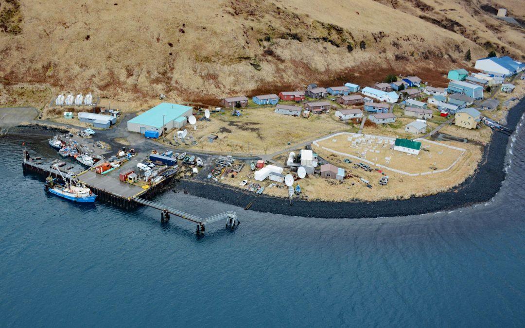
by CoastView | Mar 9, 2025 | 2025, Alaska, Biodiversity, Canneries, Climate Change, Coastal Features, Communities, Developments, Embayments, Historical, Islands, Land Use, Natural History
Listen to the article here https://coastview.org/wp-content/uploads/2025/03/Akutan.mp3 Akutan is a community on the northern shore of Akutan Harbor, on Akutan Island, one of the Krenitzin Islands in the Fox Islands group of the Eastern Aleutians, about 766 miles...