
by CoastView | Mar 2, 2024 | 2024, British Columbia, Coastal Features, Developments, Headlands, Islands, Land Use, Lighthouses, Natural History
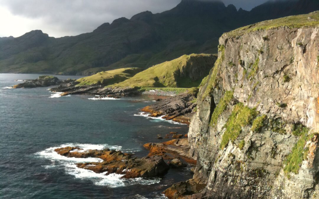
Langara is the northernmost island of the Haida Gwaii archipelago and the site of a historic light station that marks the southern boundary of Dixon Entrance, about 94 miles (151 km) southwest of Ketchikan, Alaska and 38 miles (61 km) west-northwest of Masset, British...
by CoastView | Mar 1, 2024 | 2024, Alaska, Biodiversity, Coastal Features, Developments, Embayments, Islands, Land Use, Natural History
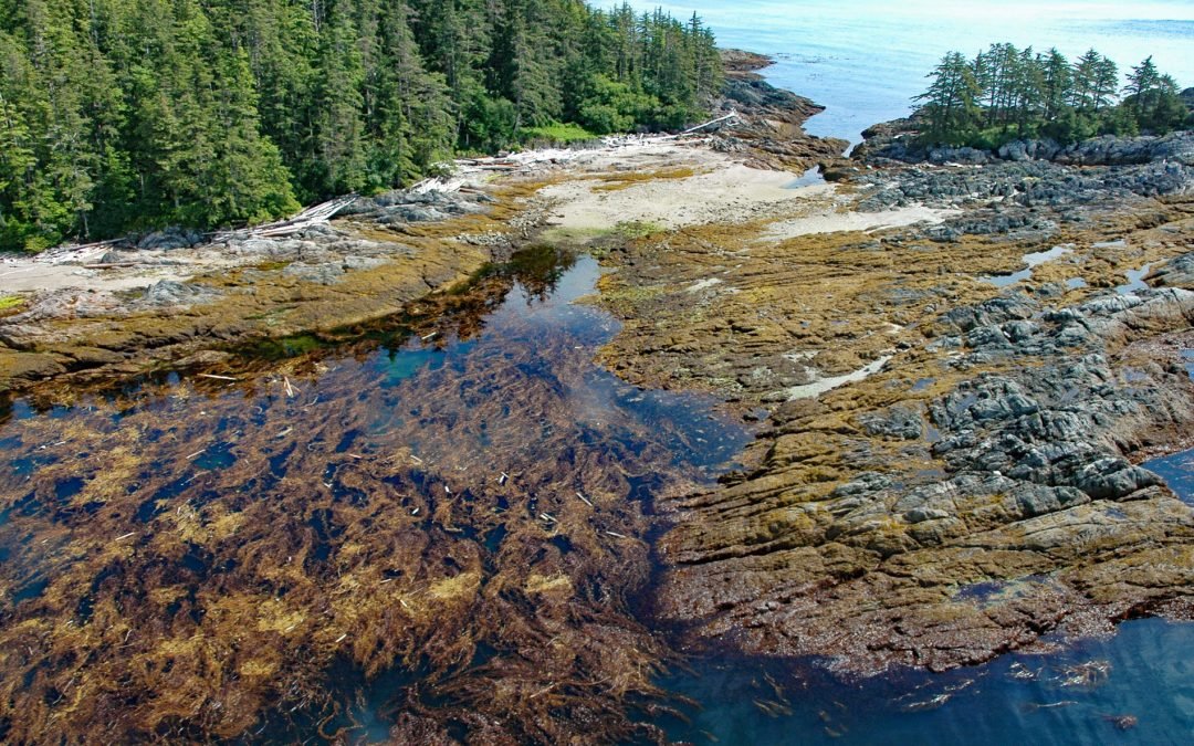
Boot Bay is 3 miles (5 km) west of Kagalaska Strait on the south coast of Adak Island, the site of intensive military activity from 1942 to 1997, near the western extent of the Andreanof Islands group of the Aleutian Islands, about 443 miles (713 km) southwest of...
by CoastView | Feb 21, 2024 | 2024, Alaska, Coastal Features, Embayments, Historical, Islands, Natural History, Shipwrecks
Kaigani Point is at the southwest tip of Long Island between Kaigani Strait to the west and Cordova Bay to the east, about 100 miles (161 km) northwest of Prince Rupert and 56 miles (90 km) southwest of Ketchikan, Alaska. Long Island is directly south of Sukkwan...
by CoastView | Feb 20, 2024 | 2024, Alaska, Biodiversity, Coastal Features, Embayments, Islands, Land Use, Natural History
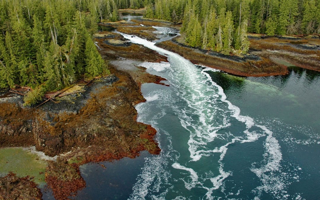
A skookumchuck is a tidal rapid that occurs at the mouth of an unnamed embayment that nearly bisects Brownson Island which is located on the west shore of Ernest Sound and separated from Etolin Island by Canoe Passage, about 47 miles (75 km) north-northwest of...
by CoastView | Feb 17, 2024 | 2024, Beaches, Embayments, Headlands, Islands, Land Use, Lighthouses, Natural History, Parks, Washington
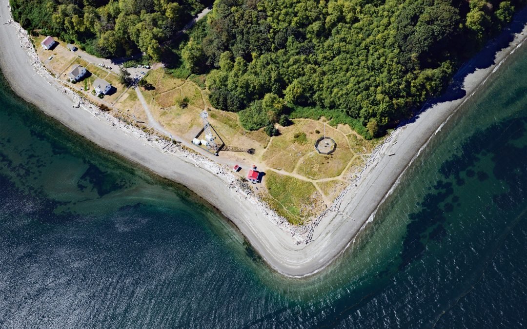
Point Robinson is the eastern point of Maury Island in Puget Sound and the site of a historic lighthouse, about 15 miles (24 km) south of Seattle and 10 miles (16 km) north-northeast of Tacoma, Washington. The point was named in 1841 by the United States Exploring...

by CoastView | Feb 15, 2024 | 2024, Biodiversity, British Columbia, Coastal Features, Embayments, Islands, Land Use, Natural History
Halibut Island is about 0.4 miles (0.7 km) long and 0.1 miles (0.2 km) wide and 9.67 acres (3.9 ha), located off the east coast of Sidney Island in Haro Strait, about 14 miles (23 km) north-northeast of Victoria and 6 miles (10 km) east-southeast of Sidney, British...