by CoastView | May 29, 2023 | 2026, British Columbia, Coastal Features, Communities, Islands, Land Use, May 2026, Natural History
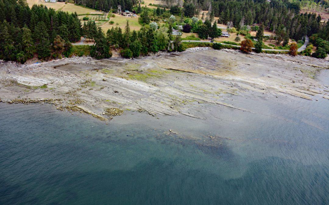
Listen to the article here https://coastview.org/wp-content/uploads/2026/02/FalseNarrows.mp3 False Narrows is a waterway 10 to 30 feet (3-9 m) deep, navigable only by small boats with local knowledge, and about 1.3 miles (2 km) long, separating Gabriola Island to the...

by CoastView | May 23, 2023 | 2026, Alaska, Biodiversity, Embayments, Islands, Kachemak, Land Use, May 2026, Natural History
Listen to the article here https://coastview.org/wp-content/uploads/2026/02/GullIsland.mp3 Gull Island is roughly 633 feet (193 m) long and 93 feet (28 m) high and is located about 0.6 miles (1 km) northwest of Moosehead Point near the entrance to Peterson Bay on the...
by CoastView | May 16, 2023 | 2026, Biodiversity, British Columbia, Coastal Features, Embayments, Islands, Land Use, May 2026, Natural History
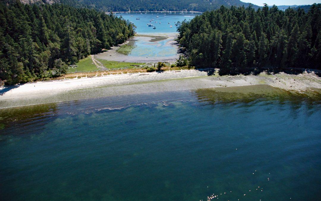
Listen to the article here https://coastview.org/wp-content/uploads/2026/01/MontagueHarbour.mp3 Montague Harbour is a provincial marine park on Trincomali Channel on the southern coast of Galiano Island, one of the Gulf Islands in the Strait of Georgia, about 32 miles...
by CoastView | May 7, 2023 | 2026, Alaska, Climate Change, Communities, Developments, Islands, Land Use, May 2026, Natural History
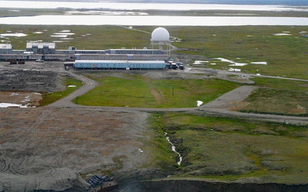
Listen to the article here https://coastview.org/wp-content/uploads/2026/01/BarterIsland.mp3 The North Warning System station at Barter Island is a long-range radar facility on the Beaufort Sea coast adjacent to the village of Kaktovik, about 273 miles (440 km)...
by CoastView | May 6, 2023 | 2026, Alaska, Biodiversity, Coastal Features, Communities, Embayments, Islands, Land Use, May 2026, Natural History
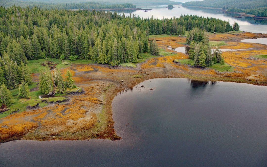
Listen to the article here https://coastview.org/wp-content/uploads/2026/01/WhalePass.mp3 Whale Passage is a waterway about 10 miles (16 km) long situated between Thorne Island to the east and Prince of Wales Island to the west, roughly 40 miles (65 km) southwest of...
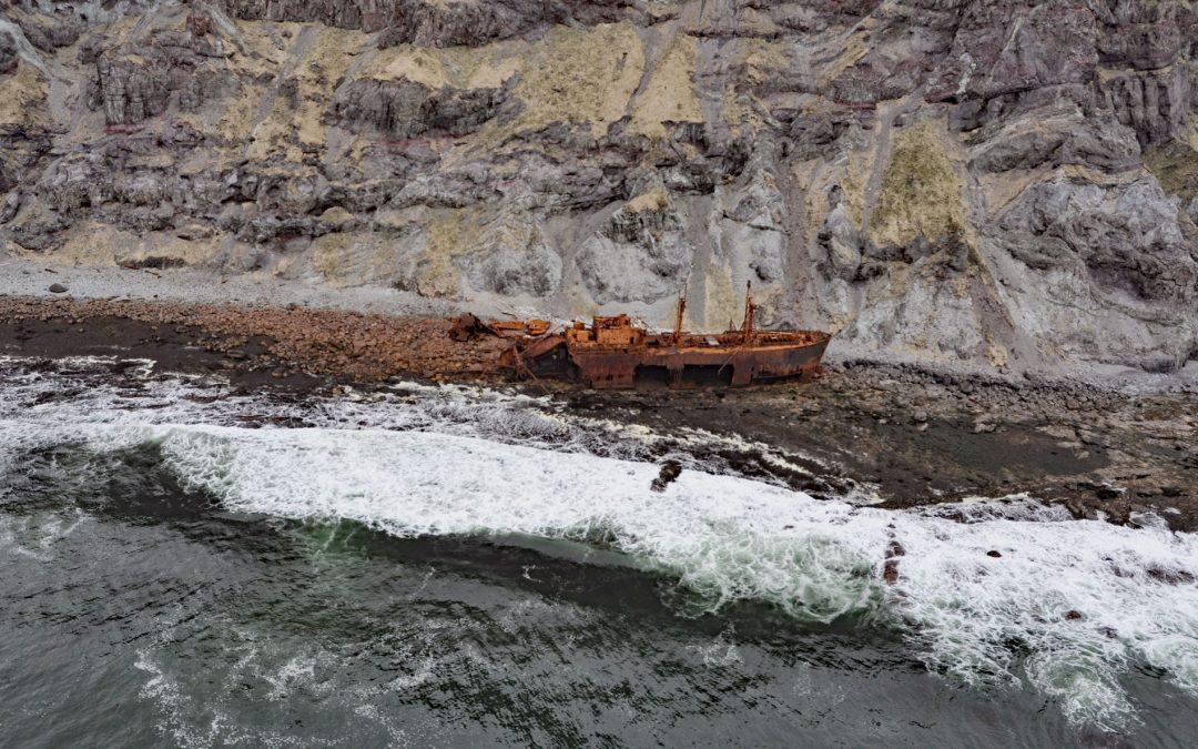
by CoastView | May 4, 2023 | 2026, Alaska, Coastal Features, Historical, Islands, May 2026, Natural History, Shipwrecks
Listen to the article here https://coastview.org/wp-content/uploads/2026/01/SSOduna.mp3 Cape Pankof is a point of land at the eastern tip of the Ikatan Peninsula on Unimak Island, about 148 miles (239 km) north-east of Dutch Harbor and 18 miles (29 km) southeast of...