• CoastView
  • Go Exploring
    • Overview
    • Categories
      • Beaches
      • Canneries
      • Glaciers
      • Lighthouses
      • Shipwrecks
      • Waterfalls
      • Alaska
      • British Columbia
      • California
      • Oregon
      • Washington
    • This Month
    • Last Month
    • Best of 2025
    • Best of 2024
    • Best of 2023
    • Archives
  • Featured Article
  • Map Explorer
  • Subscribe
    • Sign up
    • Log in
  • Donate
  • About
    • About Us
    • Contributors
    • Terms of Use
    • Privacy Policy
    • Image Use
    • Contact Us
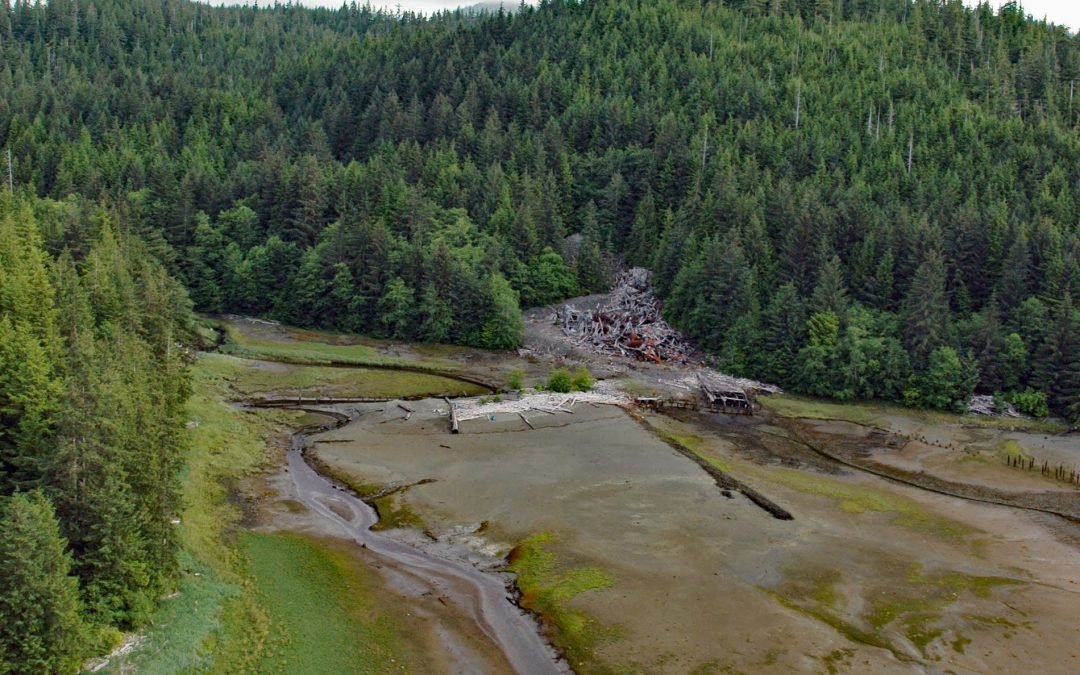
Salt Chuck Mine, Kasaan Bay

Salt Chuck Mine, Kasaan Bay

by CoastView | Sep 29, 2023 | 2023, Alaska, Developments, Embayments, Historical, Land Use, Mines

Salt Chuck is a historical mining village at the head of Kasaan Bay on the eastern coast of Prince of Wales Island, about 39 miles (63 km) northwest of Ketchikan and 4.5 miles (7.3 km) southwest of Thorne Bay, Alaska. The local name was first published in 1943 by the...
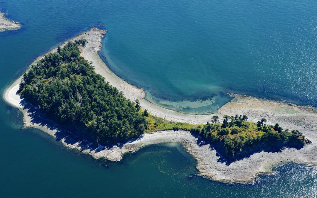
Little Sucia Island, San Juan Islands

Little Sucia Island, San Juan Islands

by CoastView | Sep 28, 2023 | 2023, Islands, Land Use, Parks, Washington

Little Sucia Island is part of an archipelago of ten islands including Sucia Island, Ewing, Justice, Herndon, Cluster Islands, and several smaller unnamed islands, about 20 miles (32 km) west of Bellingham and 3.5 miles (5.6 km) north of Eastsound, Washington. The...
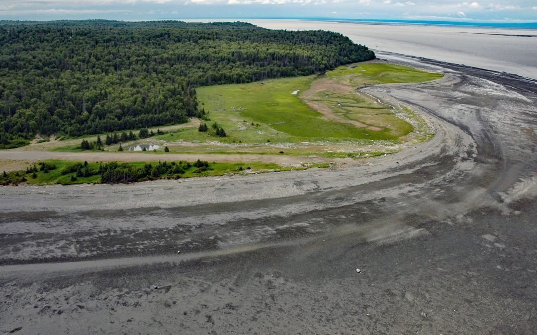
Fire Island, Cook Inlet

Fire Island, Cook Inlet

by CoastView | Sep 28, 2023 | 2023, Alaska, Beaches, Developments, Islands, Land Use

Fire Island is about 5.5 miles (8.9 km) long, located at the head of Cook Inlet within the Municipality of Anchorage, about 24 miles (39 km) northwest of Hope and 9 miles (14.5 km) southwest of downtown Anchorage, Alaska. The island was named “Turnagain...
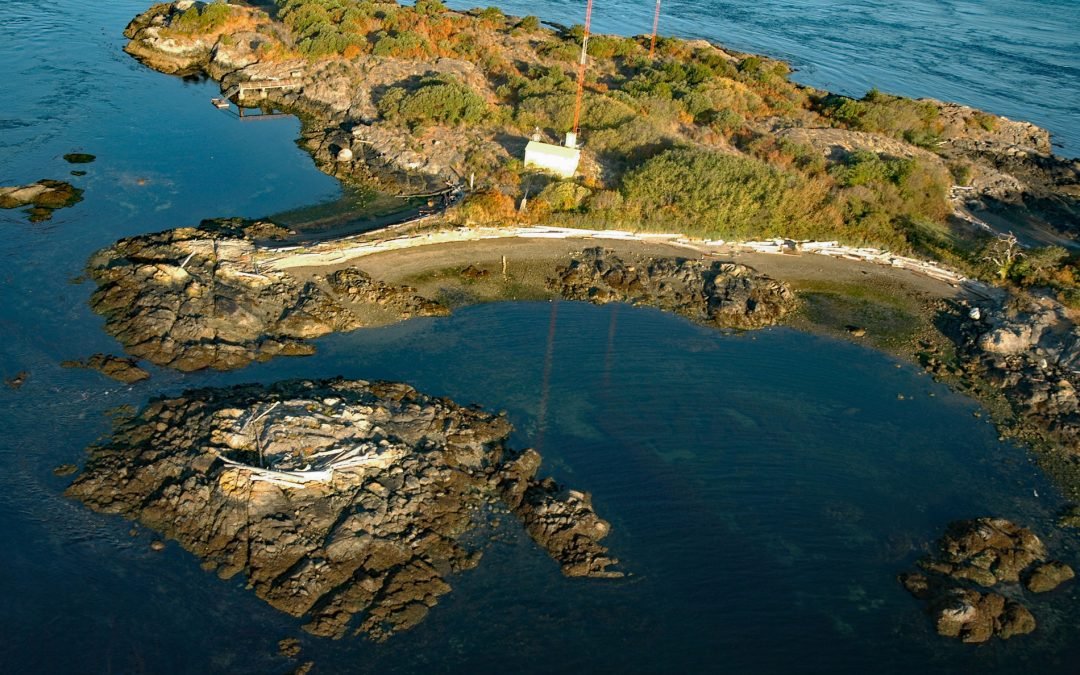
Strongtide Islet, Chatham Islands

Strongtide Islet, Chatham Islands

by CoastView | Sep 27, 2023 | 2023, British Columbia, Developments, Islands, Land Use

Strongtide Islet is part of the Chatham Islands that are off the southern coast of Vancouver Island, about 5.4 miles (8.7 km) east-northeast of Victoria and 2.5 miles (4 km) northeast of Oak Bay, British Columbia. The Chatham Islands were given their current name in...
Next Entries »

Search

Recent Posts

  • Kincaid Park, Point Campbell
  • Turkey Head, Oak Bay
  • The Salt Chuck, Hobart Bay
  • Claybluff Point, Icy Cape
  • Little River Punchbowl, Mendocino
  • Mount Saint Elias, Icy Bay
Coastview

ABOUT COASTVIEW SCIENCE

Coastview is a science education non-profit. The contents of this website, including but not limited to images and text, are intended for educational and informational purposes only. Our mission is to promote exploration of the Alaska, Pacific Northwest, and California coasts through pictures and stories. Please contact us with suggestions, comments, or to report errors.

Thanks for visiting!

Contact Us
  • Follow
  • Follow
  • Follow
  • Follow
  • Follow

Terms of use

Privacy Policy

Copyright 2018-2026. Coastview Science. All rights reserved.

No images or other content displayed on this web site may be reproduced, digitized, stored in a retrieval system, made available via any computer or wireless networks, transmitted or circulated in any form or by any means, without prior written permission of the copyright owner