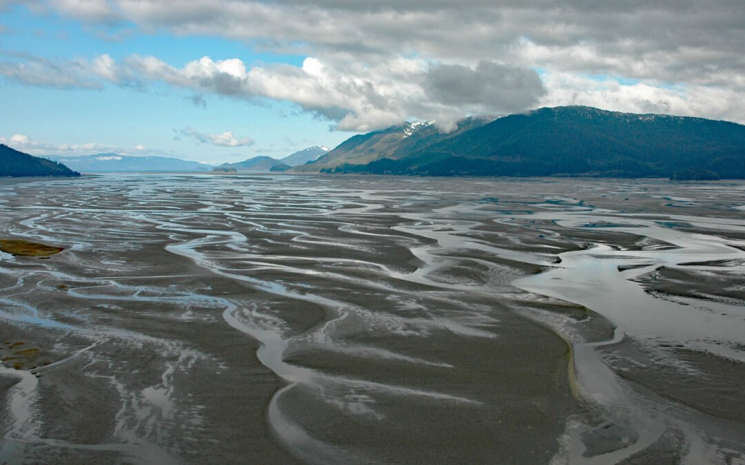
by CoastView | Feb 10, 2025 | 2025, Alaska, Biodiversity, Coastal Features, Land Use, Natural History, Rivers
Listen to the article here https://coastview.org/wp-content/uploads/2025/03/Dry-Strait.mp3 Dry Strait is a tidal channel in the Stikine Flats, part of the Stikine River delta separating Mitkof Island to the west from Dry Island to the east in the Stikine-LeConte...

by CoastView | Jan 12, 2025 | 2025, Alaska, Climate Change, Coastal Features, Embayments, Glaciers, Natural History
Listen to the article here https://coastview.org/wp-content/uploads/2025/03/Le-Conte.mp3 Le Conte Glacier starts from the Stikine Icefield in the Coast Mountains of British Columbia, at an elevation of about 8,500 feet (2,591 m) between Devils Thumb and Mount Gilroy,...
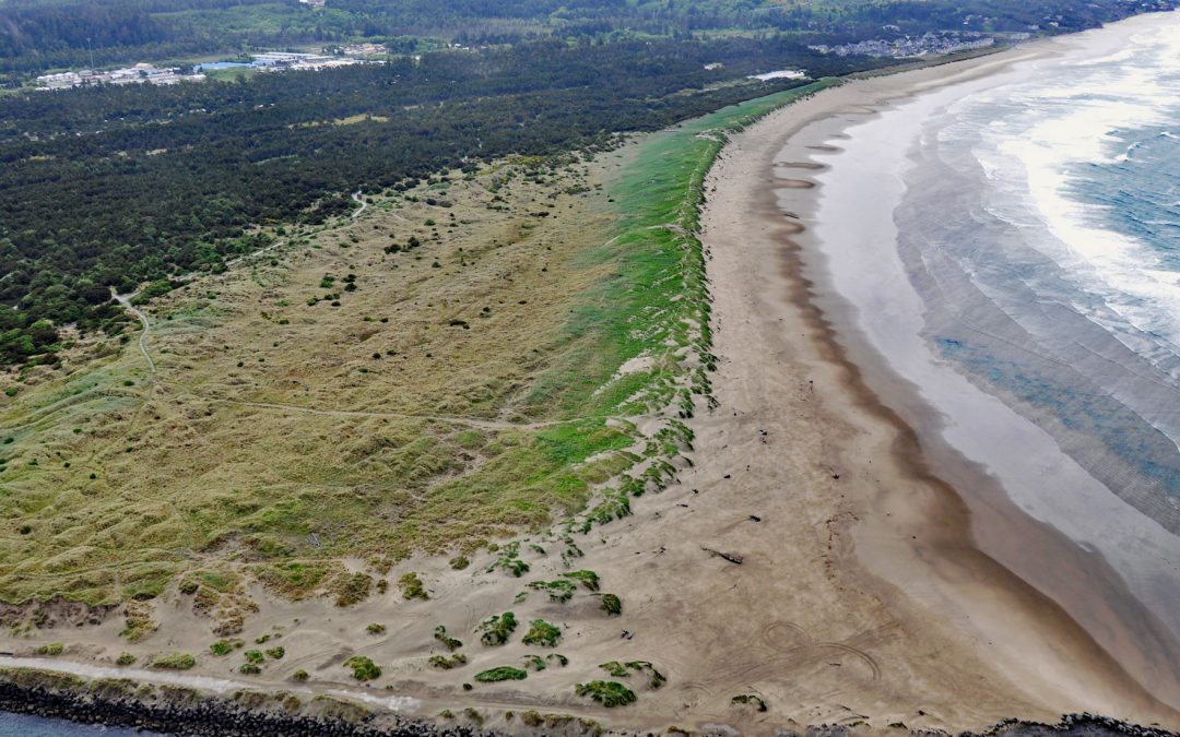
by CoastView | Dec 31, 2024 | 2024, Beaches, Biodiversity, Coastal Features, Developments, Embayments, Historical, Land Use, Natural History, Oregon, Parks
South Beach is a state park south of the jetty protecting the mouth of Yaquina Bay and extending for 1 mile (1.6 km) along the Pacific coast, about 12 miles (19 km) north of Waldport and 2 miles (3.2 km) south-southwest of Newport, Oregon. The beach continues south...

by CoastView | Dec 21, 2024 | 2024, Alaska, Biodiversity, Climate Change, Coastal Features, Communities, Developments, Embayments, Freshwater, Historical, Islands, Land Use, Natural History
Thorne Bay is a small community, and an estuary of the Thorne River on the eastern coast of Prince of Wales Island, the largest of approximately 1,100 islands interspersed by marine channels in the Alexander Archipelago of Southeast Alaska, about 55 miles (89 km)...

by CoastView | Dec 12, 2024 | 2024, Alaska, Climate Change, Coastal Features, Historical, Islands, Land Use, Natural History
King Island is about 1.7 miles (2.7 km) long and 1.4 miles (2.3 km) wide with steep rocky cliffs on all sides and a summit elevation of about 1,050 feet (320 m), located in the northern Bering Sea, about 86 miles (139 km) northwest of Nome, and 44 miles (71 km) south...
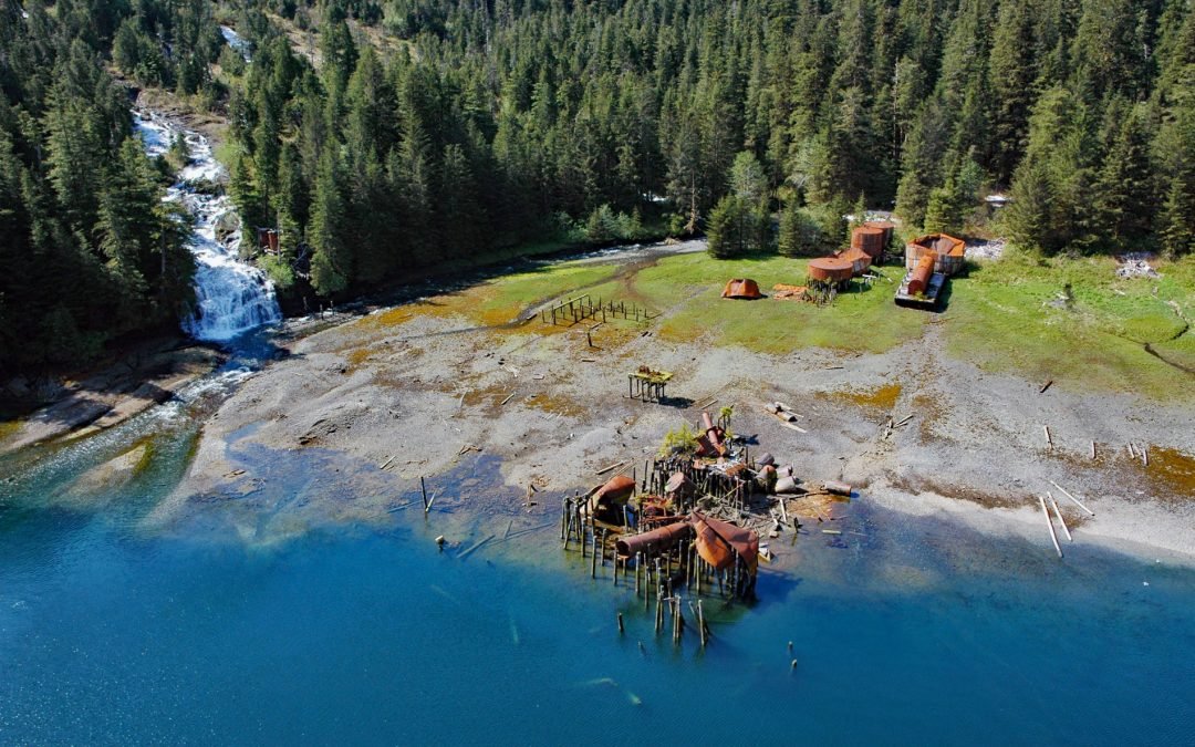
by CoastView | Dec 8, 2024 | 2024, Alaska, Biodiversity, Canneries, Developments, Embayments, Historical, Islands, Land Use, Natural History, Waterfalls
Port Walter is a fjord 3.7 miles (6 km) long that opens into Chatham Strait on the southeast coast of Baranof Island, about 91 miles (146 km) west of Wrangell and 51 miles (82 km) south-southeast of Sitka, Alaska. The fjord includes a small embayment near the entrance...