
by CoastView | Nov 7, 2023 | 2023, Beaches, Coastal Features, Developments, Historical, Land Use, Lighthouses, Natural History, Parks, Washington
New Dungeness Light Station is located on Dungeness Spit in Dungeness National Wildlife Refuge on the southern coast of the Strait of Juan de Fuca, about 17 miles (27 km) west-northwest of Port Townsend and 7 miles (11 km) north of Sequim, Washington. Dungeness Spit...
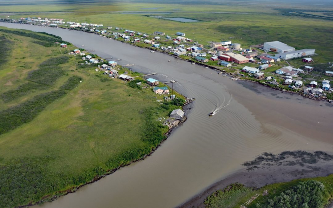
by CoastView | Nov 6, 2023 | 2023, Alaska, Communities, Developments, Land Use, Natural History, Rivers
Kotlik is a Yup’ik community situated on Kotlik Slough, a side channel of Apoon Pass formed by the confluence of the Kotlik and Little Kotlik River in the Yukon River Delta, 6 miles (10 km) inland from Pastol Bay on the southern coast of Norton Sound, about 116...
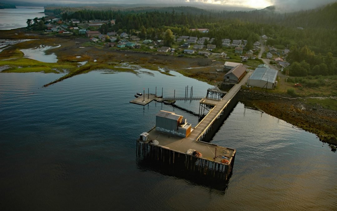
by CoastView | Nov 5, 2023 | 2023, Alaska, Biodiversity, Coastal Features, Communities, Embayments, Islands, Land Use, Natural History
Hydaburg is a community situated on Sukkwan Strait at the northern end of Cordova Bay, opposite Sukkwan Island to the south, on the highly convoluted southwestern coast of Prince of Wales Island in the Alexander Archipelago, about 160 miles (258 km) south-southeast of...

by CoastView | Nov 4, 2023 | 2023, Beaches, Biodiversity, California, Coastal Features, Developments, Historical, Land Use, Natural History, Parks
Limekiln State Park is 716 acres (290 ha) on the Big Sur coast at Rockland Landing, about 31 miles (50 km) northwest of San Simeon and 2 miles (3.2 km) south of Lucia, California. The park was established in 1994 and includes the ruins of four historic limekilns,...

by CoastView | Nov 3, 2023 | 2023, Alaska, Climate Change, Coastal Features, Communities, Land Use, Natural History, Rivers
Quinhagak, or Kwinhagak, is a Central Yup’ik community situated on the Yukon-Kuskokwim Delta near the mouth of the Kanektok River, about 73 miles (118 km) south of Bethel and 45 miles (72 km) north of Goodnews Bay, Alaska. The name is anglicized from the...

by CoastView | Nov 2, 2023 | 2023, British Columbia, Coastal Features, Headlands, Historical, Natural History
Octopus Point is a headland on the western shore of Sansum Narrows between Maple Bay on Vancouver Island to the west and Burgoyne Bay on Saltspring Island to the east, about 27 miles (44 km) north-northwest of Victoria and 2.5 miles (4 km) southeast of Maple Bay,...