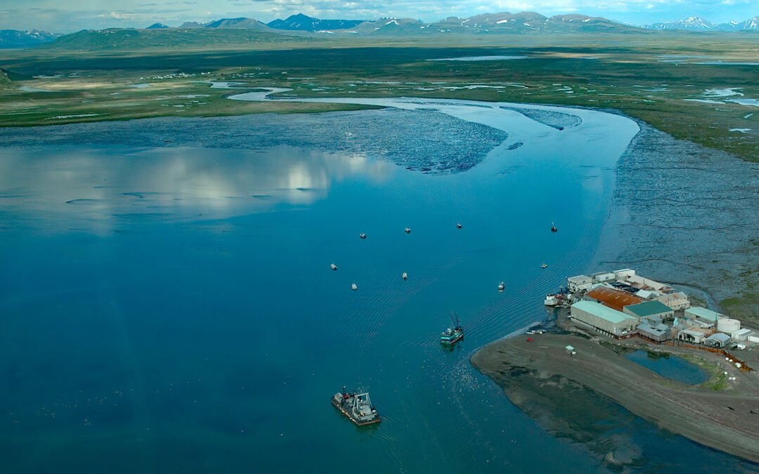
by CoastView | Sep 13, 2024 | 2024, Alaska, Biodiversity, Canneries, Communities, Developments, Embayments, Freshwater, Historical, Parks, Rivers
Togiak River starts at Togiak Lake and drains a watershed of 1,279,512 acres (517,800 ha), flowing generally southwest for 58 miles (93 km) to a wetland marsh about 4 miles (6 km) wide where the river channel splits, with the east channel flowing past the village of...

by CoastView | Sep 11, 2024 | 2024, Beaches, California, Coastal Features, Communities, Developments, Embayments, Historical, Land Use, Parks
China Beach is a small sandy cove on the South Bay of the Golden Gate tucked between Lands End and Baker Beach, once used as a campsite by Chinese fishermen, about 7 miles (11 km) north of Daly City and 5 miles (8 km) west of downtown San Francisco, California. The...

by CoastView | Sep 9, 2024 | 2024, Beaches, Biodiversity, Climate Change, Coastal Features, Land Use, Natural History, Oregon, Parks
Strawberry Hill is part of Neptune State Park, situated between Nancy Creek and Bob Creek, about 19 miles (31 km) north of Florence and 5 miles (8 km) south of Yachats, Oregon. The Strawberry Hill Rocky Shore Area is a series of basalt outcrops along the base of Cape...

by CoastView | Sep 7, 2024 | 2024, Alaska, Canneries, Chemical Pollution, Developments, Embayments, Historical, Islands, Land Use, Mines, Parks
Greens Creek Mine is the 5th largest silver producer in the world, located on the eastern shore of Hawk Inlet on Admiralty Island, about 77 miles (124 km) north-northeast of Sitka and 18 miles (29 km) southwest of Juneau, Alaska. Admiralty Island is 96 miles (155 km)...

by CoastView | Sep 3, 2024 | 2024, Beaches, Coastal Features, Communities, Developments, Headlands, Historical, Land Use, Lighthouses, Oregon, Parks
Yaquina Head is a prominent basalt headland, adjacent to the community of Agate Beach, rising over 100 feet (30 m) in elevation and extending 0.75 miles (1.2 km) into the Pacific Ocean, about 9 miles (15 km) south of Depoe Bay and 3 miles (5 km) north-northwest of...

by CoastView | Aug 29, 2024 | 2024, Biodiversity, California, Coastal Features, Communities, Embayments, Historical, Land Use, Parks
Bolinas Lagoon is a tidal estuary situated between the communities of Bolinas to the west and Stinson Beach to the east, about 35 miles (56 km) south-southeast of Bodega Bay and 17 miles (27 km) northwest of San Francisco, California. The lagoon opens to Bolinas Bay,...