by CoastView | May 9, 2026 | 2026, Alaska, Developments, Embayments, Land Use, May 2026, Natural History, Rivers
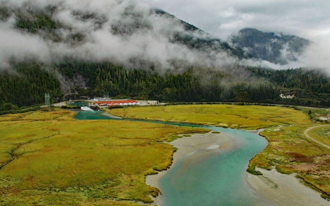
Listen to the article here https://coastview.org/wp-content/uploads/2026/01/Snettisham.mp3 Speel Arm extends generally northeast for 9 miles (14.5 km) from the head of Port Snettisham to the mouth of the Speel River, and is the site of a hydroelectric facility powered...

by CoastView | May 8, 2026 | 2026, Communities, Land Use, May 2026, Natural History, Oregon, Rivers
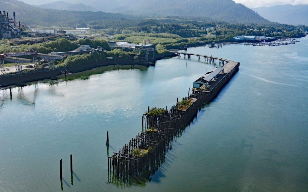
Listen to the article here https://coastview.org/wp-content/uploads/2026/01/Gardiner.mp3 Blacks Island sits at the confluence of the Smith and Umpqua rivers, on the historic Southern Pacific Railroad spur line connecting Eugene with Coos Bay, about 1.7 miles (2.7 km)...
by CoastView | May 6, 2026 | 2026, Biodiversity, British Columbia, Communities, Developments, Embayments, Land Use, May 2026, Natural History, Rivers
Listen to the article here https://coastview.org/wp-content/uploads/2026/01/PortEdward.mp3 Port Edward is a community on the eastern shore of Porpoise Harbor on the Tsimpsean Peninsula near the mouth of the Skeena River, about 98 miles (158 km) southeast of Ketchikan...

by CoastView | May 1, 2026 | 2026, Alaska, Embayments, Kachemak, May 2026, Natural History, Parks, Rivers
Listen to the article here https://coastview.org/wp-content/uploads/2026/01/McKeonFlats.mp3 McKeon Flats is formed by the Wosnesenski River, which flows into Neptune Bay on the south shore of Kachemak Bay on the Kenai Peninsula, about 14 miles (23 km) north-east of...

by CoastView | Apr 30, 2026 | 2026, April 2026, Beaches, Communities, Land Use, Natural History, Oregon, Rivers, Shipwrecks
Listen to the article here https://coastview.org/wp-content/uploads/2026/01/SiuslawRiver.mp3 The Siuslaw River flows generally west-northwest for 110 miles (177 km) to the Pacific Ocean at Florence, about 53 miles (85 km) west of Eugene and 43 miles (69 km) south of...

by CoastView | Apr 8, 2026 | 2026, Alaska, April 2026, Biodiversity, Coastal Features, Embayments, Kachemak, Land Use, Natural History, Rivers
Listen to the article here https://coastview.org/wp-content/uploads/2026/01/FoxRiver.mp3 Fox River starts at the terminus of Chernof Glacier in the Kenai Mountains at an elevation of 1,100 feet (335 m) and flows north-west for 11 miles (18 km), then south-west for 16...