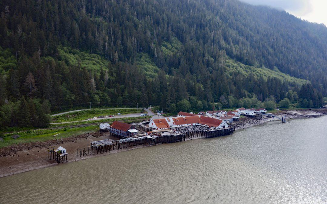
by CoastView | Apr 7, 2026 | 2026, April 2026, Biodiversity, British Columbia, Canneries, Developments, Embayments, Historical, Land Use, Natural History, Rivers
Listen to the article here https://coastview.org/wp-content/uploads/2026/01/NorthPacificCannery.mp3 North Pacific Cannery was built in 1889 on 183 acres (74 ha) of Crown land on the north shore of Inverness Passage, across from Smith Island and near the mouth of the...
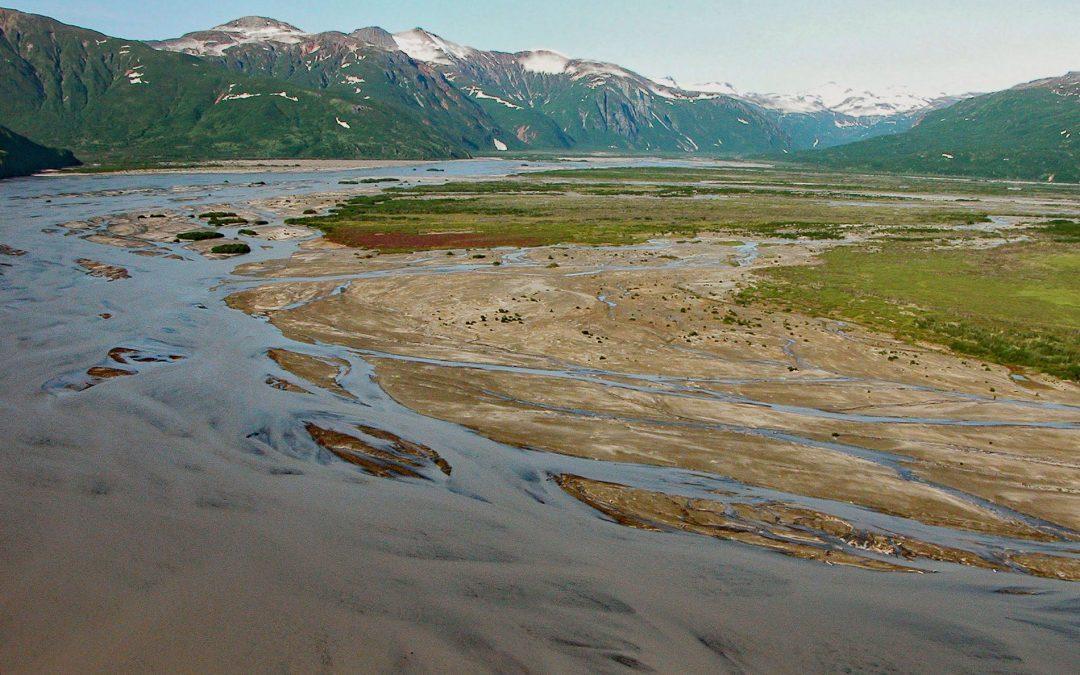
by CoastView | Apr 6, 2026 | 2026, Alaska, April 2026, Biodiversity, Embayments, Land Use, Natural History, Parks, Rivers
Listen to the article here https://coastview.org/wp-content/uploads/2026/01/AguchikRiver.mp3 The Aguchik River starts at the terminus of Aguchik Glacier at an elevation of about 1,060 feet (323 m) and flows generally south-east for 8 miles (13 km) to the head of Kukak...

by CoastView | Mar 29, 2026 | 2026, Beaches, California, Coastal Features, Land Use, March 2026, Natural History, Rivers
Listen to the article here https://coastview.org/wp-content/uploads/2026/01/EelRiver.mp3 A delta of 33,000 acres (13,355 ha) is formed by the Eel River, which starts at an elevation of 6,245 feet (1,903 m) on the southern flank of Bald Mountain in Mendocino National...

by CoastView | Feb 27, 2026 | 2026, Alaska, Beaches, Biodiversity, Coastal Features, Embayments, February 2026, Kachemak, Land Use, Parks, Rivers
Listen to the article here https://coastview.org/wp-content/uploads/2026/01/GrewingkCreek.mp3 Grewingk Creek drains a glaciated watershed of 29,138 acres (11,792 ha) and flows northwest for 3.5 miles (5.6 km) from the terminus lake of the retreating Grewingk Glacier...

by CoastView | Feb 24, 2026 | 2026, Alaska, Coastal Features, Developments, Embayments, February 2026, Islands, Land Use, Rivers
Listen to the article here https://coastview.org/wp-content/uploads/2026/01/TerrorBay.mp3 Terror Bay lies on Kodiak Island’s northern coast and extends about 7 miles (11 km) south from Uganik Passage to the mouth of Terror River in Kodiak National Wildlife...
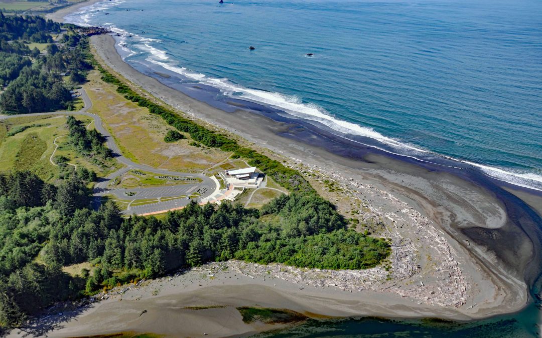
by CoastView | Feb 21, 2026 | 2026, Beaches, Coastal Features, Developments, February 2026, Land Use, Natural History, Oregon, Parks, Rivers
Listen to the article here https://coastview.org/wp-content/uploads/2026/01/Crissey-Field.mp3 The Winchuck River starts at an elevation of about 2,000 feet (610 m) and flows generally south-west for 19 miles (31 km) through the Rogue River–Siskiyou National Forest to...